Home / Weather News /

Staying safe during Storm Eunice

07:00
18 February 2022

Take care today
Staying safe during Storm Eunice

WindRadar

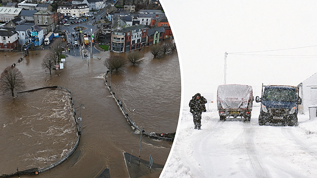
Storm Eunice has arrived with fierce winds approaching the southwest, it is important to take extra precautions.

Multiple storm warnings are in effect covering much of the UK and Ireland. Scotland will avoid the worst of today’s weather but southern areas could still see dangerous conditions.

Many public spaces and tourist sites have already announced closures. This includes Warwick Castle, Oxfordshire’s Cotswold Wildlife Park, and many public parks.

Settings for external content

Privacy Policy

In Wales a number of schools are also closed today while travel should only be made where essential across much of the UK and Ireland.

There are a number of precautions that you should take before the worst of the gales, which may reach highs of 86 mph inland.

TimePrecaution
As Eunice approachesSecure loose objects in the garden which could break windows
Fasten windows and doors
Try to park vehicles away from areas with possible debris
During the storm's peakOnly travel where essential
Identify alternative routes before leaving and take care on exposed roads
Take extra care around vans, lorries, and other high-sided vehicles
Keep cats and other outdoor pets inside until safe
After the stormDo not interfere with downed power or telephone lines
Check in on vulnerable friends, family, and neighbours

Stay safe and stay informed with forecasts in your area and by checking the WindRadar for the latest conditions.

Ryan Hathaway
More on the topic
Split image showing a towering storm cloud with rain shafts over the sea on the left and a vivid red aurora illuminating the night sky above residential rooftops on the right, divided by a curved white line.
Tuesday, 9 December 2025

Your weather - Your shots

Autumn captured by you
Temperature map showing maximum values at the beginning of next week and wind radar showing a storm system over the Atlantic that is directing mild air towards Europe
Thursday, 4 December 2025

Gusty in the UK & Ireland

Storms will soon bring spring air
A split image showing a close-up of a full moon on the left, and on the right a UK and Ireland weather map with blue and white patches indicating widespread rain or cloud. Several moon and cloud icons appear over different regions, with temperatures marked mostly between 4°C and 8°C.
Thursday, 4 December 2025

Cold Moon rises tonight

Third and final supermoon of the year
All weather news
This might also interest you
Split weather map showing UK wind speeds in orange-red shades up to 40 mph on the left and warning levels in green-yellow on the right, with a central wind warning sign.
Wednesday, 22 October 2025

Warnings active

Storm Benjamin impacts the UK
Weather map of the UK and Ireland showing scattered showers with cloudy patches across much of the region, especially around western and northern areas. Sunshine symbols appear over London, Cardiff, and parts of southern England, while temperatures range from 17°C to 18°C in most places. Areas of heavier rain are visible over the Atlantic to the west.
Friday, 29 August 2025

Breakfast brief

Unsettled conditions into the weekend
Weather graphic showing rain and wind fields over the Canary Islands and a central warning symbol.
Friday, 12 December 2025

Storm and rain

Turbulent weather in the Canary Islands
All articles
Weather & Radar

Weather & Radar is also available on

Google Play StoreApp Store

Company

Contact us Privacy Policy Legal info Accessibility statement

Services

Uploader

Socials

facebooktwittertikToklinkList