Home
Weather London
WeatherRadar
RainfallRadar
TemperatureRadar
WindRadar
LightningRadar
Weather News
Editor's Pick
Discover the app
Weather widget
Contact us
Apps
Career
    Home / Editor's Pick /

    What to do now - Preparing for the storm

17:00
22 October 2026

What to do now
Preparing for the storms

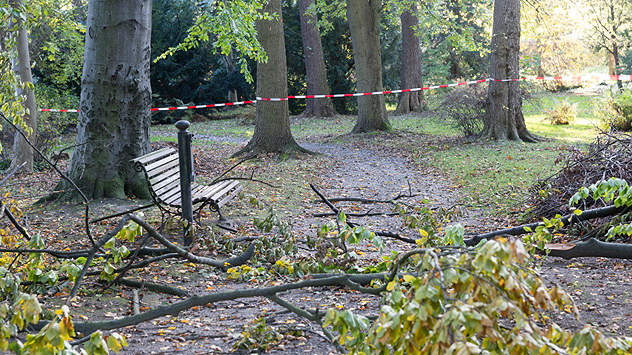
Fallen tree branches and green leaves cover a woodland path beside a bench, with red and white safety tape cordoning off the area.
With trees yet to lose their leaves, there's an additional danger in strong winds.

Storms Austen and Boelo are set to bring severe gales and heavy rain. There's plenty to do to prepare if you are in a warning area.

Adjust your outdoor plans

Planning an autumnal walk in the woods? Many trees still have their leaves, catching more wind. Even moderately strong gusts could cause branches to break or trees to fall. Avoid forests or other heavily wooded areas until the storm passes.

Prepare your garden

Bring loose items such as flowerpots, garden furniture, and parasols indoors, or secure them firmly. Don't forget your wheelie bins! Check that fences, garden gates, and other potentially loose structures are properly secured.

Remember the car and balcony

If you live in an apartment, check your balcony for anything that could blow away. During stormy weather, avoid parking your car beneath large trees, as falling branches can cause considerable damage.

Keep an eye on the WindRadar regularly over the coming days as Austen and Boelo move through.

Weather & Radar editorial team

More on the topic

Where do our storm names come from?. Austen possible this week. . . Monday, 19 October 2026
Lightning strikes beneath dark storm clouds over fields, with warning signs for thunderstorms and strong winds shown in foreground.
Monday, 19 October 2026

Austen possible this week

Where do our storm names come from?
Winds grow and rain spreads Wednesday. Prelude to Austen. . . Wednesday, 21 October 2026
Split weather map showing strong winds up to 40 mph across southern Britain and blue rain bands over Scotland, Ireland and England, with warning symbols.
Wednesday, 21 October 2026

Prelude to Austen

Winds grow and rain spreads Wednesday
First major storm of the season. Storm Austen named. . . Tuesday, 20 October 2026
On the left, WindRadar shows a storm system over the UK with strong winds. On the right, high waves are crashing against a sea wall. A warning symbol indicates a storm.
Tuesday, 20 October 2026

Storm Austen named

First major storm of the season
All weather news

This might also interest you

Historic Storm Éowyn arrives. On this day.... . . Saturday, 24 January 2026
Split image showing a person in a yellow jacket struggling against strong winds and heavy rain on a street at night on the left, and an Irish wind forecast map on the right with red and purple shading, gusts up to 75 mph, and a wind warning icon, divided by a curved white line.
Saturday, 24 January 2026

On this day...

Historic Storm Éowyn arrives
New records for England and Wales. Broken again tomorrow?. . . Thursday, 25 June 2026
Temperature map of southwest Britain on 25.06 showing extreme heat across southern Wales and southwest England, with Bute Park in Cardiff highlighted at 34.2°C and Yeovilton at 36.4°C amid widespread deep red heat zones.
Thursday, 25 June 2026

Broken again tomorrow?

New records for England and Wales
Seasonal warmth between spring thunder. Your weather - Your shots. . . Sunday, 19 April 2026
Split image showing coastal sunset with layered lenticular clouds over rooftops and palm trees on the left, and a green valley with river and hills under soft daylight on the right.
Sunday, 19 April 2026

Your weather - Your shots

Seasonal warmth between spring thunder
All articles
Weather & Radar

Weather & Radar is also available on

Google Play StoreApp Store

Company

Contact us Privacy Policy Legal info Accessibility statement

Services

Uploader

Socials

facebooktwittertikToklinkList