Home
Weather London
WeatherRadar
RainfallRadar
TemperatureRadar
WindRadar
LightningRadar
Weather News
Editor's Pick
Discover the app
Weather widget
Contact us
Apps
Career
    Home / Editor's Pick /

    Austen possible this week - Where do our storm names come from?

09:22
19 October 2026

Austen possible this week
Where do our storm names come from?

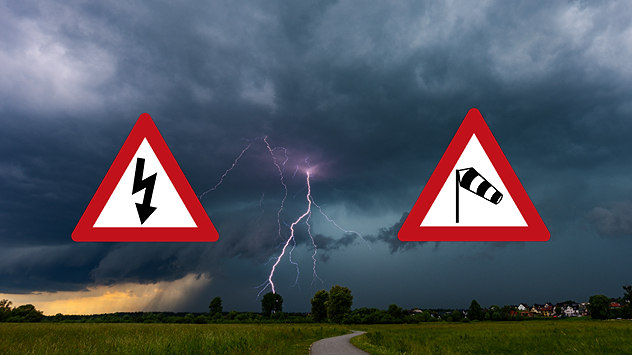
Lightning strikes beneath dark storm clouds over fields, with warning signs for thunderstorms and strong winds shown in foreground.

We could potentially see the arrival of Storm Austen later in the week, but where do the names come from?

The UK and Ireland's storm names are released at the start of each storm season, in a joint partnership between the Met Office, Met Éireann, and the Dutch weather service KNMI.

This year, a special partnership between the Met Office and Aardman Animations saw the public asked to choose between naming a storm after Shaun the Sheep, or Timmy from the show, with Shaun winning the vote.

Storm names (A-G)Storm names (H-N)Storm names (O-W)
AustenHeatherOlaf
BoeloIvyPhelim
ChloeJadeRuban
DanoKilianShaun
EvelynLaoiseTheo
FinnMiriamVesna
GwendolynNicolaWende

Each named storm takes its name from public suggestions across the three countries. This year, Chloe was among the most popular names, with more than 130 suggestions.

Each country contributes seven names to the list, with letters Q, U, X, Y, and Z not being used due to a lack of variety in names with those letters and to maintain convention with the US hurricane warning system.

Currently, there is moderate confidence that Friday will bring the first of these storms, Austen. It is still uncertain what path the system will take precisely, with the current path moving through southern England.

Extra names?

Ex-hurricanes or ex-tropical systems that cross the Atlantic Ocean also retain the name they were given by the US National Hurricane Centre.

Ryan Hathaway

More on the topic

Brazil: A spring full of storms. Rain and flooding. . . Friday, 13 November 2026
Split. On the left, a weather map of Brazil showing clouds, rain and lightning. On the right, a thundercloud
Friday, 13 November 2026

Rain and flooding

Brazil: A spring full of storms
First widespread frost of the season. Freezing evenings. . . Wednesday, 11 November 2026
Temperature map showing -3°C near Cardiff, -2°C in Dublin, -1°C in Glasgow and Liverpool, and 2°C near Aberdeen and London, with a blue thermometer.
Wednesday, 11 November 2026

Freezing evenings

First widespread frost of the season
Summer heat in the middle of November. Unusual temperatures. . . Tuesday, 10 November 2026
The weather map shows the temperatures in south-eastern Europe and the Mediterranean region. It is particularly warm in the Balkans: temperatures in Belgrade are reaching 25 degrees. A red arrow indicates that warm air is flowing from the central Mediterranean towards Serbia. In Italy, Greece and Romania, too, temperatures are above 20 degrees in many places. By contrast, it is significantly cooler in the Alps and in parts of Central Europe.
Tuesday, 10 November 2026

Unusual temperatures

Summer heat in the middle of November
All weather news

This might also interest you

Seasonal warmth between spring thunder. Your weather - Your shots. . . Sunday, 19 April 2026
Split image showing coastal sunset with layered lenticular clouds over rooftops and palm trees on the left, and a green valley with river and hills under soft daylight on the right.
Sunday, 19 April 2026

Your weather - Your shots

Seasonal warmth between spring thunder
Super Typhoon Bavi threatens Taiwan. Up to 1,000 mm of rain. . . Wednesday, 8 July 2026
The image shows an intense tropical cyclone over the western Pacific, east of Taiwan and the Philippines. The centre of the system is depicted as a light purple and white vortex with a clearly visible eye, surrounded by a ring of red and orange areas indicating the strongest wind speeds. A white arrow marks the typhoon’s predicted track towards the north-west, in the direction of Taiwan. To the west of the storm lie the Philippines, with the cities of Manila and Cebu; to the north of these lies Taiwan, with Taipei. Further west, the Chinese coast, including Hong Kong, and parts of Vietnam can be seen. The coloured wind map shows predominantly green areas outside the storm’s core, indicating significantly weaker winds. White streamlines illustrate the typhoon’s anti-clockwise circulation in the Northern Hemisphere. The highest wind speeds are concentrated around the eye of the cyclone.
Wednesday, 8 July 2026

Up to 1,000 mm of rain

Super Typhoon Bavi threatens Taiwan
A frozen start to the weekend. Icy conditions. . . Friday, 13 February 2026
UK temperature map dated 14.02 showing widespread subzero values in blue shading, with readings such as −4 in Glasgow, −3 in Dublin, and −2 in London, alongside a blue thermometer icon.
Friday, 13 February 2026

Icy conditions

A frozen start to the weekend
All articles
Weather & Radar

Weather & Radar is also available on

Google Play StoreApp Store

Company

Contact us Privacy Policy Legal info Accessibility statement

Services

Uploader

Socials

facebooktwittertikToklinkList