Home
Weather London
WeatherRadar
RainfallRadar
TemperatureRadar
WindRadar
LightningRadar
Weather News
Editor's Pick
Discover the app
Weather widget
Contact us
Apps
Career
    Home / Editor's Pick /

    Your weather - Your shots: Northern Lights steal the show

09:00
25 January 2026

Your weather - Your shots
Northern Lights steal the show

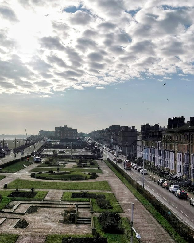
Elevated view of a coastal town seafront with a formal park and pathways in the foreground, terraced buildings lining the road to the right, light traffic, birds in the sky, and broken cloud with sunlight over the sea in the distance.
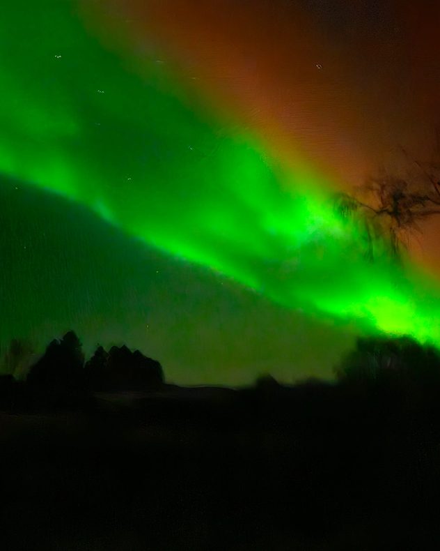
Bright green aurora arc sweeping across a dark night sky, with faint stars visible and black silhouettes of trees and low hills along the horizon.
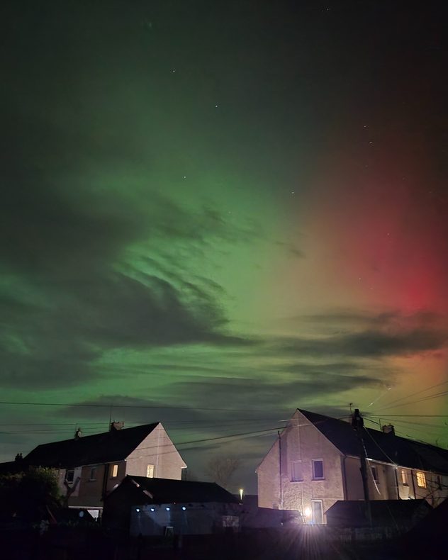
Night sky filled with green aurora curtains and a red glow to the right, with stars visible above silhouetted rooftops, power lines, and softly lit houses below.
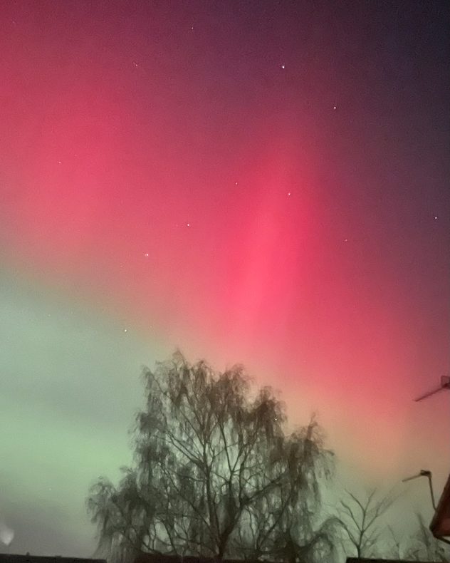
Night sky glowing with vivid red aurora above and soft green aurora below, dotted with small stars and framed by the silhouette of a leafless tree and rooftops at the bottom.
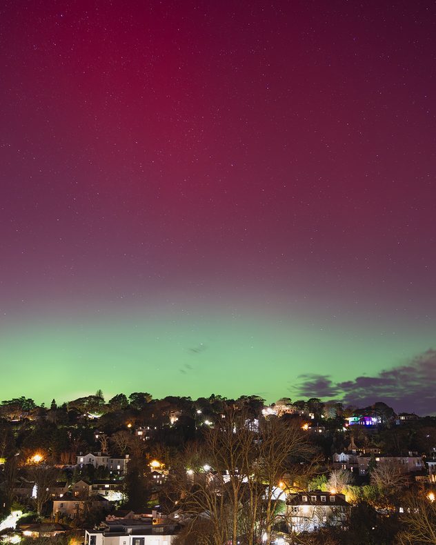
Wide night view of a town on a hillside with house lights below, beneath a star-filled sky glowing deep red above and bright green along the horizon from an aurora display.
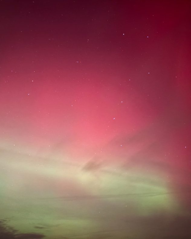
Night sky filled with deep red aurora glow fading into pale green near the horizon, with scattered stars visible through thin cloud layers.
1/6
The change over Lowestoft, Suffolk is clear as a front moves through. - © Elaine High

On an unsettled week, there was one clear event that stands out... the strongest solar storm in over two decades delivered a vibrant aurora overhead.

Reaching as far south as the Alps, the classic green and red hues of solar activity were on show across the UK and Ireland, where gaps in the clouds could be found.

Did you see the event? Or, any other interesting weather views? Tap the image icon in the app or head straight to the uploaders for the UK or Ireland to send in your pictures and videos!

Weather & Radar editorial team
More on the topic
Severe weather hits Mallorca and Italy. Severe thunderstorms. . . Thursday, 10 September 2026
Numerous thunderstorms are sweeping across La Palma. The many lightning symbols on the radar and lightning map show that there is heavy lightning activity across large parts of the island. The thunderstorms are striking particularly in the island’s interior and in the south. On the right, you can see the aftermath: a large fallen tree has buried a car beneath it. Emergency services are clearing up the damage. So, along with the thunderstorms, not only heavy rain but also gusts of wind can become a problem.
Thursday, 10 September 2026

Severe thunderstorms

Severe weather hits Mallorca and Italy
Severe weather in southern Europe. Thunderstorms & heavy rain. . . Wednesday, 9 September 2026
On the left, dark storm clouds over a coastline. On the right, a weather map shows thunderstorms over the western Mediterranean, with warning symbols for tornadoes, storms and hail.
Wednesday, 9 September 2026

Thunderstorms & heavy rain

Severe weather in southern Europe
Severe weather in the Mediterranean. Is a medicane on the way?. . . Monday, 14 September 2026
A weather map shows a powerful low-pressure system over the Mediterranean, with warning symbols for storms and heavy rain.
Monday, 14 September 2026

Is a medicane on the way?

Severe weather in the Mediterranean
All weather news
This might also interest you
Historic Storm Éowyn arrives. On this day.... . . Saturday, 24 January 2026
Split image showing a person in a yellow jacket struggling against strong winds and heavy rain on a street at night on the left, and an Irish wind forecast map on the right with red and purple shading, gusts up to 75 mph, and a wind warning icon, divided by a curved white line.
Saturday, 24 January 2026

On this day...

Historic Storm Éowyn arrives
Storm Chandra makes impact. Severe gales & heavy rain. . . Tuesday, 27 January 2026
Split image showing strong winds over the UK on a forecast map and widespread rain and snow on a weather radar map.
Tuesday, 27 January 2026

Severe gales & heavy rain

Storm Chandra makes impact
A frozen start to the weekend. Icy conditions. . . Friday, 13 February 2026
UK temperature map dated 14.02 showing widespread subzero values in blue shading, with readings such as −4 in Glasgow, −3 in Dublin, and −2 in London, alongside a blue thermometer icon.
Friday, 13 February 2026

Icy conditions

A frozen start to the weekend
All articles
Weather & Radar

Weather & Radar is also available on

Google Play StoreApp Store

Company

Contact us Privacy Policy Legal info Accessibility statement

Services

Uploader

Socials

facebooktwittertikToklinkList