Home
Weather London
WeatherRadar
RainfallRadar
TemperatureRadar
WindRadar
LightningRadar
Weather News
Editor's Pick
Discover the app
Weather widget
Contact us
Apps
Career
    Home / Editor's Pick /

    Your weather - Your shots: An international spring collection

08:00
13 April 2025

Your weather - Your shots
An international spring collection

Snow covered valley in Tirol, Austria, pictured from a higher vantage point looking down at the view.
1/4
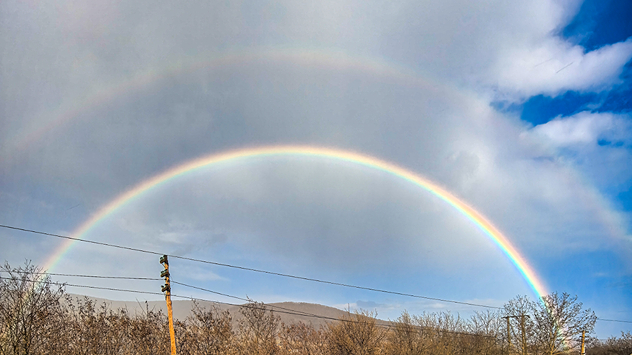
A spring double rainbow arches across Răducești, Romania. - © Catalin George

Each week we have a look at the shots captured from across the UK and Ireland, today it's a little different.

Just for this week, we have a collection of shots from our users around the world.

We return home next weekend, if you want to get involved just tap the image icon in the app or use one of our dedicated uploaders for the UK or Ireland.

Get involved: Using the uploaderread more
Weather & Radar editorial team
More on the topic
Half of England now in drought. Joining North Wales. . . Wednesday, 29 July 2026
Dry section of the River Thames beneath a small stone bridge, with the riverbed exposed and cracked after prolonged, dry weather, while a person walks along the roadside above.
Wednesday, 29 July 2026

Joining North Wales

Half of England now in drought
Fourth heatwave of the year. Peaking Wednesday. . . Tuesday, 28 July 2026
Temperature map of England and Wales on Wednesday 29.07 showing widespread hot conditions, with temperatures reaching 33°C near Cambridge, 32°C around London, Norwich, and Southend-on-Sea, and a large heat warning symbol highlighting elevated heat risk.
Tuesday, 28 July 2026

Peaking Wednesday

Fourth heatwave of the year
UV levels peak with the heat today. Latest heatwave. . . Wednesday, 29 July 2026
Split graphic showing a temperature map of England and eastern Ireland with temperatures reaching 33°C near London, 32°C in Norwich, and 29°C around Birmingham on the left, alongside a person applying sunscreen with a UV icon on the right.
Wednesday, 29 July 2026

Latest heatwave

UV levels peak with the heat today
All weather news
This might also interest you
Super Typhoon Bavi threatens Taiwan. Up to 1,000 mm of rain. . . Wednesday, 8 July 2026
The image shows an intense tropical cyclone over the western Pacific, east of Taiwan and the Philippines. The centre of the system is depicted as a light purple and white vortex with a clearly visible eye, surrounded by a ring of red and orange areas indicating the strongest wind speeds. A white arrow marks the typhoon’s predicted track towards the north-west, in the direction of Taiwan. To the west of the storm lie the Philippines, with the cities of Manila and Cebu; to the north of these lies Taiwan, with Taipei. Further west, the Chinese coast, including Hong Kong, and parts of Vietnam can be seen. The coloured wind map shows predominantly green areas outside the storm’s core, indicating significantly weaker winds. White streamlines illustrate the typhoon’s anti-clockwise circulation in the Northern Hemisphere. The highest wind speeds are concentrated around the eye of the cyclone.
Wednesday, 8 July 2026

Up to 1,000 mm of rain

Super Typhoon Bavi threatens Taiwan
Storm Chandra makes impact. Severe gales & heavy rain. . . Tuesday, 27 January 2026
Split image showing strong winds over the UK on a forecast map and widespread rain and snow on a weather radar map.
Tuesday, 27 January 2026

Severe gales & heavy rain

Storm Chandra makes impact
Bright and warm conditions take hold. Spring-like outlook. . . Thursday, 23 April 2026
Split UK map showing warm temperatures up to 21 degrees in orange on the left and clear sunny conditions with temperatures from 12 to 18 degrees on the right, with sun icons across the country.
Thursday, 23 April 2026

Spring-like outlook

Bright and warm conditions take hold
All articles
Weather & Radar

Weather & Radar is also available on

Google Play StoreApp Store

Company

Contact us Privacy Policy Legal info Accessibility statement

Services

Uploader

Socials

facebooktwittertikToklinkList