Home
Weather London
WeatherRadar
RainfallRadar
TemperatureRadar
WindRadar
LightningRadar
Weather News
Editor's Pick
Discover the app
Weather widget
Contact us
Apps
Career
    Home / Editor's Pick /

    Your weather - Your shots: A varied week of heat and rain

15:00
21 June 2026

Your weather - Your shots
A varied week of heat and rain

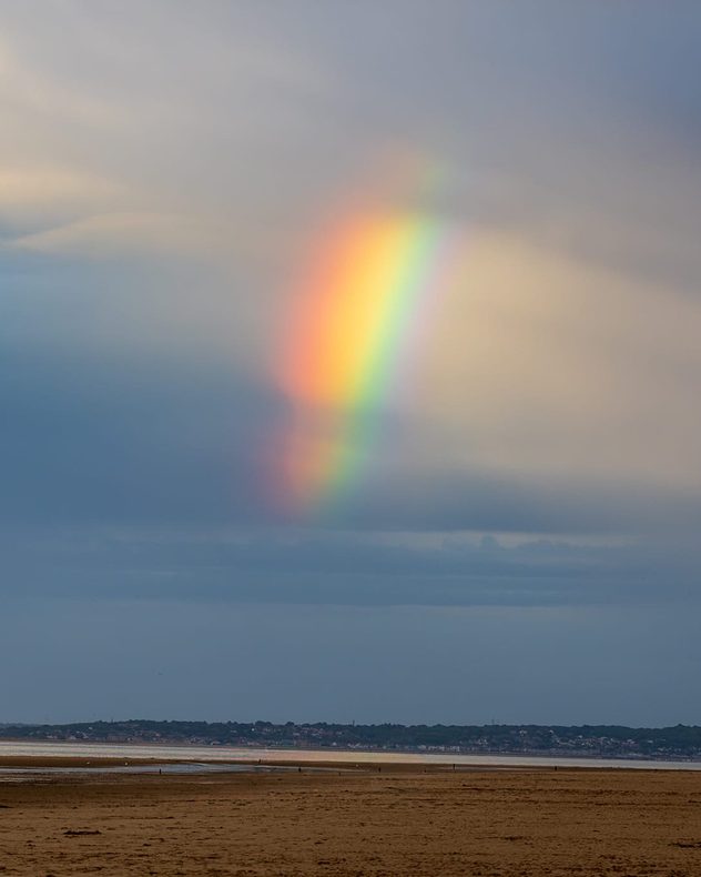
Bright partial rainbow descending from grey rain clouds above a wide tidal shoreline, with exposed sand flats, calm water, and a distant coastal town along the horizon.
White lighthouse silhouetted against a golden sunset over the sea, with dark blue clouds overhead, reflections on calm water, and distant offshore wind turbines along the horizon.
Fiery orange sunset over a coastal harbour with calm water, silhouetted piers, lamp posts, and industrial structures along the horizon beneath layered evening clouds.
Stone cottage illuminated by warm golden sunset light beside grassy fields, with dark purple-grey storm clouds overhead and a calm coastal horizon in the horizon.
1/4
Passing showers over Talacre Beach, Flintshire produced a vibrant partial rainbow. - © Ajith Kumar

In a week that has seen the temperatures soaring back into heatwave territory for some, it's still rather dull and rainy for others. Making for a great variety in scenes across the UK and Ireland!

Want to get involved? It's simple, just tap the image icon in the top-right corner of the page, or go straight to the Uploader for the UK or Ireland.

Don't forget to try recording your own weather moment in the app, where you can upload directly once you're happy with your clip.

Weather & Radar editorial team
More on the topic
Japan braces itself for Typhoon Doplhin. Landslides feared. . . Wednesday, 5 August 2026
Weather map showing a typhoon south of Japan. The centre of the storm is over the Pacific and is moving westwards. The coloured wind fields indicate its high intensity.
Wednesday, 5 August 2026

Landslides feared

Japan braces itself for Typhoon Doplhin
Stronger winds make a return. Low pressure influence. . . Tuesday, 4 August 2026
Wind forecast map of the UK and Ireland showing a low-pressure system north of Scotland, a windsock icon highlighting blustery conditions, and widespread winds of 30–40 mph across the British Isles, with the strongest winds around Ireland and northern Britain.
Tuesday, 4 August 2026

Low pressure influence

Stronger winds make a return
Stormy day in parts of the UK & Ireland. Lightning potential. . . Tuesday, 4 August 2026
Satellite and lightning map of Scotland showing widespread rain and thunderstorms across the Highlands and western Scotland, with lightning strikes around the west coast and Hebrides. A thunderstorm icon highlights the active weather, while temperatures range from 15°C in Aberdeen to 24°C in Newcastle.
Tuesday, 4 August 2026

Lightning potential

Stormy day in parts of the UK & Ireland
All weather news
This might also interest you
Flooding, gales, and heavy snow. Storm Chandra. . . Tuesday, 27 January 2026
Split image showing aerial flooding in a town with muddy water covering roads on the left, and a rural road on the right blocked by heavy snowfall with vans stopped and a person walking in snow.
Tuesday, 27 January 2026

Storm Chandra

Flooding, gales, and heavy snow
Super Typhoon Bavi threatens Taiwan. Up to 1,000 mm of rain. . . Wednesday, 8 July 2026
The image shows an intense tropical cyclone over the western Pacific, east of Taiwan and the Philippines. The centre of the system is depicted as a light purple and white vortex with a clearly visible eye, surrounded by a ring of red and orange areas indicating the strongest wind speeds. A white arrow marks the typhoon’s predicted track towards the north-west, in the direction of Taiwan. To the west of the storm lie the Philippines, with the cities of Manila and Cebu; to the north of these lies Taiwan, with Taipei. Further west, the Chinese coast, including Hong Kong, and parts of Vietnam can be seen. The coloured wind map shows predominantly green areas outside the storm’s core, indicating significantly weaker winds. White streamlines illustrate the typhoon’s anti-clockwise circulation in the Northern Hemisphere. The highest wind speeds are concentrated around the eye of the cyclone.
Wednesday, 8 July 2026

Up to 1,000 mm of rain

Super Typhoon Bavi threatens Taiwan
Storm Chandra makes impact. Severe gales & heavy rain. . . Tuesday, 27 January 2026
Split image showing strong winds over the UK on a forecast map and widespread rain and snow on a weather radar map.
Tuesday, 27 January 2026

Severe gales & heavy rain

Storm Chandra makes impact
All articles
Weather & Radar

Weather & Radar is also available on

Google Play StoreApp Store

Company

Contact us Privacy Policy Legal info Accessibility statement

Services

Uploader

Socials

facebooktwittertikToklinkList