Home
Weather London
WeatherRadar
RainfallRadar
TemperatureRadar
WindRadar
LightningRadar
Weather News
Editor's Pick
Discover the app
Weather widget
Contact us
Apps
Career
    Home / Editor's Pick /

    What's changed: Why has July been cool and unsettled?

11:00
13 July 2023

What's changed
Why has July been cool and unsettled?

Jet stream powering across the UK, delivering low pressure systems.

It's certainly been a shock to our system going from the hottest June on record to a cool and unsettled July. But what's changed?

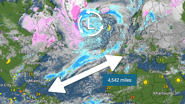
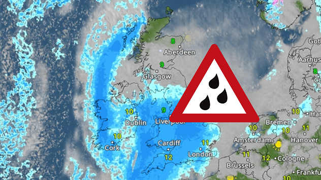
Our July has so far been dominated largely by low pressure across the UK and Ireland. Our weather pattern has changed mainly due to a change in the jet stream.

The jet stream is a fast-flowing, meandering band of air, stationed 30,000 feet high in the atmosphere and blowing west to east across the Earth. It is the result of a large temperature gradient between the northern and southern hemisphere.

In June it was sat to the north of the UK and Ireland, allowing warmer air to build in from the south. Additionally, as the jet stream is a conveyor belt for low pressure systems, it kept them out our way passing to our north, allowing high pressure to build.

In July, the jet stream shifted southwards, flowing across the UK and Ireland, carrying low pressure systems directly to us. This set-up is more akin to it's winter position, when the temperature difference is greater and the jet stream becomes stronger.

With a shift in position southwards, this also means the warm air remains contained across central and southern Europe where there is currently a severe heatwave, while dragging in cooler air to the UK and Ireland.

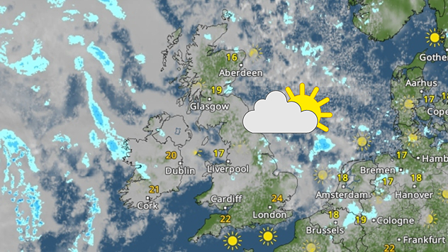
Temperatures have been widely around or below-average for much of the month of July, with the start of the month in particular on the cooler side.

In terms of rainfall, we have seen an increasing amount through the month, working its way wetter than average there too.

Into next week the jet stream looks to hold a similar position, so no sign of a changing weather pattern just yet. Be sure to keep tabs on our regular Weather Trends for any further detail though.

More on the topic
A marked change in the weather. Cold front heading south. . . Monday, 7 September 2026
Map of Europe showing a cold front stretching from Scandinavia to Spain. Thunderstorms are shown in southern and central Europe.
Monday, 7 September 2026

Cold front heading south

A marked change in the weather
More rain needed to ease drought. Reservoirs still falling. . . Tuesday, 8 September 2026
Aerial view of a depleted reservoir with exposed banks and a narrow winding stream through the dry basin, surrounded by green hills and roads.
Tuesday, 8 September 2026

Reservoirs still falling

More rain needed to ease drought
Severe weather hits Mallorca and Italy. Severe thunderstorms. . . Thursday, 10 September 2026
Numerous thunderstorms are sweeping across La Palma. The many lightning symbols on the radar and lightning map show that there is heavy lightning activity across large parts of the island. The thunderstorms are striking particularly in the island’s interior and in the south. On the right, you can see the aftermath: a large fallen tree has buried a car beneath it. Emergency services are clearing up the damage. So, along with the thunderstorms, not only heavy rain but also gusts of wind can become a problem.
Thursday, 10 September 2026

Severe thunderstorms

Severe weather hits Mallorca and Italy
All weather news
This might also interest you
Seasonal warmth between spring thunder. Your weather - Your shots. . . Sunday, 19 April 2026
Split image showing coastal sunset with layered lenticular clouds over rooftops and palm trees on the left, and a green valley with river and hills under soft daylight on the right.
Sunday, 19 April 2026

Your weather - Your shots

Seasonal warmth between spring thunder
Bright and warm conditions take hold. Spring-like outlook. . . Thursday, 23 April 2026
Split UK map showing warm temperatures up to 21 degrees in orange on the left and clear sunny conditions with temperatures from 12 to 18 degrees on the right, with sun icons across the country.
Thursday, 23 April 2026

Spring-like outlook

Bright and warm conditions take hold
A frozen start to the weekend. Icy conditions. . . Friday, 13 February 2026
UK temperature map dated 14.02 showing widespread subzero values in blue shading, with readings such as −4 in Glasgow, −3 in Dublin, and −2 in London, alongside a blue thermometer icon.
Friday, 13 February 2026

Icy conditions

A frozen start to the weekend
All articles
Weather & Radar

Weather & Radar is also available on

Google Play StoreApp Store

Company

Contact us Privacy Policy Legal info Accessibility statement

Services

Uploader

Socials

facebooktwittertikToklinkList