Home
Weather London
WeatherRadar
RainfallRadar
TemperatureRadar
WindRadar
LightningRadar
Weather News
Editor's Pick
Discover the app
Weather widget
Contact us
Apps
Career
    Home / Editor's Pick /

    Trickier than you think - Why it's hard to pinpoint thunderstorms

09:36
27 May 2026

Trickier than you think
Why it's hard to pinpoint thunderstorms

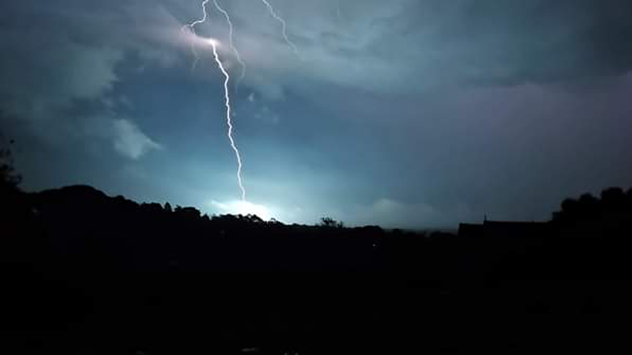
Bright lightning bolt striking beneath dark storm clouds over a silhouetted landscape at night, illuminating the sky with blue-white flashes.
Lightning strikes the ground in Ivybridge, Devon. - © Weather & Radar Uploader

Mentioning a risk of thunderstorms in a forecast often comes with a mixture of feelings. Some of us love them, while others of us are more thankful when they miss our location.

When thunderstorms pop up in forecasts, most of us will check if they're nearby. Instead, finding a thunderstorm warning area with no pinpointed location where the thunderstorm will occur.

This is because locking down the location of a thunderstorm is actually rather difficult before it forms. The best way to explain why is the case is by using an analogy of a saucepan boiling some water.

When boiling water, you know that bubbles will eventually appear when the conditions are right, you just don’t know where they will appear.

This is similar to the prediction of thunderstorms. We can see an area of unstable conditions growing to aid the development of a thunderstorm. We just cannot pinpoint where the exact conditions will be to identify the specific location of the thunderstorm itself.

Once a thunderstorm has been established, we are able to use current weather observation data to update our forecasts to both keep track of the thunderstorm and predict where it will move.

Ryan Hathaway
More on the topic
Split image showing a tranquil reservoir at sunset with rolling hills on the left, and a dramatic cloud illuminated by crepuscular sun rays above a tree-lined horizon on the right.
Sunday, 31 May 2026

Your weather - Your shots

Cooler views after the week's heat
Heat map centered on London showing intense red temperatures across southeast England, with Heathrow highlighted at 33.5°C and nearby cities around 30–32°C.
Monday, 25 May 2026

33.5 °C and still rising

Hottest May day on record
v
Thursday, 28 May 2026

Gusts exceeding 124 mph

Typhoon risk in the Western Pacific
All weather news
This might also interest you
UK temperature map dated 14.02 showing widespread subzero values in blue shading, with readings such as −4 in Glasgow, −3 in Dublin, and −2 in London, alongside a blue thermometer icon.
Friday, 13 February 2026

Icy conditions

A frozen start to the weekend
Split image showing aerial flooding in a town with muddy water covering roads on the left, and a rural road on the right blocked by heavy snowfall with vans stopped and a person walking in snow.
Tuesday, 27 January 2026

Storm Chandra

Flooding, gales, and heavy snow
plit image showing a double rainbow over a rocky shoreline on the left and sheep grazing in a green field under stormy clouds on the right.
Sunday, 2 November 2025

Your weather - Your shots

Mixed conditions on an unsettled week
All articles
Weather & Radar

Weather & Radar is also available on

Google Play StoreApp Store

Company

Contact us Privacy Policy Legal info Accessibility statement

Services

Uploader

Socials

facebooktwittertikToklinkList