Home / Weather News /

Storm BERT - what to expect

12:31
22 November 2024

Impact timeline
Storm Bert - what to expect

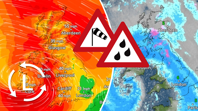
WeatherRadar for Saturday 8am (left) and 11am (right). Pink areas show where snow is expected, orangey-red colours indicate potential for freezing rain and ice.

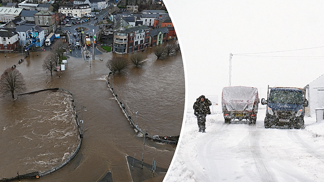
Saturday wil bring plenty of active weather to the UK and Ireland, with potential disruption on roads, railways and ferries.

Storm BERT was named by the Irish Met Éireann weather service on Thursday and is forecast to bring a fresh wave of snow, heavy rain and coastal gales this weekend. At the same time, the huge Atlantic storm system will also introduce much milder air from the subtropics as winds turn to the southwest, bringing the current cold spell to an end.

How and why are winter storms named?Background

While not all parts of the country will see the worst of the conditions, things will be very unpleasant throughout the weekend, but more particularly on Saturday.

Here is what to expect in terms of impacts:

  • Snow and ice: Mainly in N England and Scotland on Saturday morning. 10-20cm likely in places, along with drifting snow and local power cuts due to heavy, wet snow on trees and powerlines
  • Rain: Frequent, heavy rain, 30-60mm possible in many areas, but over 100mm likely in parts of South Wales and Southwest England. Increasing risk of local flooding due to a combination of rain and thawing snow
  • Wind: Strong winds and gales around most coastal regions, gusting to 50-60mph, perhaps up to 70mph in some places. Risk of some tree damage and blocked roads
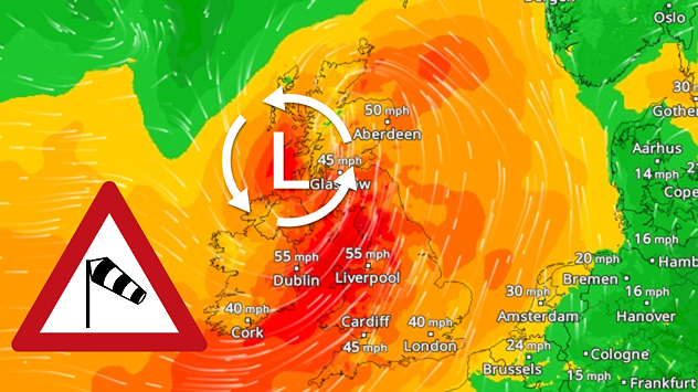
Temperatures are expected to warm significantly from southwest to northeast as BERT's weather fronts sweep through and Sunday morning will feel positively balmy for many after the current cold snap, with some areas likely to see up to 15 or 16C.

This is extremely mild for the time of year and not too far from date records for the 24th of November.

It will however remain very unsettled and windy on Sunday and Monday, with further showery outbreaks of rain interspersed with some brighter spells as temperatures remain fairly mild.

Keep a close eye on the weather and wind radar this weekend to see how and when Storm BERT will affect your area.

How to activate severe weather warningsBe prepared
Lars Lowinski
More on the topic
The weather map shows extremely low temperatures in Canada.
Monday, 15 December 2025

Minus 53 degrees

Record cold in Canada's Yukon Territory
Split image showing a towering storm cloud with rain shafts over the sea on the left and a vivid red aurora illuminating the night sky above residential rooftops on the right, divided by a curved white line.
Tuesday, 9 December 2025

Your weather - Your shots

Autumn captured by you
Radar map showing widespread blue rain bands over the UK and Ireland with a triangular heavy-rain warning icon placed over central Britain.
Tuesday, 16 December 2025

Thursday rain

Incoming downpour prompts warnings
All weather news
This might also interest you
Split weather map showing UK wind speeds in orange-red shades up to 40 mph on the left and warning levels in green-yellow on the right, with a central wind warning sign.
Wednesday, 22 October 2025

Warnings active

Storm Benjamin impacts the UK
Split weather map showing the UK and Ireland. The left side illustrates strong winds circulating around a low-pressure system, with gusts of 20–30 mph highlighted in orange and yellow. The right side shows radar imagery with widespread blue rain bands and patches of thunderstorms, especially over northern England and Scotland.
Thursday, 28 August 2025

Breakfast brief

Remaining widely unsettled
Weather graphic showing rain and wind fields over the Canary Islands and a central warning symbol.
Friday, 12 December 2025

Storm and rain

Turbulent weather in the Canary Islands
All articles
Weather & Radar

Weather & Radar is also available on

Google Play StoreApp Store

Company

Contact us Privacy Policy Legal info Accessibility statement

Services

Uploader

Socials

facebooktwittertikToklinkList