Home
Weather London
WeatherRadar
RainfallRadar
TemperatureRadar
WindRadar
LightningRadar
Weather News
Editor's Pick
Discover the app
Weather widget
Contact us
Apps
Career
    Home / Editor's Pick /

    Less oppressive heatwave - Cooler nights and lower dew points

08:00
9 July 2026

Less oppressive heatwave
Cooler nights and lower dew points

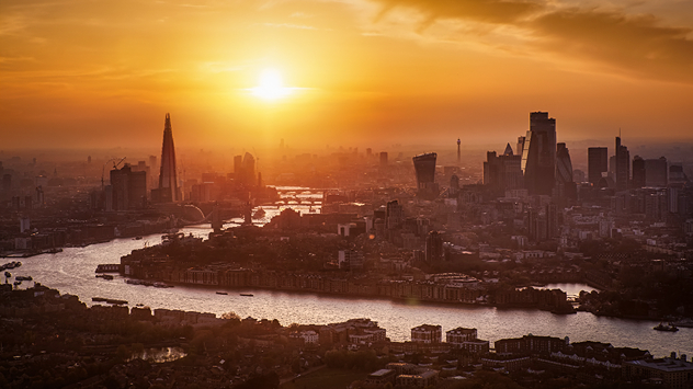
Aerial view of the London skyline at sunset with the River Thames winding through the city, the Shard and City skyscrapers silhouetted in hazy golden light, highlighting hot conditions.
London bathes in the summer sun.

We're in the midst of the third heatwave of the year, but is it feeling a little more barable than the last to you?

Unlike the June heat, which set multiple records, this time around the daily highs are slightly lower, mostly peaking in the mid-30s at the end of the week. Plus, humidity and dew points are lower too.

Dew points in particular are much lower. The dew point essentially tells us how much moisture is in the air. The higher the dew point, the less effective sweating becomes to cool the body, resulting in that sticky summer feeling.

It isn't just daytime temperatures that are lower but nighttime temperatures too. While in June we saw multiple tropical nights, whereby temperatures did not drop below 20°C, this time only a few areas will experience a handful of these.

Despite the less intense heatwave, heat-health alerts are still active and the elevated temperatures can pose a health threat if adequate precautions are not taken.

The current trend suggests a long-running period of heat, perhaps even the longest spell since the infamous 1976 heatwave which persisted for between 13 to 16 days for some parts of England.

Ryan Hathaway
More on the topic
Summer in full flow. Your weather - Your shots. . . Sunday, 5 July 2026
Split image showing golden crepuscular rays streaming through sunset clouds over the countryside on the left, and glowing blue noctilucent clouds above silhouetted trees and traffic lights at twilight on the right.
Sunday, 5 July 2026

Your weather - Your shots

Summer in full flow
Forest fires rage in southern Europe. Drought and wind. . . Monday, 6 July 2026
Split screen. On the left, a weather map of France and Spain showing the plumes of smoke from the forest fires. On the right, a fire-fighting aircraft in action.
Monday, 6 July 2026

Drought and wind

Forest fires rage in southern Europe
Yet another typhoon in the Pacific. Gusts of over 185 mph. . . Friday, 3 July 2026
Wind forecast map of the western Pacific showing a powerful typhoon east of Guam with a well-defined eye, strong wind circulation, and a windsock warning icon.
Friday, 3 July 2026

Gusts of over 185 mph

Yet another typhoon in the Pacific
All weather news
This might also interest you
Turbulent weather in the Canary Islands. Storm and rain. . . Friday, 12 December 2025
Weather graphic showing rain and wind fields over the Canary Islands and a central warning symbol.
Friday, 12 December 2025

Storm and rain

Turbulent weather in the Canary Islands
A frozen start to the weekend. Icy conditions. . . Friday, 13 February 2026
UK temperature map dated 14.02 showing widespread subzero values in blue shading, with readings such as −4 in Glasgow, −3 in Dublin, and −2 in London, alongside a blue thermometer icon.
Friday, 13 February 2026

Icy conditions

A frozen start to the weekend
New records for England and Wales. Broken again tomorrow?. . . Thursday, 25 June 2026
Temperature map of southwest Britain on 25.06 showing extreme heat across southern Wales and southwest England, with Bute Park in Cardiff highlighted at 34.2°C and Yeovilton at 36.4°C amid widespread deep red heat zones.
Thursday, 25 June 2026

Broken again tomorrow?

New records for England and Wales
All articles
Weather & Radar

Weather & Radar is also available on

Google Play StoreApp Store

Company

Contact us Privacy Policy Legal info Accessibility statement

Services

Uploader

Socials

facebooktwittertikToklinkList