Home
Weather London
WeatherRadar
RainfallRadar
TemperatureRadar
WindRadar
LightningRadar
Weather News
Editor's Pick
Discover the app
Weather widget
Contact us
Apps
Career
    Home / Editor's Pick /

    July to December - 2025: The year in weather

23:01
1 January 2026

July to December
2025: The year in weather

Temperature radar showing Europe in a heatwave.
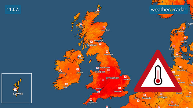
Temperature radar of the UK and Ireland with heat warning, highs of 30+ degrees in England and Wales.
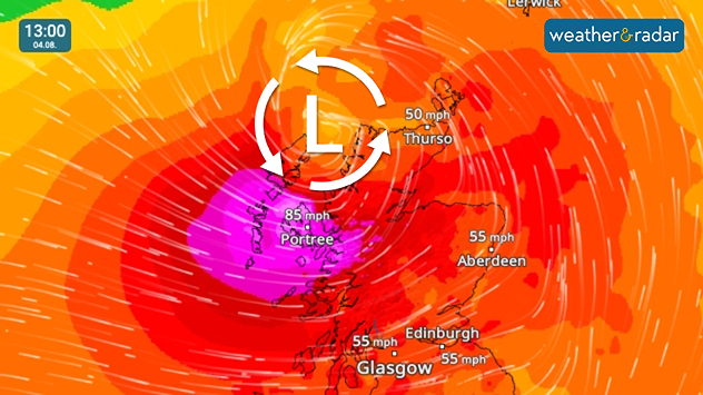
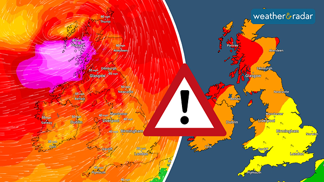
Wind map for Scotland. A pressure icon shows the location of Storm Floris. Peak gusts of 85 mph visible in Portree, 55 mph in Glasgow and Edinburgh.
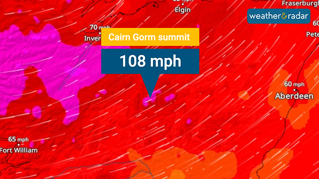
Wind radar showing a gust of 108 mph at the Cairn Gorm summit weather station.
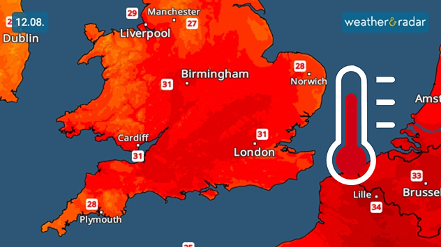
Temperature map showing Engand and Wales with a red thermometer. Map is widely red, indicating hot temperatures. Highs of 31 degrees in London, Cardiff, and Birmingham are visible.
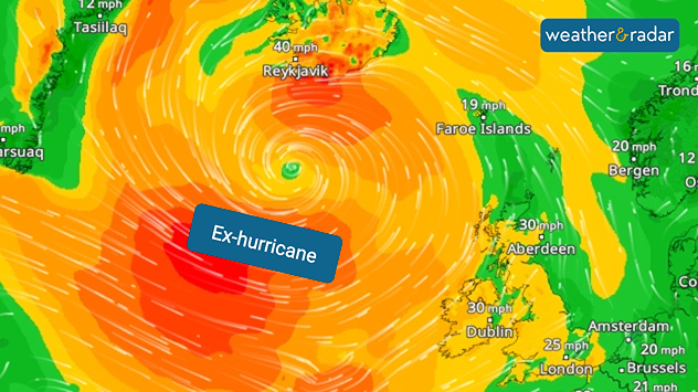
Weather map showing an ex-hurricane centred south of Iceland near Reykjavík, with swirling bands of strong winds. The heaviest winds, marked in red and orange, spread across the North Atlantic towards Ireland and the UK, with speeds up to 40 mph near Iceland and 30 mph in parts of Ireland and Scotland.
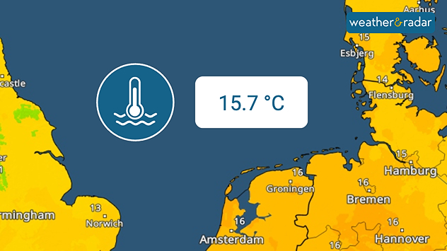
TemperatureRadar shows the North Sea with a water temperature of 15.7 degrees.
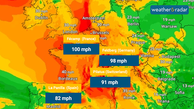
Weather map with colour representation of strong winds and marked peak gusts in Western Europe.
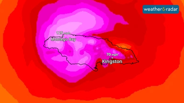
A weather map shows Hurricane Melissa over Jamaica. The Category 5 hurricane is moving over Montego Bay and Kingston with strong winds. Colours indicate wind speeds.
1/10
The second half of the year began with a continental heatwave.

Our year in weather slowed towards the middle of 2025, but from July things certainly picked up.

Multiple heatwaves, named storms, and records arrived. Further afield, the most impactful event was Hurricane Melissa which tore through Jamaica in October.

Hurricane Melissa impacts JamaicaFlashback
Weather & Radar editorial team
More on the topic
Typhoon warning for China. Up to 500 mm of rain. . . Friday, 24 July 2026
Weather map of the southern Chinese coast and Taiwan showing a powerful tropical cyclone. The eye of the storm is located near the coastal city of Shantou in the Chinese province of Guangdong. Around the centre, intense shades of red, pink and violet indicate gale-force winds, whilst a large orange wind field extends as far as the west coast of Taiwan. An overlaid windsack warning sign indicates dangerous storm winds. Cities such as Hong Kong, Guangzhou, Xiamen, Taipei and Taichung are shown, as are wind speeds and white flow lines illustrating the cyclonic air circulation.
Friday, 24 July 2026

Up to 500 mm of rain

Typhoon warning for China
Heat becoming a bigger factor in drought. New study. . . Thursday, 23 July 2026
A hand holds dry, dusty earth above a parched field. The ground is cracked and covered with plant debris – a sign of prolonged drought.
Thursday, 23 July 2026

New study

Heat becoming a bigger factor in drought
Fourth heatwave of the year. Peaking Wednesday. . . Tuesday, 28 July 2026
Temperature map of England and Wales on Wednesday 29.07 showing widespread hot conditions, with temperatures reaching 33°C near Cambridge, 32°C around London, Norwich, and Southend-on-Sea, and a large heat warning symbol highlighting elevated heat risk.
Tuesday, 28 July 2026

Peaking Wednesday

Fourth heatwave of the year
All weather news
This might also interest you
A frozen start to the weekend. Icy conditions. . . Friday, 13 February 2026
UK temperature map dated 14.02 showing widespread subzero values in blue shading, with readings such as −4 in Glasgow, −3 in Dublin, and −2 in London, alongside a blue thermometer icon.
Friday, 13 February 2026

Icy conditions

A frozen start to the weekend
Historic Storm Éowyn arrives. On this day.... . . Saturday, 24 January 2026
Split image showing a person in a yellow jacket struggling against strong winds and heavy rain on a street at night on the left, and an Irish wind forecast map on the right with red and purple shading, gusts up to 75 mph, and a wind warning icon, divided by a curved white line.
Saturday, 24 January 2026

On this day...

Historic Storm Éowyn arrives
Storm Chandra makes impact. Severe gales & heavy rain. . . Tuesday, 27 January 2026
Split image showing strong winds over the UK on a forecast map and widespread rain and snow on a weather radar map.
Tuesday, 27 January 2026

Severe gales & heavy rain

Storm Chandra makes impact
All articles
Weather & Radar

Weather & Radar is also available on

Google Play StoreApp Store

Company

Contact us Privacy Policy Legal info Accessibility statement

Services

Uploader

Socials

facebooktwittertikToklinkList