Home
Weather London
WeatherRadar
RainfallRadar
TemperatureRadar
WindRadar
LightningRadar
Weather News
Editor's Pick
Discover the app
Weather widget
Contact us
Apps
Career
    Home / Editor's Pick /

    El Niño to return? Auckland floods linked to La Niña

06:00
1 February 2023

El Niño to return?
Auckland floods linked to La Niña

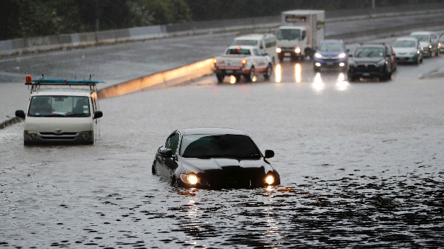
auckland floods
© picture alliance

After three years of experiencing the La Niña weather phenomenon, El Niño is expected to return in 2023, but not without bringing new dangers.

The recent, severe floods in Auckland, New Zealand were said to be exacerbated by La Niña, which causes the North Island to receive more rainfall than normal, due to the directional shift of prevalent winds. Different impacts are expected in different areas.

Both La Niña and El Niño are two sides of the El Niño Southern Oscillation (ENSO) which impacts water temperatures in the equatorial Pacific Ocean. La Niña brings cooler waters while El Niño brings warmer waters.

El Niño is known to intensify severe weather events across much of the planet and causes large swings year-to-year in weather differences.

In addition to influencing weather, both sides of the ENSO coin impact the global climate. La Niña helps cool temperatures. Despite this, 2022 still became one of the hottest years on record.

The potential arrival of El Niño means more heat records are likely to be breached in 2023, and since it intensifies later into the year, 2024 too.

Its impact varies in different regions. In western Pacific areas such as Australia conditions become drier, and hotter. A stark change after years of severe flooding due to intense rainfall.

In Europe the impact of El Niño arriving is not as severe although Spain and Portugal can often see wetter, and warmer winters. Particularly strong events also impact the UK and Ireland similarly.

There is currently a 66% of El Niño forming by August according to the US National Oceanic and Atmospheric Administration.

Not all El Niño events are the same in scale, it is still to early to predict how severe any potential event this year would be.

Ryan Hathaway
More on the topic
A wet start before conditions settle. Commonwealth Games 2026. . . Wednesday, 22 July 2026
Split image showing a weather map for western Scotland with widespread rain around Glasgow on the left, and runners poised at a starting line on an athletics track on the right.
Wednesday, 22 July 2026

Commonwealth Games 2026

A wet start before conditions settle
Heat becoming a bigger factor in drought. New study. . . Thursday, 23 July 2026
A hand holds dry, dusty earth above a parched field. The ground is cracked and covered with plant debris – a sign of prolonged drought.
Thursday, 23 July 2026

New study

Heat becoming a bigger factor in drought
Drought across large parts of Europe. High fire risk. . . Monday, 20 July 2026
Split image showing a Europe rainfall anomaly map on the left with widespread dry conditions across much of the continent, and a cracked, parched field on the right alongside a wildfire warning symbol highlighting elevated fire risk.
Monday, 20 July 2026

High fire risk

Drought across large parts of Europe
All weather news
This might also interest you
Long-term trends need a pinch of salt. 40 °C in July?. . . Tuesday, 30 June 2026
Temperature radar of 2022 heatwave where the all-time temperature record in the UK was set. Warning symbol overlain.
Tuesday, 30 June 2026

40 °C in July?

Long-term trends need a pinch of salt
Seasonal warmth between spring thunder. Your weather - Your shots. . . Sunday, 19 April 2026
Split image showing coastal sunset with layered lenticular clouds over rooftops and palm trees on the left, and a green valley with river and hills under soft daylight on the right.
Sunday, 19 April 2026

Your weather - Your shots

Seasonal warmth between spring thunder
Historic Storm Éowyn arrives. On this day.... . . Saturday, 24 January 2026
Split image showing a person in a yellow jacket struggling against strong winds and heavy rain on a street at night on the left, and an Irish wind forecast map on the right with red and purple shading, gusts up to 75 mph, and a wind warning icon, divided by a curved white line.
Saturday, 24 January 2026

On this day...

Historic Storm Éowyn arrives
All articles
Weather & Radar

Weather & Radar is also available on

Google Play StoreApp Store

Company

Contact us Privacy Policy Legal info Accessibility statement

Services

Uploader

Socials

facebooktwittertikToklinkList