Home
Weather London
WeatherRadar
RainfallRadar
TemperatureRadar
WindRadar
LightningRadar
Weather News
Editor's Pick
Discover the app
Weather widget
Contact us
Apps
Career
    Home / Editor's Pick /

    Brewing in the Atlantic - Summer storm to start the week?

09:00
31 July 2025

Brewing in the Atlantic
Summer storm to start the week?

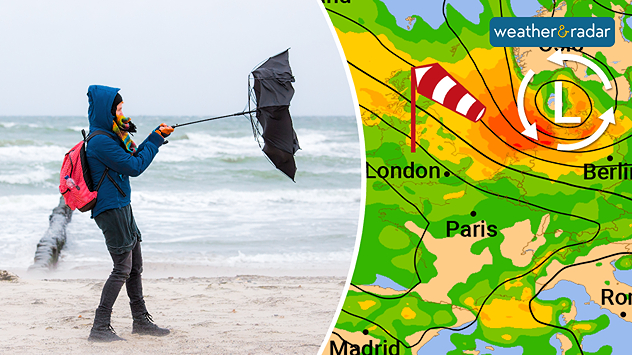
Weather maps for Tuesday evening show a storm front over the North Sea more akin to an autumn storm. - © Rainer Fuhrmann/Shutterstock.com

It could be a stormy start to August, with the outlook suggesting the arrival of a full-blown summer storm to begin next week.

The storm is expected to form overnight on Sunday, into Monday, over the eastern Atlantic and reach Ireland and the UK shortly after.

This will bring strong gusts of wind at the start of the week, with hurricane-force winds possible in the Scottish Highlands.

The low pressure system is then expected to move across the North Sea towards Denmark as a full-blown summer storm.

The Netherlands and northern and north-Eastern Germany would be particularly affected by the storm.

However, this forecast is still very uncertain. If it does happen, it would be a very dangerous weather development for the beginning of August, with wind gusts able to cause considerably more damage to leafy trees than in autumn or winter.

Weather & Radar editorial team
More on the topic
Autumn arrives with vivid colour. Your weather - Your shots. . . Sunday, 6 September 2026
Split image showing peach-lit textured clouds above silhouetted trees and golden cumulus clouds reflected in a calm canal lined with boats.
Sunday, 6 September 2026

Your weather - Your shots

Autumn arrives with vivid colour
Severe weather in the Mediterranean. Is a medicane on the way?. . . Monday, 14 September 2026
A weather map shows a powerful low-pressure system over the Mediterranean, with warning symbols for storms and heavy rain.
Monday, 14 September 2026

Is a medicane on the way?

Severe weather in the Mediterranean
Severe weather in southern Europe. Thunderstorms & heavy rain. . . Wednesday, 9 September 2026
On the left, dark storm clouds over a coastline. On the right, a weather map shows thunderstorms over the western Mediterranean, with warning symbols for tornadoes, storms and hail.
Wednesday, 9 September 2026

Thunderstorms & heavy rain

Severe weather in southern Europe
All weather news
This might also interest you
A frozen start to the weekend. Icy conditions. . . Friday, 13 February 2026
UK temperature map dated 14.02 showing widespread subzero values in blue shading, with readings such as −4 in Glasgow, −3 in Dublin, and −2 in London, alongside a blue thermometer icon.
Friday, 13 February 2026

Icy conditions

A frozen start to the weekend
Historic Storm Éowyn arrives. On this day.... . . Saturday, 24 January 2026
Split image showing a person in a yellow jacket struggling against strong winds and heavy rain on a street at night on the left, and an Irish wind forecast map on the right with red and purple shading, gusts up to 75 mph, and a wind warning icon, divided by a curved white line.
Saturday, 24 January 2026

On this day...

Historic Storm Éowyn arrives
Storm Chandra makes impact. Severe gales & heavy rain. . . Tuesday, 27 January 2026
Split image showing strong winds over the UK on a forecast map and widespread rain and snow on a weather radar map.
Tuesday, 27 January 2026

Severe gales & heavy rain

Storm Chandra makes impact
All articles
Weather & Radar

Weather & Radar is also available on

Google Play StoreApp Store

Company

Contact us Privacy Policy Legal info Accessibility statement

Services

Uploader

Socials

facebooktwittertikToklinkList