Home
Weather London
WeatherRadar
RainfallRadar
TemperatureRadar
WindRadar
LightningRadar
Weather News
Editor's Pick
Discover the app
Weather widget
Contact us
Apps
Career
    Home / Editor's Pick /

    Your weather - Your shots: Warming sunrises and post-flood scenes

16:00
14 January 2024

Your weather - Your shots
Warming sunrises and post-flood scenes

Sunrise over lake
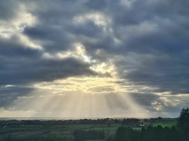
Crepuscular rays
High river levels
Puddle reflection
1/4
An early morning sunrise casts a warming glow over Lough Corrib, seen from Oughterard, Ireland. - © Pat Leonard via Weather & Radar Uploader

With flooding behind us, and snow possibly ahead, it is time to take a look at the week we're adding to the history books as captured by you!

As a true wintry week arrives, we want to see the scene near you. Frosty mornings, icy patterns, especially if you see snow!

Simply snap a picture then tap the image icon in the app, or use our dedicated uploaders for the UK or Ireland.

Get involved: How to use the uploaderread more
Weather & Radar editorial team

More on the topic

Storm Austen approaches. What to expect tonight. . . Thursday, 22 October 2026
Split image showing a wind map with 65 mph near Brest and a swirling storm south of England, beside a man wearing glasses and holding a microphone.
Thursday, 22 October 2026

What to expect tonight

Storm Austen approaches
Autumn storms sweep across Europe. Boelo and more. . . Monday, 26 October 2026
Split image showing a wind forecast with 60 mph near Aberdeen and 50 mph near Dublin, beside a fallen tree blocking a pavement near parked cars.
Monday, 26 October 2026

Boelo and more

Autumn storms sweep across Europe
Overnight impacts as Austen hits. Power cuts, travel issues. . . Friday, 23 October 2026
Split image showing floodwater surging beneath a railway bridge at night and a wind map with low pressure over the English Channel and 60 mph near Brest.
Friday, 23 October 2026

Power cuts, travel issues

Overnight impacts as Austen hits
All weather news

This might also interest you

Storm Chandra makes impact. Severe gales & heavy rain. . . Tuesday, 27 January 2026
Split image showing strong winds over the UK on a forecast map and widespread rain and snow on a weather radar map.
Tuesday, 27 January 2026

Severe gales & heavy rain

Storm Chandra makes impact
Historic Storm Éowyn arrives. On this day.... . . Saturday, 24 January 2026
Split image showing a person in a yellow jacket struggling against strong winds and heavy rain on a street at night on the left, and an Irish wind forecast map on the right with red and purple shading, gusts up to 75 mph, and a wind warning icon, divided by a curved white line.
Saturday, 24 January 2026

On this day...

Historic Storm Éowyn arrives
Bright and warm conditions take hold. Spring-like outlook. . . Thursday, 23 April 2026
Split UK map showing warm temperatures up to 21 degrees in orange on the left and clear sunny conditions with temperatures from 12 to 18 degrees on the right, with sun icons across the country.
Thursday, 23 April 2026

Spring-like outlook

Bright and warm conditions take hold
All articles
Weather & Radar

Weather & Radar is also available on

Google Play StoreApp Store

Company

Contact us Privacy Policy Legal info Accessibility statement

Services

Uploader

Socials

facebooktwittertikToklinkList