Home
Weather London
WeatherRadar
RainfallRadar
TemperatureRadar
WindRadar
LightningRadar
Weather News
Editor's Pick
Discover the app
Weather widget
Contact us
Apps
Career
    Home / Editor's Pick /

    Your weather - Your shots: Vibrant skies for the last week of July

11:00
2 August 2026

Your weather - Your shots
Vibrant skies for the last week of July

Golden-orange sunset over open farmland with silhouetted trees on the horizon, streaked high clouds glowing in the evening sky, and a small flock of birds flying across the fading light.
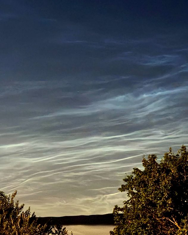
Electric-blue noctilucent clouds rippling across a dark twilight sky above silhouetted trees and a distant horizon, with delicate wave-like bands glowing after sunset.
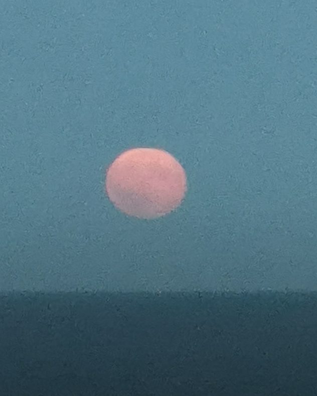
Full Moon low above a dark horizon, glowing soft pink through thick atmospheric haze beneath a muted blue-gray evening sky.
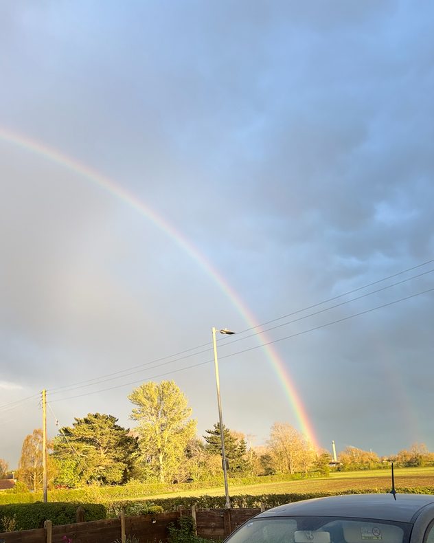
Bright rainbow arching across a stormy sky above sunlit trees and fields, with dark rain clouds, a streetlight, power lines, and part of a parked car in the foreground.
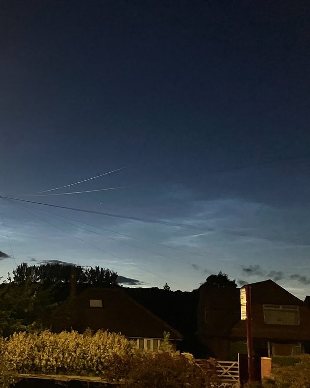
Electric-blue noctilucent clouds glowing above silhouetted houses and trees after sunset, with faint aircraft contrails and overhead utility wires crossing the deep twilight sky.
Sweeping cirrus clouds and smooth lenticular clouds above rolling farmland under a deep blue sky, with golden harvested fields, hedgerows, and scattered trees stretching across the countryside.
1/6
A golden sunset over Wicken, Cambridgeshire. - © Alicia Basil Shawes

The final week of July delivered vibrant sunsets, rainbows, and noctilucent clouds in parts of the UK.

Once again, it isn't just the still that were captured, but a collection of weather moments filmed with the Weather & Radar app!

Send in your pictures to appear here next week through the Uploader, or film your weather in the moment with the video feature, it's easy to do:

Weather & Radar editorial team
More on the topic
Cooler nights on the horizon. For parts of Europe. . . Thursday, 6 August 2026
Temperature Radar showing the night-time lows in Central Europe. Cooler air is reaching the west and north in particular, whilst the south-east remains significantly warmer.
Thursday, 6 August 2026

For parts of Europe

Cooler nights on the horizon
The Perseids reach their peak. Shooting stars overhead. . . Tuesday, 11 August 2026
Shooting stars in the night sky
Tuesday, 11 August 2026

Shooting stars overhead

The Perseids reach their peak
Huge hailstones in Poland. Severe weather hits towns. . . Friday, 7 August 2026
Friday, 7 August 2026

Severe weather hits towns

Huge hailstones in Poland
All weather news
This might also interest you
Flooding, gales, and heavy snow. Storm Chandra. . . Tuesday, 27 January 2026
Split image showing aerial flooding in a town with muddy water covering roads on the left, and a rural road on the right blocked by heavy snowfall with vans stopped and a person walking in snow.
Tuesday, 27 January 2026

Storm Chandra

Flooding, gales, and heavy snow
Historic Storm Éowyn arrives. On this day.... . . Saturday, 24 January 2026
Split image showing a person in a yellow jacket struggling against strong winds and heavy rain on a street at night on the left, and an Irish wind forecast map on the right with red and purple shading, gusts up to 75 mph, and a wind warning icon, divided by a curved white line.
Saturday, 24 January 2026

On this day...

Historic Storm Éowyn arrives
Super Typhoon Bavi threatens Taiwan. Up to 1,000 mm of rain. . . Wednesday, 8 July 2026
The image shows an intense tropical cyclone over the western Pacific, east of Taiwan and the Philippines. The centre of the system is depicted as a light purple and white vortex with a clearly visible eye, surrounded by a ring of red and orange areas indicating the strongest wind speeds. A white arrow marks the typhoon’s predicted track towards the north-west, in the direction of Taiwan. To the west of the storm lie the Philippines, with the cities of Manila and Cebu; to the north of these lies Taiwan, with Taipei. Further west, the Chinese coast, including Hong Kong, and parts of Vietnam can be seen. The coloured wind map shows predominantly green areas outside the storm’s core, indicating significantly weaker winds. White streamlines illustrate the typhoon’s anti-clockwise circulation in the Northern Hemisphere. The highest wind speeds are concentrated around the eye of the cyclone.
Wednesday, 8 July 2026

Up to 1,000 mm of rain

Super Typhoon Bavi threatens Taiwan
All articles
Weather & Radar

Weather & Radar is also available on

Google Play StoreApp Store

Company

Contact us Privacy Policy Legal info Accessibility statement

Services

Uploader

Socials

facebooktwittertikToklinkList