Home
Weather London
WeatherRadar
RainfallRadar
TemperatureRadar
WindRadar
LightningRadar
Weather News
Editor's Pick
Discover the app
Weather widget
Contact us
Apps
Career
    Home / Editor's Pick /

    Your weather - Your shots: Summer in full flow

13:00
5 July 2026

Your weather - Your shots
Summer in full flow

Golden crepuscular rays streaming through layered clouds at sunset above a rolling countryside, with silhouetted trees, grassy fields, and warm orange light along the horizon.
Kitesurfer riding choppy waves beneath layered white clouds and a deep blue sky, with a colourful kite soaring overhead above a wideswept beach and rough sea.
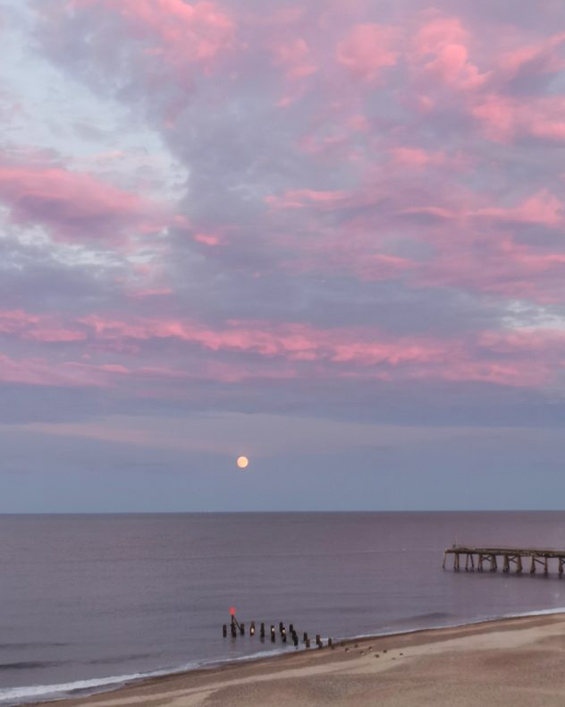
Full moon rising above a calm sea beneath pink and purple sunset clouds, with a sandy beach, wooden groynes, and a pier extending into the water on the right.
Blue sky filled with sweeping wispy cirrus streaks and rippled altocumulus cloud bands above scattered fair-weather cumulus clouds near a coastal car park and marina.
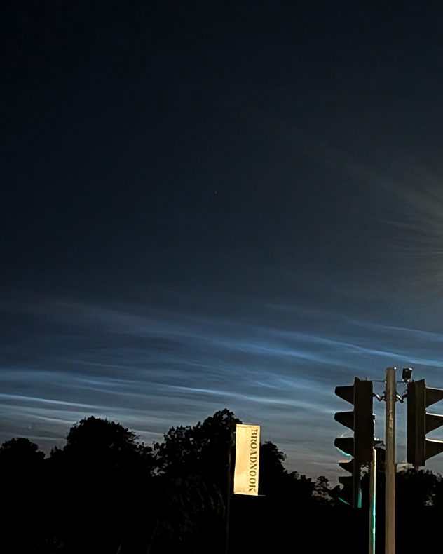
Electric-blue noctilucent clouds streching across a dark twilight sky above silhouetted trees and traffic lights, with delicate rippled bands glowing near the horizon.
1/5
Crepsulcular rays bloom behind the clouds at Bowden Hill, Wiltshire. - © Patrick Goley

The temperatures eased, but summer is now in full flow and provided a slew of photogenic scenes this week across the UK and Ireland.

Have pictures or videos to share with us? Head to the Uploader, or film your own weather moment and send it in or share it with friends with the video feature!

Weather & Radar editorial team

More on the topic

Severe weather on the Adriatic coast. Rain, storms and snow. . . Thursday, 12 November 2026
The weather warning map shows heavy rain from Thursday to Friday, stretching from northern Italy through Slovenia and Croatia to Montenegro. Particularly heavy rainfall is expected along the northern Adriatic coast.
Thursday, 12 November 2026

Rain, storms and snow

Severe weather on the Adriatic coast
A foggy start to a frosty end. Your weather - Your shots. . . Sunday, 15 November 2026
Split image showing a calm lake shrouded in dense gray fog beside terraced houses beneath textured purple-gray sunset clouds.
Sunday, 15 November 2026

Your weather - Your shots

A foggy start to a frosty end
First widespread frost of the season. Scrapers at the ready!. . . Thursday, 12 November 2026
Split image showing a UK and Ireland temperature map with lows of -3°C near Cardiff, beside a gloved hand scraping frost from a car windscreen.
Thursday, 12 November 2026

Scrapers at the ready!

First widespread frost of the season
All weather news

This might also interest you

Super Typhoon Bavi threatens Taiwan. Up to 1,000 mm of rain. . . Wednesday, 8 July 2026
The image shows an intense tropical cyclone over the western Pacific, east of Taiwan and the Philippines. The centre of the system is depicted as a light purple and white vortex with a clearly visible eye, surrounded by a ring of red and orange areas indicating the strongest wind speeds. A white arrow marks the typhoon’s predicted track towards the north-west, in the direction of Taiwan. To the west of the storm lie the Philippines, with the cities of Manila and Cebu; to the north of these lies Taiwan, with Taipei. Further west, the Chinese coast, including Hong Kong, and parts of Vietnam can be seen. The coloured wind map shows predominantly green areas outside the storm’s core, indicating significantly weaker winds. White streamlines illustrate the typhoon’s anti-clockwise circulation in the Northern Hemisphere. The highest wind speeds are concentrated around the eye of the cyclone.
Wednesday, 8 July 2026

Up to 1,000 mm of rain

Super Typhoon Bavi threatens Taiwan
Historic Storm Éowyn arrives. On this day.... . . Saturday, 24 January 2026
Split image showing a person in a yellow jacket struggling against strong winds and heavy rain on a street at night on the left, and an Irish wind forecast map on the right with red and purple shading, gusts up to 75 mph, and a wind warning icon, divided by a curved white line.
Saturday, 24 January 2026

On this day...

Historic Storm Éowyn arrives
Storm Chandra makes impact. Severe gales & heavy rain. . . Tuesday, 27 January 2026
Split image showing strong winds over the UK on a forecast map and widespread rain and snow on a weather radar map.
Tuesday, 27 January 2026

Severe gales & heavy rain

Storm Chandra makes impact
All articles
Weather & Radar

Weather & Radar is also available on

Google Play StoreApp Store

Company

Contact us Privacy Policy Legal info Accessibility statement

Services

Uploader

Socials

facebooktwittertikToklinkList