Home
Weather London
WeatherRadar
RainfallRadar
TemperatureRadar
WindRadar
LightningRadar
Weather News
Editor's Pick
Discover the app
Weather widget
Contact us
Apps
Career
    Home / Editor's Pick /

    Your weather - Your shots: Late season views as summer rolls on

16:00
9 August 2026

Your weather - Your shots
Late season views as summer rolls on

Small wooden sailboat with one person aboard on a calm coastal bay at low tide, with exposed rocks, green seaweed, and a distant stone tower beneath broken clouds.
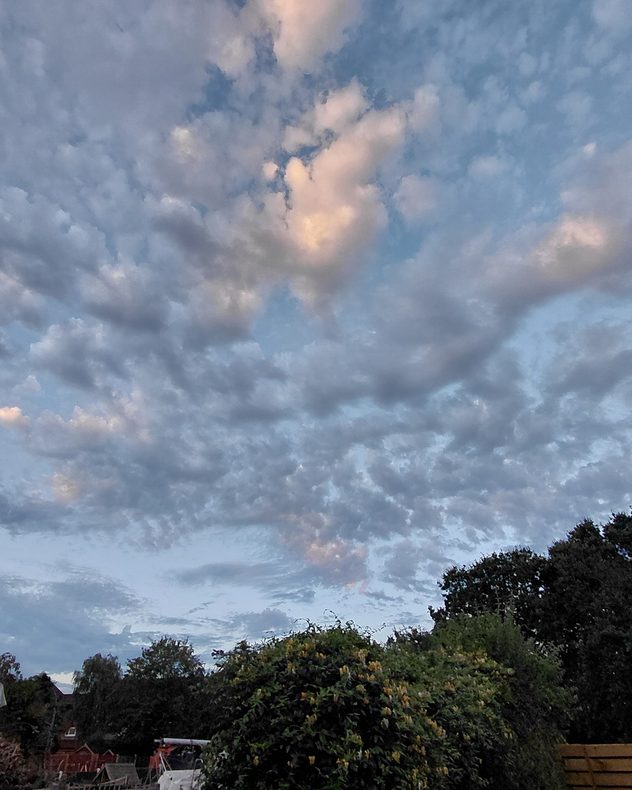
Textured altocumulus clouds spread across a blue evening sky, with soft pink light touching higher cloud patches above silhouetted trees and garden shrubs.
View over a black-and-white horse on a hillside trail surrounded by green bracken, woodland and rolling countryside beneath a vivid blue sky with scattered cumulus clouds.
Vivid pink, red and orange sunset clouds layered above silhouetted rooftops and trees, with darker streaks radiating through the glowing evening sky.
Rippled altocumulus cloud bands and scattered clouds glowing peach and gold at sunset against a blue evening sky above silhouetted treetops.
Scattered cumulus clouds glowing orange and peach at sunset beneath a hazy gray sky, with warm golden light intensifying toward the horizon.
Golden sun setting behind distant hills beneath layered clouds, with orange light reflecting across a winding body of water and dark vegetation in the foreground.
1/7
In Kinvara, Co. Galway the waters were calm on this summer's day. - © Ann Illing

The final month of summer has arrived, and the late-season views are rolling in across the UK and Ireland.

From the calm, sunny snaps, to videos of your weather moments captured in the week.

Want to get involved? Use the Uploader to send in your pictures, or film your own weather moment in the app and submit videos once you're finished!

Weather & Radar editorial team
More on the topic
Stronger winds make a return. Low pressure influence. . . Tuesday, 4 August 2026
Wind forecast map of the UK and Ireland showing a low-pressure system north of Scotland, a windsock icon highlighting blustery conditions, and widespread winds of 30–40 mph across the British Isles, with the strongest winds around Ireland and northern Britain.
Tuesday, 4 August 2026

Low pressure influence

Stronger winds make a return
Huge hailstones in Poland. Severe weather hits towns. . . Friday, 7 August 2026
Friday, 7 August 2026

Severe weather hits towns

Huge hailstones in Poland
Stormy day in parts of the UK & Ireland. Lightning potential. . . Tuesday, 4 August 2026
Satellite and lightning map of Scotland showing widespread rain and thunderstorms across the Highlands and western Scotland, with lightning strikes around the west coast and Hebrides. A thunderstorm icon highlights the active weather, while temperatures range from 15°C in Aberdeen to 24°C in Newcastle.
Tuesday, 4 August 2026

Lightning potential

Stormy day in parts of the UK & Ireland
All weather news
This might also interest you
Super Typhoon Bavi threatens Taiwan. Up to 1,000 mm of rain. . . Wednesday, 8 July 2026
The image shows an intense tropical cyclone over the western Pacific, east of Taiwan and the Philippines. The centre of the system is depicted as a light purple and white vortex with a clearly visible eye, surrounded by a ring of red and orange areas indicating the strongest wind speeds. A white arrow marks the typhoon’s predicted track towards the north-west, in the direction of Taiwan. To the west of the storm lie the Philippines, with the cities of Manila and Cebu; to the north of these lies Taiwan, with Taipei. Further west, the Chinese coast, including Hong Kong, and parts of Vietnam can be seen. The coloured wind map shows predominantly green areas outside the storm’s core, indicating significantly weaker winds. White streamlines illustrate the typhoon’s anti-clockwise circulation in the Northern Hemisphere. The highest wind speeds are concentrated around the eye of the cyclone.
Wednesday, 8 July 2026

Up to 1,000 mm of rain

Super Typhoon Bavi threatens Taiwan
New records for England and Wales. Broken again tomorrow?. . . Thursday, 25 June 2026
Temperature map of southwest Britain on 25.06 showing extreme heat across southern Wales and southwest England, with Bute Park in Cardiff highlighted at 34.2°C and Yeovilton at 36.4°C amid widespread deep red heat zones.
Thursday, 25 June 2026

Broken again tomorrow?

New records for England and Wales
Storm Chandra makes impact. Severe gales & heavy rain. . . Tuesday, 27 January 2026
Split image showing strong winds over the UK on a forecast map and widespread rain and snow on a weather radar map.
Tuesday, 27 January 2026

Severe gales & heavy rain

Storm Chandra makes impact
All articles
Weather & Radar

Weather & Radar is also available on

Google Play StoreApp Store

Company

Contact us Privacy Policy Legal info Accessibility statement

Services

Uploader

Socials

facebooktwittertikToklinkList