Home
Weather London
WeatherRadar
RainfallRadar
TemperatureRadar
WindRadar
LightningRadar
Weather News
Editor's Pick
Discover the app
Weather widget
Contact us
Apps
Career
    Home / Editor's Pick /

    Your weather - Your shots: From unsettled to warm and toasty

11:00
24 May 2026

Your weather - Your shots
From unsettled to warm and toasty

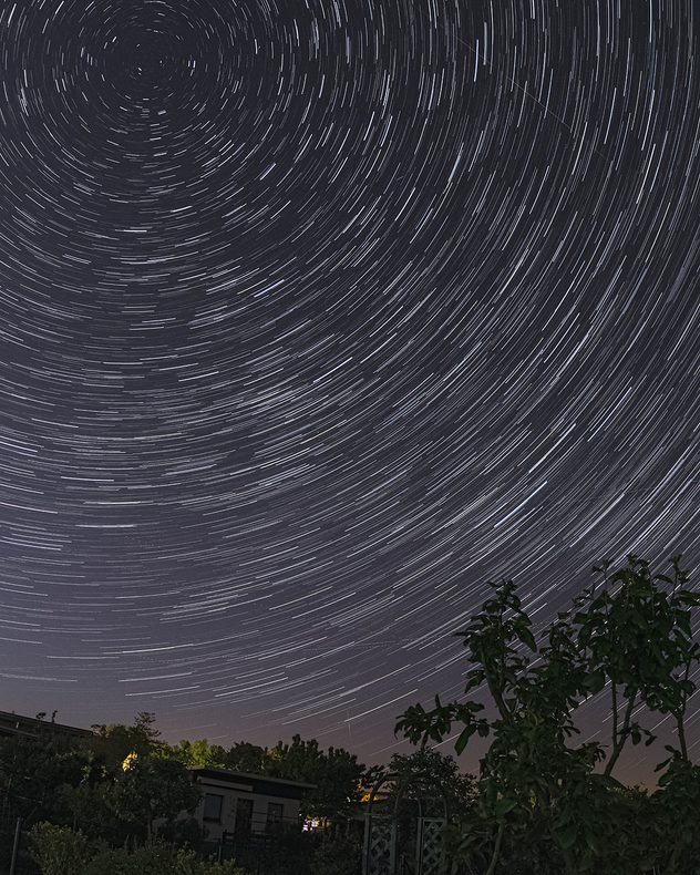
Long-exposure night sky showing circular star trails rotating around the celestial pole above silhouetted trees and garden structures.
1/4
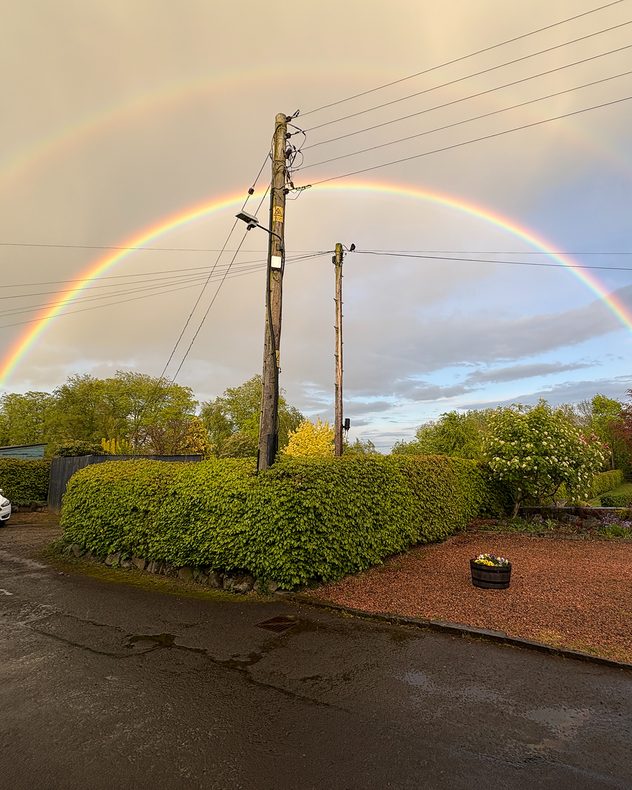
After spring rain, a bright double rainbow brightens St. David's in Crieff, Perthshire. - © Weather & Radar Uploader

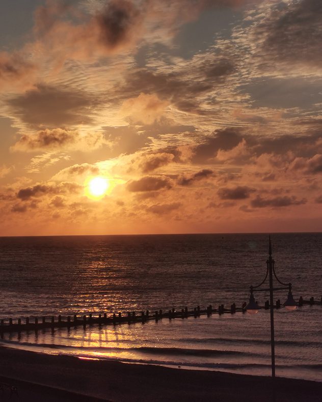
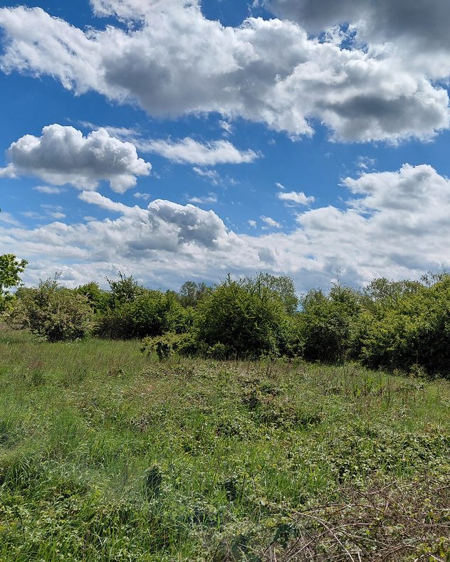
The heat is on, but it was an unsettled lead-up to the warmer spell which was captured through pictures and videos by you!

Rain spread early in the week, before more widespread blue skies took over. A little of each were recorded and sent in.

Have great snaps to share with us? Use the uploaders for the UK or Ireland to get involved, and send in your videos as you capture them with our latest feature!

Weather & Radar editorial team
More on the topic
First taste of winter in the Alps. White mountain peaks. . . Friday, 25 September 2026
Winter scenery in the Alps along the Großglockner High Alpine Road
Friday, 25 September 2026

White mountain peaks

First taste of winter in the Alps
Hurricane POLO remains dangerous. Many storms in the Pacific. . . Thursday, 24 September 2026
Thursday, 24 September 2026

Many storms in the Pacific

Hurricane POLO remains dangerous
Europe split in two distinct patterns. Autumn meets summer. . . Tuesday, 22 September 2026
Weather maps show a storm over the North Atlantic and temperatures of up to 37 degrees in Spain and Portugal.
Tuesday, 22 September 2026

Autumn meets summer

Europe split in two distinct patterns
All weather news
This might also interest you
Bright and warm conditions take hold. Spring-like outlook. . . Thursday, 23 April 2026
Split UK map showing warm temperatures up to 21 degrees in orange on the left and clear sunny conditions with temperatures from 12 to 18 degrees on the right, with sun icons across the country.
Thursday, 23 April 2026

Spring-like outlook

Bright and warm conditions take hold
Super Typhoon Bavi threatens Taiwan. Up to 1,000 mm of rain. . . Wednesday, 8 July 2026
The image shows an intense tropical cyclone over the western Pacific, east of Taiwan and the Philippines. The centre of the system is depicted as a light purple and white vortex with a clearly visible eye, surrounded by a ring of red and orange areas indicating the strongest wind speeds. A white arrow marks the typhoon’s predicted track towards the north-west, in the direction of Taiwan. To the west of the storm lie the Philippines, with the cities of Manila and Cebu; to the north of these lies Taiwan, with Taipei. Further west, the Chinese coast, including Hong Kong, and parts of Vietnam can be seen. The coloured wind map shows predominantly green areas outside the storm’s core, indicating significantly weaker winds. White streamlines illustrate the typhoon’s anti-clockwise circulation in the Northern Hemisphere. The highest wind speeds are concentrated around the eye of the cyclone.
Wednesday, 8 July 2026

Up to 1,000 mm of rain

Super Typhoon Bavi threatens Taiwan
Flooding, gales, and heavy snow. Storm Chandra. . . Tuesday, 27 January 2026
Split image showing aerial flooding in a town with muddy water covering roads on the left, and a rural road on the right blocked by heavy snowfall with vans stopped and a person walking in snow.
Tuesday, 27 January 2026

Storm Chandra

Flooding, gales, and heavy snow
All articles
Weather & Radar

Weather & Radar is also available on

Google Play StoreApp Store

Company

Contact us Privacy Policy Legal info Accessibility statement

Services

Uploader

Socials

facebooktwittertikToklinkList