Home
Weather London
WeatherRadar
RainfallRadar
TemperatureRadar
WindRadar
LightningRadar
Weather News
Editor's Pick
Discover the app
Weather widget
Contact us
Apps
Career
    Home / Editor's Pick /

    Your weather - Your shots: Foggy mornings and crisp autumn days

15:00
8 November 2026

Your weather - Your shots
Foggy mornings and crisp autumn days

Golden sunbeams stream through gaps in dark gray clouds onto a choppy sea with white-capped waves and a small offshore structure on the horizon.
Railway tracks curve into thick morning fog across grassy countryside, with a pale sun glowing above the mist in a pastel orange-blue sky.
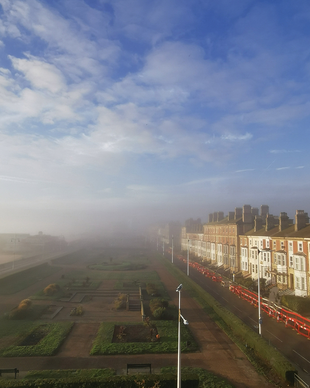
Dense morning fog blankets seafront gardens and a promenade, with rows of sunlit terraced houses emerging beneath a blue sky with scattered clouds.
Grey cumulus clouds drift across a pale blue sky, with soft golden sunset light illuminating their edges above dark residential rooftops.
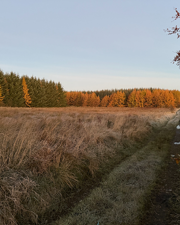
Golden-orange autumn trees line a meadow of pale, frost-covered grass beneath a clear blue sky, with a narrow muddy path along the right.
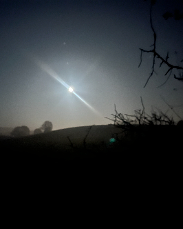
Bright moon glows above dark rolling hills and misty trees at night, with a diagonal lens flare and silhouetted branches in the foreground.
1/6
Crisp sunbeams shine over the North Sea in this shot from Lowestoft, Suffolk. - © Elaine High

Foggy mornings and autumnal colours are breaking through the crowd in this week's weather shots captured by you!

The spooky season was also captured perfectly in Kenilworth as fog descended over the Halloween night.

Want to get involved? Use the uploader for the UK or Ireland to send in your pictures, or record your weather in the moment with our video feature!

Weather & Radar editorial team

More on the topic

Autumn is the season for fog. High pressure, but no sun. . . Thursday, 5 November 2026
A split-screen image showing the weather radar for Europe and a mountain landscape. On the right, snow-capped peaks rise above a thick blanket of fog against a blue sky.
Thursday, 5 November 2026

High pressure, but no sun

Autumn is the season for fog
A final October collection. Your weather - Your shots. . . Sunday, 1 November 2026
Split image showing fog covering seafront gardens and terraced houses beside a bright full moon above orange sunset clouds and silhouetted trees.
Sunday, 1 November 2026

Your weather - Your shots

A final October collection
Mediterranean stays stormy. Spreading chill winds. . . Monday, 2 November 2026
WeatherRadar shows a storm over the Mediterranean.
Monday, 2 November 2026

Spreading chill winds

Mediterranean stays stormy
All weather news

This might also interest you

Seasonal warmth between spring thunder. Your weather - Your shots. . . Sunday, 19 April 2026
Split image showing coastal sunset with layered lenticular clouds over rooftops and palm trees on the left, and a green valley with river and hills under soft daylight on the right.
Sunday, 19 April 2026

Your weather - Your shots

Seasonal warmth between spring thunder
Historic Storm Éowyn arrives. On this day.... . . Saturday, 24 January 2026
Split image showing a person in a yellow jacket struggling against strong winds and heavy rain on a street at night on the left, and an Irish wind forecast map on the right with red and purple shading, gusts up to 75 mph, and a wind warning icon, divided by a curved white line.
Saturday, 24 January 2026

On this day...

Historic Storm Éowyn arrives
Super Typhoon Bavi threatens Taiwan. Up to 1,000 mm of rain. . . Wednesday, 8 July 2026
The image shows an intense tropical cyclone over the western Pacific, east of Taiwan and the Philippines. The centre of the system is depicted as a light purple and white vortex with a clearly visible eye, surrounded by a ring of red and orange areas indicating the strongest wind speeds. A white arrow marks the typhoon’s predicted track towards the north-west, in the direction of Taiwan. To the west of the storm lie the Philippines, with the cities of Manila and Cebu; to the north of these lies Taiwan, with Taipei. Further west, the Chinese coast, including Hong Kong, and parts of Vietnam can be seen. The coloured wind map shows predominantly green areas outside the storm’s core, indicating significantly weaker winds. White streamlines illustrate the typhoon’s anti-clockwise circulation in the Northern Hemisphere. The highest wind speeds are concentrated around the eye of the cyclone.
Wednesday, 8 July 2026

Up to 1,000 mm of rain

Super Typhoon Bavi threatens Taiwan
All articles
Weather & Radar

Weather & Radar is also available on

Google Play StoreApp Store

Company

Contact us Privacy Policy Legal info Accessibility statement

Services

Uploader

Socials

facebooktwittertikToklinkList