Home
Weather London
WeatherRadar
RainfallRadar
TemperatureRadar
WindRadar
LightningRadar
Weather News
Editor's Pick
Discover the app
Weather widget
Contact us
Apps
Career
    Home / Editor's Pick /

    Weather explainer: How do thunderstorms develop?

07:00
6 May 2023

Weather explainer
How do thunderstorms develop?

Lightning

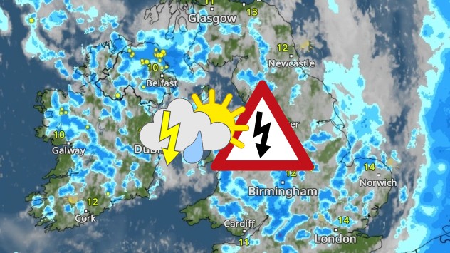
Thunderstorms have been bubbling up across the UK, but how do they actually develop?

They begin to form when warm air lies under colder air in an unstable atmosphere. The warm air will then rise quickly and condense into water droplets to form a cumulonimbus cloud.

Within the cloud, the warm air and water droplets continue to rise and will eventually freeze into positively charged ice crystals. When the ice crystals are heavy enough, they begin to fall as hail.

As the hail falls, it becomes negatively charged. The negatively charged pieces of hail at the base of the cloud then become attracted to the positively charged Earth's surface.

When the attraction is strong enough, the charges come together creating a flash of lightning. It is the rapid expansion and heating of the air which causes the claps of thunder.

Watch our weather explained video below to find out more about how thunderstorms develop:

More on the topic
Heat becoming a bigger factor in drought. New study. . . Thursday, 23 July 2026
A hand holds dry, dusty earth above a parched field. The ground is cracked and covered with plant debris – a sign of prolonged drought.
Thursday, 23 July 2026

New study

Heat becoming a bigger factor in drought
Typhoon warning for China. Up to 500 mm of rain. . . Friday, 24 July 2026
Weather map of the southern Chinese coast and Taiwan showing a powerful tropical cyclone. The eye of the storm is located near the coastal city of Shantou in the Chinese province of Guangdong. Around the centre, intense shades of red, pink and violet indicate gale-force winds, whilst a large orange wind field extends as far as the west coast of Taiwan. An overlaid windsack warning sign indicates dangerous storm winds. Cities such as Hong Kong, Guangzhou, Xiamen, Taipei and Taichung are shown, as are wind speeds and white flow lines illustrating the cyclonic air circulation.
Friday, 24 July 2026

Up to 500 mm of rain

Typhoon warning for China
Drought across large parts of Europe. High fire risk. . . Monday, 20 July 2026
Split image showing a Europe rainfall anomaly map on the left with widespread dry conditions across much of the continent, and a cracked, parched field on the right alongside a wildfire warning symbol highlighting elevated fire risk.
Monday, 20 July 2026

High fire risk

Drought across large parts of Europe
All weather news
This might also interest you
Flooding, gales, and heavy snow. Storm Chandra. . . Tuesday, 27 January 2026
Split image showing aerial flooding in a town with muddy water covering roads on the left, and a rural road on the right blocked by heavy snowfall with vans stopped and a person walking in snow.
Tuesday, 27 January 2026

Storm Chandra

Flooding, gales, and heavy snow
A frozen start to the weekend. Icy conditions. . . Friday, 13 February 2026
UK temperature map dated 14.02 showing widespread subzero values in blue shading, with readings such as −4 in Glasgow, −3 in Dublin, and −2 in London, alongside a blue thermometer icon.
Friday, 13 February 2026

Icy conditions

A frozen start to the weekend
Super Typhoon Bavi threatens Taiwan. Up to 1,000 mm of rain. . . Wednesday, 8 July 2026
The image shows an intense tropical cyclone over the western Pacific, east of Taiwan and the Philippines. The centre of the system is depicted as a light purple and white vortex with a clearly visible eye, surrounded by a ring of red and orange areas indicating the strongest wind speeds. A white arrow marks the typhoon’s predicted track towards the north-west, in the direction of Taiwan. To the west of the storm lie the Philippines, with the cities of Manila and Cebu; to the north of these lies Taiwan, with Taipei. Further west, the Chinese coast, including Hong Kong, and parts of Vietnam can be seen. The coloured wind map shows predominantly green areas outside the storm’s core, indicating significantly weaker winds. White streamlines illustrate the typhoon’s anti-clockwise circulation in the Northern Hemisphere. The highest wind speeds are concentrated around the eye of the cyclone.
Wednesday, 8 July 2026

Up to 1,000 mm of rain

Super Typhoon Bavi threatens Taiwan
All articles
Weather & Radar

Weather & Radar is also available on

Google Play StoreApp Store

Company

Contact us Privacy Policy Legal info Accessibility statement

Services

Uploader

Socials

facebooktwittertikToklinkList