Home
Weather London
WeatherRadar
RainfallRadar
TemperatureRadar
WindRadar
LightningRadar
Weather News
Editor's Pick
Discover the app
Weather widget
Contact us
Apps
Career
    Home / Editor's Pick /

    Weather explainer: How do thunderstorms develop?

07:00
6 May 2023

Weather explainer
How do thunderstorms develop?

Lightning

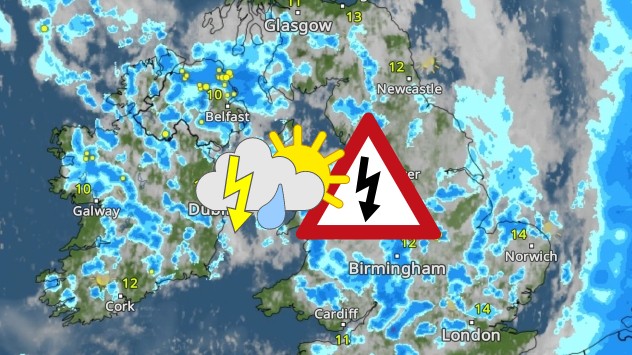
Thunderstorms have been bubbling up across the UK, but how do they actually develop?

They begin to form when warm air lies under colder air in an unstable atmosphere. The warm air will then rise quickly and condense into water droplets to form a cumulonimbus cloud.

Within the cloud, the warm air and water droplets continue to rise and will eventually freeze into positively charged ice crystals. When the ice crystals are heavy enough, they begin to fall as hail.

As the hail falls, it becomes negatively charged. The negatively charged pieces of hail at the base of the cloud then become attracted to the positively charged Earth's surface.

When the attraction is strong enough, the charges come together creating a flash of lightning. It is the rapid expansion and heating of the air which causes the claps of thunder.

Watch our weather explained video below to find out more about how thunderstorms develop:

More on the topic
Split image showing a tranquil reservoir at sunset with rolling hills on the left, and a dramatic cloud illuminated by crepuscular sun rays above a tree-lined horizon on the right.
Sunday, 31 May 2026

Your weather - Your shots

Cooler views after the week's heat
Split image showing a nighttime lightning strike beneath storm clouds on the left and a lightning detection map with dense storm activity across central England on the right.
Wednesday, 27 May 2026

Trickier than you think

Why it's hard to pinpoint thunderstorms
Weather warning map of Wales and western Britain showing a yellow thunderstorm alert with lightning symbols, alongside a large warning triangle for lightning.
Wednesday, 27 May 2026

Wales & western England

Thunderstorm watch continues
All weather news
This might also interest you
Split image showing a person in a yellow jacket struggling against strong winds and heavy rain on a street at night on the left, and an Irish wind forecast map on the right with red and purple shading, gusts up to 75 mph, and a wind warning icon, divided by a curved white line.
Saturday, 24 January 2026

On this day...

Historic Storm Éowyn arrives
Split image showing coastal sunset with layered lenticular clouds over rooftops and palm trees on the left, and a green valley with river and hills under soft daylight on the right.
Sunday, 19 April 2026

Your weather - Your shots

Seasonal warmth between spring thunder
plit image showing a double rainbow over a rocky shoreline on the left and sheep grazing in a green field under stormy clouds on the right.
Sunday, 2 November 2025

Your weather - Your shots

Mixed conditions on an unsettled week
All articles
Weather & Radar

Weather & Radar is also available on

Google Play StoreApp Store

Company

Contact us Privacy Policy Legal info Accessibility statement

Services

Uploader

Socials

facebooktwittertikToklinkList