Home
Weather London
WeatherRadar
RainfallRadar
TemperatureRadar
WindRadar
LightningRadar
Weather News
Editor's Pick
Discover the app
Weather widget
Contact us
Apps
Career
    Home / Editor's Pick /

    Twenty year ago today - Hurricane Katrina hits US Gulf Coast

09:00
29 August 2025

Twenty years ago today
Hurricane Katrina hits US Gulf Coast

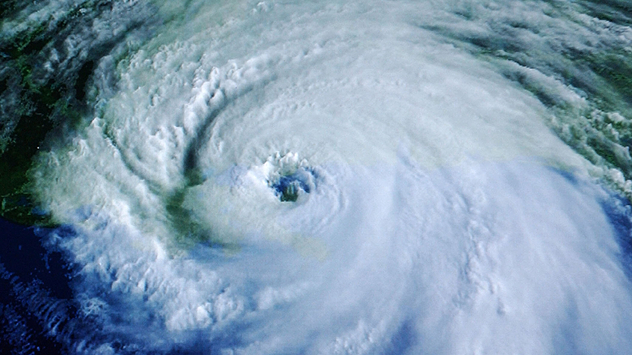
Satellite image shows the enormous Hurricane Katrina with a clearly visible eye structure.
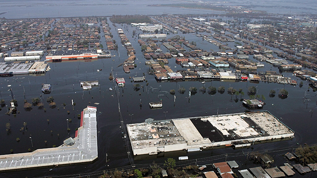
Aerial view of New Orleans, large parts of the city are under water after the hurricane.
A man clears away food debris in a flooded supermarket with a small excavator.
A soldier stands armed in front of the New Orleans Centre, surrounded by rubble and rubbish.
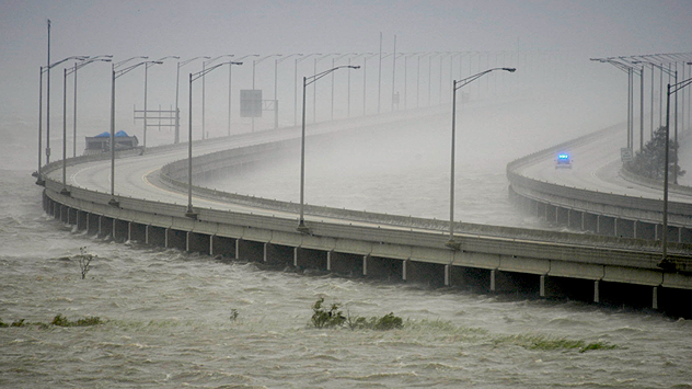
A long bridge stands in the storm, water lashes against the pillars, visibility is severely restricted by rain and spray.
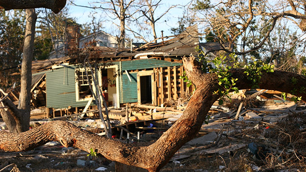
A house is badly damaged, walls and roof collapsed, debris scattered everywhere. In the foreground, a fallen tree.
Several sailing boats lie tightly wedged together and damaged in the harbour after Hurricane Katrina.
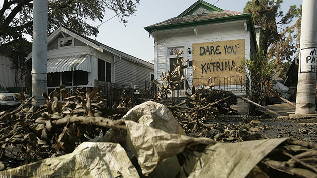
A house with a handwritten sign saying „Dare You Katrina“ among broken branches and debris.
1/8
Hurricane Katrina reached enormous proportions and struck the US Gulf Coast with full force exactly 20 years ago. - © dpa

On August 29th, 2005, Hurricane Katrina struck the US Gulf Coast with full force, causing considerable damage in the states of Mississippi, Alabama, and Louisiana.

The effects of the Category 5 hurricane were particularly devastating in New Orleans.

There, Katrina pushed a flood wave more than 10 metres high in front of it, causing dykes to break and entire neighbourhoods to be flooded. Over 1,800 people died and more than a million lost their homes.

Electricity, water, and infrastructure collapsed, fires raged, looting shook the city. Long after the storm, the city remained scarred.

Annika Jacob
Ryan Hathaway
More on the topic
Clouds return to capture the scene. Your weather - Your shots. . . Sunday, 26 July 2026
Waxing crescent Moon above vivid pink and magenta sunset clouds, with silhouetted trees along the horizon beneath a deepening blue twilight sky.
Sunday, 26 July 2026

Your weather - Your shots

Clouds return to capture the scene
Catastrophic forest fires in Europe. Thousands evacuated. . . Monday, 27 July 2026
A composite image showing a temperature map of south-western Europe and a drone shot of a forest fire near Cap Ferret. A warning symbol featuring a flame indicates the increased risk of forest fires.
Monday, 27 July 2026

Thousands evacuated

Catastrophic forest fires in Europe
Icy spells in the Southern Hemisphere. Snow in the Andes. . . Tuesday, 28 July 2026
A composite image showing a temperature radar map of South America and a snow-covered town in Chile. The winter cold is bringing heavy snowfall to the Andes and, in some areas, snow down to lower altitudes.
Tuesday, 28 July 2026

Snow in the Andes

Icy spells in the Southern Hemisphere
All weather news
This might also interest you
Storm Chandra makes impact. Severe gales & heavy rain. . . Tuesday, 27 January 2026
Split image showing strong winds over the UK on a forecast map and widespread rain and snow on a weather radar map.
Tuesday, 27 January 2026

Severe gales & heavy rain

Storm Chandra makes impact
Super Typhoon Bavi threatens Taiwan. Up to 1,000 mm of rain. . . Wednesday, 8 July 2026
The image shows an intense tropical cyclone over the western Pacific, east of Taiwan and the Philippines. The centre of the system is depicted as a light purple and white vortex with a clearly visible eye, surrounded by a ring of red and orange areas indicating the strongest wind speeds. A white arrow marks the typhoon’s predicted track towards the north-west, in the direction of Taiwan. To the west of the storm lie the Philippines, with the cities of Manila and Cebu; to the north of these lies Taiwan, with Taipei. Further west, the Chinese coast, including Hong Kong, and parts of Vietnam can be seen. The coloured wind map shows predominantly green areas outside the storm’s core, indicating significantly weaker winds. White streamlines illustrate the typhoon’s anti-clockwise circulation in the Northern Hemisphere. The highest wind speeds are concentrated around the eye of the cyclone.
Wednesday, 8 July 2026

Up to 1,000 mm of rain

Super Typhoon Bavi threatens Taiwan
Long-term trends need a pinch of salt. 40 °C in July?. . . Tuesday, 30 June 2026
Temperature radar of 2022 heatwave where the all-time temperature record in the UK was set. Warning symbol overlain.
Tuesday, 30 June 2026

40 °C in July?

Long-term trends need a pinch of salt
All articles
Weather & Radar

Weather & Radar is also available on

Google Play StoreApp Store

Company

Contact us Privacy Policy Legal info Accessibility statement

Services

Uploader

Socials

facebooktwittertikToklinkList