Home
Weather London
WeatherRadar
RainfallRadar
TemperatureRadar
WindRadar
LightningRadar
Weather News
Editor's Pick
Discover the app
Weather widget
Contact us
Apps
Career
    Home / Editor's Pick /

    Trickier than you think - Why it's hard to pinpoint thunderstorms

09:36
27 May 2026

Trickier than you think
Why it's hard to pinpoint thunderstorms

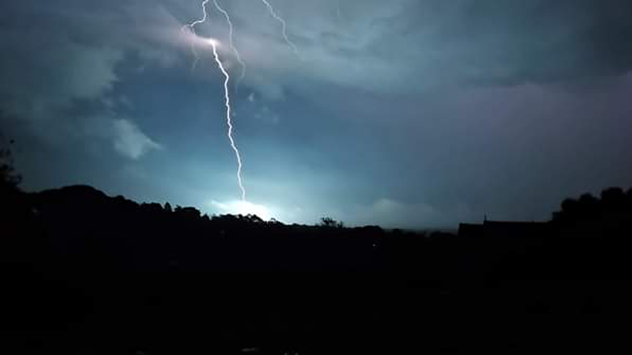
Bright lightning bolt striking beneath dark storm clouds over a silhouetted landscape at night, illuminating the sky with blue-white flashes.
Lightning strikes the ground in Ivybridge, Devon. - © Weather & Radar Uploader

Mentioning a risk of thunderstorms in a forecast often comes with a mixture of feelings. Some of us love them, while others of us are more thankful when they miss our location.

When thunderstorms pop up in forecasts, most of us will check if they're nearby. Instead, finding a thunderstorm warning area with no pinpointed location where the thunderstorm will occur.

This is because locking down the location of a thunderstorm is actually rather difficult before it forms. The best way to explain why is the case is by using an analogy of a saucepan boiling some water.

When boiling water, you know that bubbles will eventually appear when the conditions are right, you just don’t know where they will appear.

This is similar to the prediction of thunderstorms. We can see an area of unstable conditions growing to aid the development of a thunderstorm. We just cannot pinpoint where the exact conditions will be to identify the specific location of the thunderstorm itself.

Once a thunderstorm has been established, we are able to use current weather observation data to update our forecasts to both keep track of the thunderstorm and predict where it will move.

Ryan Hathaway
More on the topic
Hurricane POLO remains dangerous. Many storms in the Pacific. . . Thursday, 24 September 2026
Thursday, 24 September 2026

Many storms in the Pacific

Hurricane POLO remains dangerous
Low delivers days of gusty conditions. Into the weekend. . . Thursday, 17 September 2026
Wind map showing low pressure near the Faroe Islands, with winds reaching 35 mph around Aberdeen and Dublin and stronger Atlantic winds west of the UK.
Thursday, 17 September 2026

Into the weekend

Low delivers days of gusty conditions
Huge low-pressure system off Iceland. Impacting the UK & Ireland. . . Wednesday, 16 September 2026
WeatherRadar showing a large low-pressure system over the North Atlantic between Greenland and Iceland.
Wednesday, 16 September 2026

Impacting the UK & Ireland

Huge low-pressure system off Iceland
All weather news
This might also interest you
Seasonal warmth between spring thunder. Your weather - Your shots. . . Sunday, 19 April 2026
Split image showing coastal sunset with layered lenticular clouds over rooftops and palm trees on the left, and a green valley with river and hills under soft daylight on the right.
Sunday, 19 April 2026

Your weather - Your shots

Seasonal warmth between spring thunder
Bright and warm conditions take hold. Spring-like outlook. . . Thursday, 23 April 2026
Split UK map showing warm temperatures up to 21 degrees in orange on the left and clear sunny conditions with temperatures from 12 to 18 degrees on the right, with sun icons across the country.
Thursday, 23 April 2026

Spring-like outlook

Bright and warm conditions take hold
Flooding, gales, and heavy snow. Storm Chandra. . . Tuesday, 27 January 2026
Split image showing aerial flooding in a town with muddy water covering roads on the left, and a rural road on the right blocked by heavy snowfall with vans stopped and a person walking in snow.
Tuesday, 27 January 2026

Storm Chandra

Flooding, gales, and heavy snow
All articles
Weather & Radar

Weather & Radar is also available on

Google Play StoreApp Store

Company

Contact us Privacy Policy Legal info Accessibility statement

Services

Uploader

Socials

facebooktwittertikToklinkList