Home
Weather London
WeatherRadar
RainfallRadar
TemperatureRadar
WindRadar
LightningRadar
Weather News
Editor's Pick
Discover the app
Weather widget
Contact us
Apps
Career
    Home / Editor's Pick /

    Three days running - June temperature record broken again

13:13
26 June 2026

Three days running
June temperature record broken again

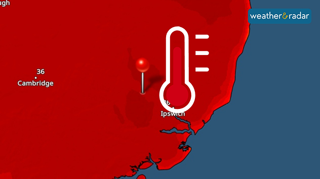
Temperature map of eastern England showing extreme heat around Ipswich and nearby areas, with temperatures reaching 36°C near Cambridge and a large red thermometer icon highlighting intense heat.

For the third consecutive day, the all-time June temperature record has been broken.

Prior to Wednesday, the hottest June day record had stood since 1976. Now, a high of 36.9 °C in Wattisham, Suffolk marks the third record in three days.

Set just before 02:00 pm, there is a good chance this rises further.

Update

As of 04:30 pm on Friday, the new record stands at 37.3 °C in Santon Downham, Suffolk.

Ryan Hathaway

More on the topic

Storm Boelo named. Weekend impacts. . . Thursday, 22 October 2026
Split weather maps showing Storm Boelo northwest of Scotland, winds reaching 50 mph near Glasgow and Liverpool, and spiralling Atlantic rain bands.
Thursday, 22 October 2026

Weekend impacts

Storm Boelo named
Winds grow and rain spreads Wednesday. Prelude to Austen. . . Wednesday, 21 October 2026
Split weather map showing strong winds up to 40 mph across southern Britain and blue rain bands over Scotland, Ireland and England, with warning symbols.
Wednesday, 21 October 2026

Prelude to Austen

Winds grow and rain spreads Wednesday
Shooting stars from the Orionids peak. Mixed visibility overnight. . . Wednesday, 21 October 2026
Split image showing a bright green meteor streaking across a starry night sky beside a UK weather map with rain over Scotland and southern England.
Wednesday, 21 October 2026

Mixed visibility overnight

Shooting stars from the Orionids peak
All weather news

This might also interest you

Super Typhoon Bavi threatens Taiwan. Up to 1,000 mm of rain. . . Wednesday, 8 July 2026
The image shows an intense tropical cyclone over the western Pacific, east of Taiwan and the Philippines. The centre of the system is depicted as a light purple and white vortex with a clearly visible eye, surrounded by a ring of red and orange areas indicating the strongest wind speeds. A white arrow marks the typhoon’s predicted track towards the north-west, in the direction of Taiwan. To the west of the storm lie the Philippines, with the cities of Manila and Cebu; to the north of these lies Taiwan, with Taipei. Further west, the Chinese coast, including Hong Kong, and parts of Vietnam can be seen. The coloured wind map shows predominantly green areas outside the storm’s core, indicating significantly weaker winds. White streamlines illustrate the typhoon’s anti-clockwise circulation in the Northern Hemisphere. The highest wind speeds are concentrated around the eye of the cyclone.
Wednesday, 8 July 2026

Up to 1,000 mm of rain

Super Typhoon Bavi threatens Taiwan
Long-term trends need a pinch of salt. 40 °C in July?. . . Tuesday, 30 June 2026
Temperature radar of 2022 heatwave where the all-time temperature record in the UK was set. Warning symbol overlain.
Tuesday, 30 June 2026

40 °C in July?

Long-term trends need a pinch of salt
Flooding, gales, and heavy snow. Storm Chandra. . . Tuesday, 27 January 2026
Split image showing aerial flooding in a town with muddy water covering roads on the left, and a rural road on the right blocked by heavy snowfall with vans stopped and a person walking in snow.
Tuesday, 27 January 2026

Storm Chandra

Flooding, gales, and heavy snow
All articles
Weather & Radar

Weather & Radar is also available on

Google Play StoreApp Store

Company

Contact us Privacy Policy Legal info Accessibility statement

Services

Uploader

Socials

facebooktwittertikToklinkList