Home
Weather London
WeatherRadar
RainfallRadar
TemperatureRadar
WindRadar
LightningRadar
Weather News
Editor's Pick
Discover the app
Weather widget
Contact us
Apps
Career
    Home / Editor's Pick /

    Staying safe: Do you know how to prepare for a flood?

06:00
9 November 2022

Staying safe
Do you know how to prepare for a flood?

Flooding

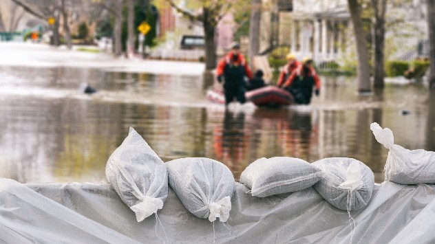
When a flood warning is issued, are you aware of how to react?

Since 1998 the UK has seen six of the 10 wettest years on record, when severe rainfall hits and flooding develops it is imperative that you know how best to behave for safety.

Before you can react to any warning, you need to receive them. The Environment Agency offers a free flood warning service, currently covering 1.6 million properties, which will alert you of any danger.

There are three levels in the UK: Flood alert, flood warning, and severe flood warning. For an alert, prepare an emergency bag containing medicine and any insurance documents.

In a warning, disconnect your utilities, take any vehicles to higher ground, and move upstairs or to a high point of safety.

Severe warnings generally coincide with evacuation orders, do not waste any time and follow advice from emergency services.

You can contact your local council for help obtaining sandbags to better secure your property, as well as surrounding the perimeter, the Red Cross also suggest placing a bag in toilet bowls to avoid sewage back flow.

Once a flood strikes, remain in place. Water can be deceptively dangerous, just six inches of fast flowing water can knock a person over and sewage contamination brings other dangers.

The government has committed £5.2 billion to flood and coastal defences, which will help protect an additional 336,000 properties by 2027.

Research published in 2022 by the Environment Agency revealed that two in three households at risk of being flooded do not believe it will happen to them. If it does, be prepared.

There are currently multiple flood alerts in effect, if you are covered by an alert be sure to check the WeatherRadar and plan accordingly.

Ryan Hathaway
More on the topic
UV levels peak with the heat today. Latest heatwave. . . Wednesday, 29 July 2026
Split graphic showing a temperature map of England and eastern Ireland with temperatures reaching 33°C near London, 32°C in Norwich, and 29°C around Birmingham on the left, alongside a person applying sunscreen with a UV icon on the right.
Wednesday, 29 July 2026

Latest heatwave

UV levels peak with the heat today
Clouds return to capture the scene. Your weather - Your shots. . . Sunday, 26 July 2026
Waxing crescent Moon above vivid pink and magenta sunset clouds, with silhouetted trees along the horizon beneath a deepening blue twilight sky.
Sunday, 26 July 2026

Your weather - Your shots

Clouds return to capture the scene
Heavier rainfall over the week for some. Ireland & Scotland. . . Tuesday, 28 July 2026
Split image showing a Europe rainfall accumulation forecast map on the left with the highest totals across the UK, Ireland, and Scandinavia, and a satellite weather map on the right with a broad band of rain stretching across Ireland, Scotland, and northern Britain, highlighted by a rain cloud icon.
Tuesday, 28 July 2026

Ireland & Scotland

Heavier rainfall over the week for some
All weather news
This might also interest you
Bright and warm conditions take hold. Spring-like outlook. . . Thursday, 23 April 2026
Split UK map showing warm temperatures up to 21 degrees in orange on the left and clear sunny conditions with temperatures from 12 to 18 degrees on the right, with sun icons across the country.
Thursday, 23 April 2026

Spring-like outlook

Bright and warm conditions take hold
Seasonal warmth between spring thunder. Your weather - Your shots. . . Sunday, 19 April 2026
Split image showing coastal sunset with layered lenticular clouds over rooftops and palm trees on the left, and a green valley with river and hills under soft daylight on the right.
Sunday, 19 April 2026

Your weather - Your shots

Seasonal warmth between spring thunder
Flooding, gales, and heavy snow. Storm Chandra. . . Tuesday, 27 January 2026
Split image showing aerial flooding in a town with muddy water covering roads on the left, and a rural road on the right blocked by heavy snowfall with vans stopped and a person walking in snow.
Tuesday, 27 January 2026

Storm Chandra

Flooding, gales, and heavy snow
All articles
Weather & Radar

Weather & Radar is also available on

Google Play StoreApp Store

Company

Contact us Privacy Policy Legal info Accessibility statement

Services

Uploader

Socials

facebooktwittertikToklinkList