Home
Weather London
WeatherRadar
RainfallRadar
TemperatureRadar
WindRadar
LightningRadar
Weather News
Editor's Pick
Discover the app
Weather widget
Contact us
Apps
Career
    Home / Editor's Pick /

    Red warnings now live - Schools closed and more heat disruption

09:35
24 June 2026

Red warnings now live
Schools closed and more heat disruption

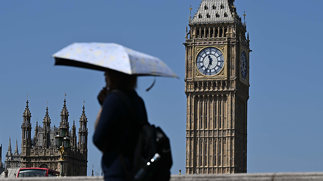
Person carrying a sun umbrella walking past the Elizabeth Tower in London under clear blue skies, using shade to cope with hot weather during a heatwave.
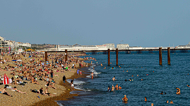
Busy pebble beach packed with sunbathers and swimmers along a crowded coastline, with people enjoying warm weather beside the sea and a long pier visible in the background.
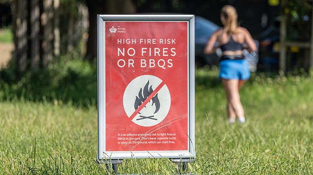
Red warning sign in a grassy park reading “HIGH FIRE RISK – NO FIRES OR BBQS,” with a crossed-out flame symbol, while a person walks in the background on a sunny day.
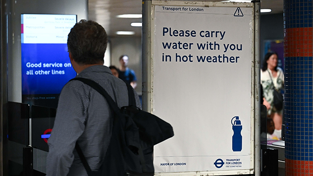
Commuter walking through a London Underground station beside a Transport for London sign reading “Please carry water with you in hot weather,” promoting hydration during high temperatures.
1/4
Temperatures soar in London, umbrellas are handy to stay in shade. - © picture alliance

Hundreds of schools are closed today as a rare red extreme heat warning comes into effect until Thursday evening.

Red and amber heat warnings cover much of central to southern England and Wales. Daily highs are very likely to break the existing June high of 35.6 °C.

As a result, close to a thousand schools are fully or partially closed today. Meanwhile, travel has been disrupted with multiple train lines reporting delays or cancellations. As part of the heat warnings, non-essential travel is discouraged to reduce this disruption.

On the continent, the heat dome is also resulting in disruptions impacting the UK with the Eurostar running a reduced service between London and Paris until Friday.

Paris itself is forecast to hit 41 °C on Wednesday, while in western France power outages related to the extreme heat is exacerbating the impact of the conditions.

The heat will ease from the weekend as the heat dome finally breaks away reducing highs back to the low to mid-20s across the country.

London

We
18
33
Th
19
27
Fr
16
25
Sa
16
26
Su
16
28
Mo
20
30
Tu
18
26
We
18
26
Th
17
25
Fr
16
25
Sa
17
25
Su
16
24
Mo
17
25
Tu
16
26
Max (°C)
Min (°C)
moreless

Manchester

We
16
24
Th
15
20
Fr
10
20
Sa
12
19
Su
9
24
Mo
17
26
Tu
15
23
We
13
21
Th
13
21
Fr
12
21
Sa
13
22
Su
14
22
Mo
14
22
Tu
14
22
Max (°C)
Min (°C)
moreless

Dublin

We
17
23
Th
11
20
Fr
10
20
Sa
9
19
Su
8
19
Mo
14
21
Tu
11
19
We
12
20
Th
10
18
Fr
11
20
Sa
12
20
Su
12
20
Mo
13
21
Tu
13
21
Max (°C)
Min (°C)
moreless

Edinburgh

We
16
20
Th
11
18
Fr
9
16
Sa
10
19
Su
11
21
Mo
13
19
Tu
12
19
We
12
18
Th
11
19
Fr
11
19
Sa
12
20
Su
13
20
Mo
13
21
Tu
12
20
Max (°C)
Min (°C)
moreless

Cardiff

We
15
25
Th
17
23
Fr
10
22
Sa
10
22
Su
13
25
Mo
15
25
Tu
16
24
We
15
23
Th
14
22
Fr
14
22
Sa
14
22
Su
15
22
Mo
15
23
Tu
15
23
Max (°C)
Min (°C)
moreless
Ryan Hathaway
More on the topic
Clouds return to capture the scene. Your weather - Your shots. . . Sunday, 26 July 2026
Waxing crescent Moon above vivid pink and magenta sunset clouds, with silhouetted trees along the horizon beneath a deepening blue twilight sky.
Sunday, 26 July 2026

Your weather - Your shots

Clouds return to capture the scene
Forest fires are getting out of control. Spain and France. . . Saturday, 25 July 2026
A split-screen image featuring a photograph and a weather map. On the left, thick, dark-grey smoke rises from several fire sites in a wooded coastal area; a calm stretch of water can be seen in the foreground. On the right, a weather map shows south-western France and northern Spain. A red arrow points from the Atlantic towards the French Atlantic coast, symbolising an onshore wind. Sunny weather is forecast for Bordeaux at around 20 degrees, and Bilbao is also expected to be sunny at around 27 degrees. A large warning sign with a flame symbol indicates an increased risk of forest fires.
Saturday, 25 July 2026

Spain and France

Forest fires are getting out of control
Typhoon warning for China. Up to 500 mm of rain. . . Friday, 24 July 2026
Weather map of the southern Chinese coast and Taiwan showing a powerful tropical cyclone. The eye of the storm is located near the coastal city of Shantou in the Chinese province of Guangdong. Around the centre, intense shades of red, pink and violet indicate gale-force winds, whilst a large orange wind field extends as far as the west coast of Taiwan. An overlaid windsack warning sign indicates dangerous storm winds. Cities such as Hong Kong, Guangzhou, Xiamen, Taipei and Taichung are shown, as are wind speeds and white flow lines illustrating the cyclonic air circulation.
Friday, 24 July 2026

Up to 500 mm of rain

Typhoon warning for China
All weather news
This might also interest you
Flooding, gales, and heavy snow. Storm Chandra. . . Tuesday, 27 January 2026
Split image showing aerial flooding in a town with muddy water covering roads on the left, and a rural road on the right blocked by heavy snowfall with vans stopped and a person walking in snow.
Tuesday, 27 January 2026

Storm Chandra

Flooding, gales, and heavy snow
Super Typhoon Bavi threatens Taiwan. Up to 1,000 mm of rain. . . Wednesday, 8 July 2026
The image shows an intense tropical cyclone over the western Pacific, east of Taiwan and the Philippines. The centre of the system is depicted as a light purple and white vortex with a clearly visible eye, surrounded by a ring of red and orange areas indicating the strongest wind speeds. A white arrow marks the typhoon’s predicted track towards the north-west, in the direction of Taiwan. To the west of the storm lie the Philippines, with the cities of Manila and Cebu; to the north of these lies Taiwan, with Taipei. Further west, the Chinese coast, including Hong Kong, and parts of Vietnam can be seen. The coloured wind map shows predominantly green areas outside the storm’s core, indicating significantly weaker winds. White streamlines illustrate the typhoon’s anti-clockwise circulation in the Northern Hemisphere. The highest wind speeds are concentrated around the eye of the cyclone.
Wednesday, 8 July 2026

Up to 1,000 mm of rain

Super Typhoon Bavi threatens Taiwan
A frozen start to the weekend. Icy conditions. . . Friday, 13 February 2026
UK temperature map dated 14.02 showing widespread subzero values in blue shading, with readings such as −4 in Glasgow, −3 in Dublin, and −2 in London, alongside a blue thermometer icon.
Friday, 13 February 2026

Icy conditions

A frozen start to the weekend
All articles
Weather & Radar

Weather & Radar is also available on

Google Play StoreApp Store

Company

Contact us Privacy Policy Legal info Accessibility statement

Services

Uploader

Socials

facebooktwittertikToklinkList