Home
Weather London
WeatherRadar
RainfallRadar
TemperatureRadar
WindRadar
LightningRadar
Weather News
Editor's Pick
Discover the app
Weather widget
Contact us
Apps
Career
    Home / Editor's Pick /

    Red warnings now live - Schools closed and more heat disruption

09:35
24 June 2026

Red warnings now live
Schools closed and more heat disruption

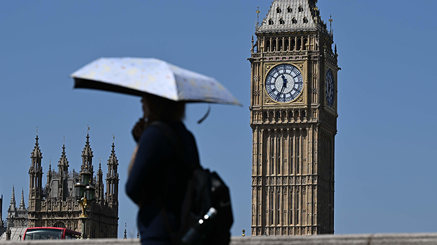
Person carrying a sun umbrella walking past the Elizabeth Tower in London under clear blue skies, using shade to cope with hot weather during a heatwave.
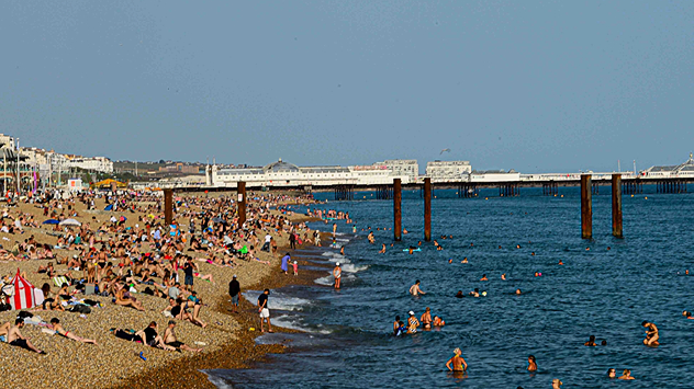
Busy pebble beach packed with sunbathers and swimmers along a crowded coastline, with people enjoying warm weather beside the sea and a long pier visible in the background.
Red warning sign in a grassy park reading “HIGH FIRE RISK – NO FIRES OR BBQS,” with a crossed-out flame symbol, while a person walks in the background on a sunny day.
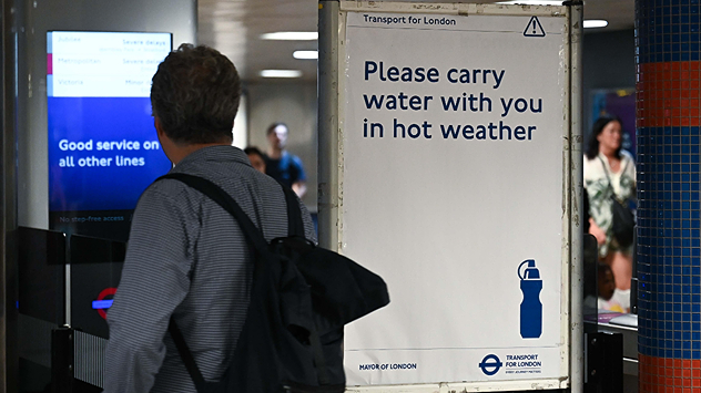
Commuter walking through a London Underground station beside a Transport for London sign reading “Please carry water with you in hot weather,” promoting hydration during high temperatures.
1/4
Temperatures soar in London, umbrellas are handy to stay in shade. - © picture alliance

Hundreds of schools are closed today as a rare red extreme heat warning comes into effect until Thursday evening.

Red and amber heat warnings cover much of central to southern England and Wales. Daily highs are very likely to break the existing June high of 35.6 °C.

As a result, close to a thousand schools are fully or partially closed today. Meanwhile, travel has been disrupted with multiple train lines reporting delays or cancellations. As part of the heat warnings, non-essential travel is discouraged to reduce this disruption.

On the continent, the heat dome is also resulting in disruptions impacting the UK with the Eurostar running a reduced service between London and Paris until Friday.

Paris itself is forecast to hit 41 °C on Wednesday, while in western France power outages related to the extreme heat is exacerbating the impact of the conditions.

The heat will ease from the weekend as the heat dome finally breaks away reducing highs back to the low to mid-20s across the country.

London

Th
14
19
Fr
16
22
Sa
13
22
Su
17
22
Mo
19
24
Tu
15
22
We
14
22
Th
14
21
Fr
14
22
Sa
15
23
Su
15
23
Mo
15
24
Tu
15
23
We
15
24
Max (°C)
Min (°C)
moreless

Manchester

Th
8
16
Fr
14
17
Sa
9
18
Su
16
19
Mo
15
22
Tu
14
18
We
11
18
Th
11
18
Fr
12
18
Sa
12
19
Su
12
19
Mo
13
20
Tu
12
19
We
13
20
Max (°C)
Min (°C)
moreless

Dublin

Th
14
19
Fr
13
18
Sa
13
21
Su
15
19
Mo
16
21
Tu
14
17
We
10
18
Th
11
18
Fr
10
17
Sa
11
19
Su
11
19
Mo
13
20
Tu
10
19
We
13
20
Max (°C)
Min (°C)
moreless

Edinburgh

Th
9
17
Fr
12
17
Sa
12
20
Su
14
17
Mo
13
19
Tu
13
17
We
11
17
Th
12
17
Fr
12
16
Sa
12
18
Su
10
17
Mo
12
18
Tu
12
18
We
12
19
Max (°C)
Min (°C)
moreless

Cardiff

Th
9
18
Fr
14
20
Sa
10
19
Su
17
20
Mo
18
23
Tu
15
19
We
13
20
Th
13
19
Fr
13
19
Sa
13
20
Su
14
21
Mo
14
21
Tu
14
21
We
15
22
Max (°C)
Min (°C)
moreless
Ryan Hathaway
More on the topic
A marked change in the weather. Cold front heading south. . . Monday, 7 September 2026
Map of Europe showing a cold front stretching from Scandinavia to Spain. Thunderstorms are shown in southern and central Europe.
Monday, 7 September 2026

Cold front heading south

A marked change in the weather
Severe weather in southern Europe. Thunderstorms & heavy rain. . . Wednesday, 9 September 2026
On the left, dark storm clouds over a coastline. On the right, a weather map shows thunderstorms over the western Mediterranean, with warning symbols for tornadoes, storms and hail.
Wednesday, 9 September 2026

Thunderstorms & heavy rain

Severe weather in southern Europe
A generally gusty Thursday. Moderate but notable wind. . . Wednesday, 2 September 2026
Wind forecast showing widespread 25-30 mph winds across the UK and Ireland, including Glasgow, Dublin, Cork, Cardiff, and London, with a windsock symbol.
Wednesday, 2 September 2026

Moderate but notable wind

A generally gusty Thursday
All weather news
This might also interest you
Flooding, gales, and heavy snow. Storm Chandra. . . Tuesday, 27 January 2026
Split image showing aerial flooding in a town with muddy water covering roads on the left, and a rural road on the right blocked by heavy snowfall with vans stopped and a person walking in snow.
Tuesday, 27 January 2026

Storm Chandra

Flooding, gales, and heavy snow
Bright and warm conditions take hold. Spring-like outlook. . . Thursday, 23 April 2026
Split UK map showing warm temperatures up to 21 degrees in orange on the left and clear sunny conditions with temperatures from 12 to 18 degrees on the right, with sun icons across the country.
Thursday, 23 April 2026

Spring-like outlook

Bright and warm conditions take hold
A frozen start to the weekend. Icy conditions. . . Friday, 13 February 2026
UK temperature map dated 14.02 showing widespread subzero values in blue shading, with readings such as −4 in Glasgow, −3 in Dublin, and −2 in London, alongside a blue thermometer icon.
Friday, 13 February 2026

Icy conditions

A frozen start to the weekend
All articles
Weather & Radar

Weather & Radar is also available on

Google Play StoreApp Store

Company

Contact us Privacy Policy Legal info Accessibility statement

Services

Uploader

Socials

facebooktwittertikToklinkList