Home
Weather London
WeatherRadar
RainfallRadar
TemperatureRadar
WindRadar
LightningRadar
Weather News
Editor's Pick
Discover the app
Weather widget
Contact us
Apps
Career
    Home / Editor's Pick /

    Peculiar clouds: Fallstreak cloud spotted in Cheshire

14:00
21 May 2023

Peculiar clouds
Fallstreak cloud spotted in Cheshire

Fallstreak cloud
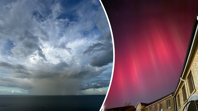
This fallstreak cloud, also known as a holepunch cloud, was snapped in Runcorn, Cheshire. - © Daniel Vincoletto

A hole punched through the clouds, that's what it looks like with this fallstreak cloud captured by a Weather & Radar user in May.

Daniel Vincoletto sent in the image above from Runcorn, Cheshire capturing a fallstreak in all its glory.

Fallstreak clouds are not technically clouds, but a formation which appears as a gap, or hole in the surrounding cirrocumulus or altocumulus clouds.

Both of these cloud types form at high, cold altitudes and contain supercooled droplets of water. This is water which can drop to as cold as -40°C without freezing thanks to the absence of other particles.

When aircraft pass through this cloud layer, it causes the surrounding air to expand and cool. The change in temperature can then cause the water droplets to suddenly freeze into solid ice crystals.

These ice crystals then fall from the sky as virga, or fallstreaks, which is precipitation that doesn’t reach the ground.

It might sound surprising, but the process of freezing actually gives off a tiny bit of heat. This heat is enough to evaporate the surrounding water droplets, leaving the sharply defined hole in the clouds that you can see in the image.

Have you ever spotted these fallstreak clouds before? We’d love to see your pictures, you can send them here.

Ryan Hathaway
More on the topic
Hottest summer on record for Ireland. Beating 2025's record. . . Thursday, 3 September 2026
Temperature map of Ireland showing 29°C in Dublin, 26°C in Cork, 24°C in Belfast, and 23°C in Galway, with a red thermometer icon.
Thursday, 3 September 2026

Beating 2025's record

Hottest summer on record for Ireland
A marked change in the weather. Cold front heading south. . . Monday, 7 September 2026
Map of Europe showing a cold front stretching from Scandinavia to Spain. Thunderstorms are shown in southern and central Europe.
Monday, 7 September 2026

Cold front heading south

A marked change in the weather
More rain needed to ease drought. Reservoirs still falling. . . Tuesday, 8 September 2026
Aerial view of a depleted reservoir with exposed banks and a narrow winding stream through the dry basin, surrounded by green hills and roads.
Tuesday, 8 September 2026

Reservoirs still falling

More rain needed to ease drought
All weather news
This might also interest you
A frozen start to the weekend. Icy conditions. . . Friday, 13 February 2026
UK temperature map dated 14.02 showing widespread subzero values in blue shading, with readings such as −4 in Glasgow, −3 in Dublin, and −2 in London, alongside a blue thermometer icon.
Friday, 13 February 2026

Icy conditions

A frozen start to the weekend
Super Typhoon Bavi threatens Taiwan. Up to 1,000 mm of rain. . . Wednesday, 8 July 2026
The image shows an intense tropical cyclone over the western Pacific, east of Taiwan and the Philippines. The centre of the system is depicted as a light purple and white vortex with a clearly visible eye, surrounded by a ring of red and orange areas indicating the strongest wind speeds. A white arrow marks the typhoon’s predicted track towards the north-west, in the direction of Taiwan. To the west of the storm lie the Philippines, with the cities of Manila and Cebu; to the north of these lies Taiwan, with Taipei. Further west, the Chinese coast, including Hong Kong, and parts of Vietnam can be seen. The coloured wind map shows predominantly green areas outside the storm’s core, indicating significantly weaker winds. White streamlines illustrate the typhoon’s anti-clockwise circulation in the Northern Hemisphere. The highest wind speeds are concentrated around the eye of the cyclone.
Wednesday, 8 July 2026

Up to 1,000 mm of rain

Super Typhoon Bavi threatens Taiwan
Historic Storm Éowyn arrives. On this day.... . . Saturday, 24 January 2026
Split image showing a person in a yellow jacket struggling against strong winds and heavy rain on a street at night on the left, and an Irish wind forecast map on the right with red and purple shading, gusts up to 75 mph, and a wind warning icon, divided by a curved white line.
Saturday, 24 January 2026

On this day...

Historic Storm Éowyn arrives
All articles
Weather & Radar

Weather & Radar is also available on

Google Play StoreApp Store

Company

Contact us Privacy Policy Legal info Accessibility statement

Services

Uploader

Socials

facebooktwittertikToklinkList