Home
Weather London
WeatherRadar
RainfallRadar
TemperatureRadar
WindRadar
LightningRadar
Weather News
Editor's Pick
Discover the app
Weather widget
Contact us
Apps
Career
    Home / Editor's Pick /

    Nowcast: The data fuelling our weather radars

16:00
22 September 2023

Nowcast
The data fuelling our weather radars

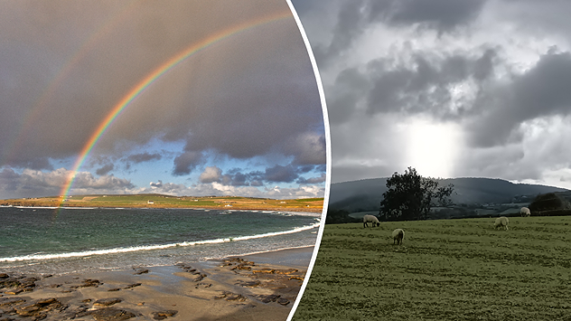
Juxtaposed weather conditions

Did you know that you can see lightning strikes as soon as 20 seconds after they occur in Europe on our LightningRadar thanks to Nowcast technology?

Launched in 2022, the LightningRadar visualises shocking lightning strikes as they happen in near-real-time. Perfect for those stormy nights to watch systems as they approach you.

It is, in part, thanks to Nowcast technology, which we have utilised for almost 14 years elsewhere in the app. Including on the WeatherRadar where it plays a vital role in providing accurate, precise data from weather stations to feed our radar.

Nowcast also enables users to enjoy super-precise radars for the immediate future, opening the possibility for 5-minute intervals when scrubbing through the WeatherRadar.

Perfect for gauging what to wear for a quick walk, or to track incoming storm systems that may influence the way you travel.

With Nowcast and the LightningRadar, Weather & Radar can comfortably cover every detail you need to know for the immediate weather situation, with detailed forecasts available for up to 14 days into the future.

This also explains the gap you may have spotted on our radars between 'Now' and 'Today'. The ‘Today’ section of our WeatherRadar is based on two main weather models: the Global Forecasting System (GFS) run by NOAA and the Integrated Forecasting System (IFS) run by ECMWF.

This model information is also used in the WeatherRadar for the coming days including ‘Today’, ‘Tomorrow’ and the two days that follow.

Forecasts for the next 90 minutes in five or 15 minute intervals is known as the “nowcast” period. Current weather patterns are being analysed and a much finer-scale trend is then calculated mathematically in a slightly different way than the longer-range model forecasts.

Weather & Radar editorial team
More on the topic
A marked change in the weather. Cold front heading south. . . Monday, 7 September 2026
Map of Europe showing a cold front stretching from Scandinavia to Spain. Thunderstorms are shown in southern and central Europe.
Monday, 7 September 2026

Cold front heading south

A marked change in the weather
Cheshire Gap produces shower funnel. Local phenomenon. . . Wednesday, 9 September 2026
Weather map showing showers moving southeast from Liverpool toward Birmingham, driven by Cheshire Gap convergence across central England.
Wednesday, 9 September 2026

Local phenomenon

Cheshire Gap produces shower funnel
Severe weather hits Mallorca and Italy. Severe thunderstorms. . . Thursday, 10 September 2026
Numerous thunderstorms are sweeping across La Palma. The many lightning symbols on the radar and lightning map show that there is heavy lightning activity across large parts of the island. The thunderstorms are striking particularly in the island’s interior and in the south. On the right, you can see the aftermath: a large fallen tree has buried a car beneath it. Emergency services are clearing up the damage. So, along with the thunderstorms, not only heavy rain but also gusts of wind can become a problem.
Thursday, 10 September 2026

Severe thunderstorms

Severe weather hits Mallorca and Italy
All weather news
This might also interest you
Seasonal warmth between spring thunder. Your weather - Your shots. . . Sunday, 19 April 2026
Split image showing coastal sunset with layered lenticular clouds over rooftops and palm trees on the left, and a green valley with river and hills under soft daylight on the right.
Sunday, 19 April 2026

Your weather - Your shots

Seasonal warmth between spring thunder
Bright and warm conditions take hold. Spring-like outlook. . . Thursday, 23 April 2026
Split UK map showing warm temperatures up to 21 degrees in orange on the left and clear sunny conditions with temperatures from 12 to 18 degrees on the right, with sun icons across the country.
Thursday, 23 April 2026

Spring-like outlook

Bright and warm conditions take hold
Super Typhoon Bavi threatens Taiwan. Up to 1,000 mm of rain. . . Wednesday, 8 July 2026
The image shows an intense tropical cyclone over the western Pacific, east of Taiwan and the Philippines. The centre of the system is depicted as a light purple and white vortex with a clearly visible eye, surrounded by a ring of red and orange areas indicating the strongest wind speeds. A white arrow marks the typhoon’s predicted track towards the north-west, in the direction of Taiwan. To the west of the storm lie the Philippines, with the cities of Manila and Cebu; to the north of these lies Taiwan, with Taipei. Further west, the Chinese coast, including Hong Kong, and parts of Vietnam can be seen. The coloured wind map shows predominantly green areas outside the storm’s core, indicating significantly weaker winds. White streamlines illustrate the typhoon’s anti-clockwise circulation in the Northern Hemisphere. The highest wind speeds are concentrated around the eye of the cyclone.
Wednesday, 8 July 2026

Up to 1,000 mm of rain

Super Typhoon Bavi threatens Taiwan
All articles
Weather & Radar

Weather & Radar is also available on

Google Play StoreApp Store

Company

Contact us Privacy Policy Legal info Accessibility statement

Services

Uploader

Socials

facebooktwittertikToklinkList