Home
Weather London
WeatherRadar
RainfallRadar
TemperatureRadar
WindRadar
LightningRadar
Weather News
Editor's Pick
Discover the app
Weather widget
Contact us
Apps
Career
    Home / Editor's Pick /

    New study - Heat becoming a bigger factor in drought, not just a lack of rainfall

13:38
23 July 2026

New study
Heat becoming a bigger factor in drought

One factor is playing an increasingly significant role in the drought across Europe: not only is there a lack of rain, but extreme heat is also causing the soil to lose moisture at an ever-faster rate.

The current drought in Europe is continuing to worsen. A new study by scientists from twelve countries shows that it is not only the lack of rain that is to blame, but above all the dramatic increase in evaporation caused by rising temperatures.

Did you know?

Despite higher levels of winter precipitation across large parts of Europe, we are now already observing an increasing tendency towards unusually dry soil conditions as early as spring.

As temperatures rise, the atmosphere’s "thirst" increases rapidly, thereby drawing even more moisture from rivers, lakes, reservoirs and the soil.

According to the researchers, agricultural soil droughts in Western Europe are now around five times more likely, and in Eastern Europe as much as eleven times more likely, than they were before industrialisation. Even small deficits in rainfall are now sufficient to trigger drought conditions.

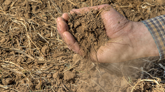
A hand holds dry, dusty earth above a parched field. The ground is cracked and covered with plant debris – a sign of prolonged drought.
A hand holds dry, dusty earth above a parched field.

The consequences are already being felt: crop failures, water restrictions, and rising food prices are putting many regions under pressure. Without a significant reduction in greenhouse gas emissions, hot and dry summers could become the new normal in Europe in future.

Sebastian Keßler
using material from dpa
More on the topic
Parts of England inching towards drought. Low rivers & reservoirs. . . Wednesday, 22 July 2026
People relaxing in a park during hot weather ,with one person sunbathing on dry yellow grass beneath large leafy trees under a blue sky with scattered fair-weather clouds.
Wednesday, 22 July 2026

Low rivers & reservoirs

Parts of England inching towards drought
Catastrophic forest fires in Europe. Thousands evacuated. . . Monday, 27 July 2026
A composite image showing a temperature map of south-western Europe and a drone shot of a forest fire near Cap Ferret. A warning symbol featuring a flame indicates the increased risk of forest fires.
Monday, 27 July 2026

Thousands evacuated

Catastrophic forest fires in Europe
Heavier rainfall over the week for some. Ireland & Scotland. . . Tuesday, 28 July 2026
Split image showing a Europe rainfall accumulation forecast map on the left with the highest totals across the UK, Ireland, and Scandinavia, and a satellite weather map on the right with a broad band of rain stretching across Ireland, Scotland, and northern Britain, highlighted by a rain cloud icon.
Tuesday, 28 July 2026

Ireland & Scotland

Heavier rainfall over the week for some
All weather news
This might also interest you
A frozen start to the weekend. Icy conditions. . . Friday, 13 February 2026
UK temperature map dated 14.02 showing widespread subzero values in blue shading, with readings such as −4 in Glasgow, −3 in Dublin, and −2 in London, alongside a blue thermometer icon.
Friday, 13 February 2026

Icy conditions

A frozen start to the weekend
Seasonal warmth between spring thunder. Your weather - Your shots. . . Sunday, 19 April 2026
Split image showing coastal sunset with layered lenticular clouds over rooftops and palm trees on the left, and a green valley with river and hills under soft daylight on the right.
Sunday, 19 April 2026

Your weather - Your shots

Seasonal warmth between spring thunder
Super Typhoon Bavi threatens Taiwan. Up to 1,000 mm of rain. . . Wednesday, 8 July 2026
The image shows an intense tropical cyclone over the western Pacific, east of Taiwan and the Philippines. The centre of the system is depicted as a light purple and white vortex with a clearly visible eye, surrounded by a ring of red and orange areas indicating the strongest wind speeds. A white arrow marks the typhoon’s predicted track towards the north-west, in the direction of Taiwan. To the west of the storm lie the Philippines, with the cities of Manila and Cebu; to the north of these lies Taiwan, with Taipei. Further west, the Chinese coast, including Hong Kong, and parts of Vietnam can be seen. The coloured wind map shows predominantly green areas outside the storm’s core, indicating significantly weaker winds. White streamlines illustrate the typhoon’s anti-clockwise circulation in the Northern Hemisphere. The highest wind speeds are concentrated around the eye of the cyclone.
Wednesday, 8 July 2026

Up to 1,000 mm of rain

Super Typhoon Bavi threatens Taiwan
All articles
Weather & Radar

Weather & Radar is also available on

Google Play StoreApp Store

Company

Contact us Privacy Policy Legal info Accessibility statement

Services

Uploader

Socials

facebooktwittertikToklinkList