Home
Weather London
WeatherRadar
RainfallRadar
TemperatureRadar
WindRadar
LightningRadar
Weather News
Editor's Pick
Discover the app
Weather widget
Contact us
Apps
Career
    Home / Editor's Pick /

    New heat record in the North Sea – lots of rain in sight

09:00
11 September 2025

Lots of rain in sight
New heat record in the North Sea

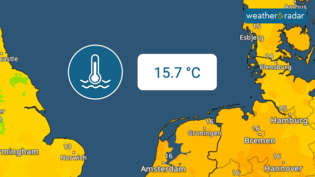
The average surface temperature of the North Sea was 15.7 degrees between June and August.

The North Sea was warmer than ever recorded in the summer of 2025, with an average temperature of 15.7 degrees, around two degrees above the long-term average.

The surface water was particularly warm in the western and southwestern North Sea up to the English Channel. Towards the east, in the areas off Denmark and Norway, the deviation was around 1.3 degrees.

Recording history

Temperature records for the North Sea have been measured since 1969.

Heavy rainfall on the coasts

In autumn, heavy rainfall often occurs on the coasts and over the sea. This is due to the still warm water and the cool air above it.

The temperature difference causes numerous showers to develop. Local wind conditions along the coast can further intensify this effect.

This means that there will be repeated rainfall in the North Sea region until the weekend. At times, there will even be heavy showers and thunderstorms.

Dennis Oswald
Ryan Hathaway
More on the topic
A composite image showing the Temperature Radar and a drinking fountain. The Temperature Radar shows Thursday’s maximum temperatures of up to 37.8 degrees in France, whilst people use a fountain to cool off.
Friday, 29 May 2026

Up to 38 °C in France

Heatwave clocks more record temperatures
Split image showing a European weather map with low-pressyre system, temperature bands, and thunderstorm icon on the left, and a bright rainbow over green countryside and mountains on the right.
Wednesday, 27 May 2026

Early summer ends

A change in the weather is on the way
Split image showing a bright rainbow above a residential street on the left and a dramatic ocean sunrise with glowing clouds and reflections on the sea on the right.
Sunday, 24 May 2026

Your weather - Your shots

From unsettled to warm and toasty
All weather news
This might also interest you
Split image showing a person in a yellow jacket struggling against strong winds and heavy rain on a street at night on the left, and an Irish wind forecast map on the right with red and purple shading, gusts up to 75 mph, and a wind warning icon, divided by a curved white line.
Saturday, 24 January 2026

On this day...

Historic Storm Éowyn arrives
plit image showing a double rainbow over a rocky shoreline on the left and sheep grazing in a green field under stormy clouds on the right.
Sunday, 2 November 2025

Your weather - Your shots

Mixed conditions on an unsettled week
Weather graphic showing rain and wind fields over the Canary Islands and a central warning symbol.
Friday, 12 December 2025

Storm and rain

Turbulent weather in the Canary Islands
All articles
Weather & Radar

Weather & Radar is also available on

Google Play StoreApp Store

Company

Contact us Privacy Policy Legal info Accessibility statement

Services

Uploader

Socials

facebooktwittertikToklinkList