Home
Weather London
WeatherRadar
RainfallRadar
TemperatureRadar
WindRadar
LightningRadar
Weather News
Editor's Pick
Discover the app
Weather widget
Contact us
Apps
Career
    Home / Editor's Pick /

    May astro outlook: Fresh meteor shower and a lunar eclipse!

15:00
2 May 2023

May astro outlook
Fresh meteor shower and a lunar eclipse!

Star gazing

A fresh month of stargazing treats has arrived, delivering another meteor shower and the arrival of the Flower Moon to kick things off.

In a matter of days, we see the rise of the full moon known as the Flower Moon. Named for its timing alongside widespread spring bloom. While a full moon is always noteworthy, this month's also sees a penumbral eclipse!

A penumbral lunar eclipse occurs when the moon passes through Earth's shadow darkening its surface. The UK and Ireland just miss out on the display which is visible across Europe, Africa, Asia, and Oceania.

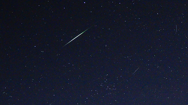
Just as we say goodbye to the Lyrids, the Eta Aquariid meteor shower arrived and quickly reaches its peak. While this shower is typically more active than the Lyrids providing up to 60 shooting stars an hour, this year we see an outburst peak with up to 160 an hour!

Sadly, many of these meteors will not be visible as the shower's peak coincides with the Flower Moon on May 5th. The full moon's strong light will be enough to obscure all but the brightest shooting stars.

Did you know?

The Eta Aquariids are associated with the famous Halley's Comet. The comet itself will not return until 2061.

If you still wish to take a trip to view the display, as always search for a dark area free from light pollution, away from a city.

Although the peak of the shower is disrupted by the moon, the shower should persist until around May 28th.

This means that the arrival of a new moon on May 19th may be the best time to try spotting a shooting star overhead without any moonlight to contend with.

If you are planning a stargazing trip this month, don't forget to consult the WeatherRadar before setting off to avoid unexpected weather disrupting your plans!

Mobile astrophotography tipsread more
Ryan Hathaway
More on the topic
Severe weather hits Mallorca and Italy. Severe thunderstorms. . . Thursday, 10 September 2026
Numerous thunderstorms are sweeping across La Palma. The many lightning symbols on the radar and lightning map show that there is heavy lightning activity across large parts of the island. The thunderstorms are striking particularly in the island’s interior and in the south. On the right, you can see the aftermath: a large fallen tree has buried a car beneath it. Emergency services are clearing up the damage. So, along with the thunderstorms, not only heavy rain but also gusts of wind can become a problem.
Thursday, 10 September 2026

Severe thunderstorms

Severe weather hits Mallorca and Italy
Hurricane Lowell threatens Hawaii. Gales and flash floods. . . Tuesday, 8 September 2026
WindRadar showing Hurricane Lowell north-west of Hawaii and its well-defined storm centre.
Tuesday, 8 September 2026

Gales and flash floods

Hurricane Lowell threatens Hawaii
Hottest summer on record for Ireland. Beating 2025's record. . . Thursday, 3 September 2026
Temperature map of Ireland showing 29°C in Dublin, 26°C in Cork, 24°C in Belfast, and 23°C in Galway, with a red thermometer icon.
Thursday, 3 September 2026

Beating 2025's record

Hottest summer on record for Ireland
All weather news
This might also interest you
Super Typhoon Bavi threatens Taiwan. Up to 1,000 mm of rain. . . Wednesday, 8 July 2026
The image shows an intense tropical cyclone over the western Pacific, east of Taiwan and the Philippines. The centre of the system is depicted as a light purple and white vortex with a clearly visible eye, surrounded by a ring of red and orange areas indicating the strongest wind speeds. A white arrow marks the typhoon’s predicted track towards the north-west, in the direction of Taiwan. To the west of the storm lie the Philippines, with the cities of Manila and Cebu; to the north of these lies Taiwan, with Taipei. Further west, the Chinese coast, including Hong Kong, and parts of Vietnam can be seen. The coloured wind map shows predominantly green areas outside the storm’s core, indicating significantly weaker winds. White streamlines illustrate the typhoon’s anti-clockwise circulation in the Northern Hemisphere. The highest wind speeds are concentrated around the eye of the cyclone.
Wednesday, 8 July 2026

Up to 1,000 mm of rain

Super Typhoon Bavi threatens Taiwan
A stormy week in the skies above. Your weather - Your shots. . . Sunday, 30 August 2026
Split image showing lightning branching beneath dark storm clouds above rooftops on the left and an orange-pink sunset over a calm sea on the right.
Sunday, 30 August 2026

Your weather - Your shots

A stormy week in the skies above
Seasonal warmth between spring thunder. Your weather - Your shots. . . Sunday, 19 April 2026
Split image showing coastal sunset with layered lenticular clouds over rooftops and palm trees on the left, and a green valley with river and hills under soft daylight on the right.
Sunday, 19 April 2026

Your weather - Your shots

Seasonal warmth between spring thunder
All articles
Weather & Radar

Weather & Radar is also available on

Google Play StoreApp Store

Company

Contact us Privacy Policy Legal info Accessibility statement

Services

Uploader

Socials

facebooktwittertikToklinkList