Home
Weather London
WeatherRadar
RainfallRadar
TemperatureRadar
WindRadar
LightningRadar
Weather News
Editor's Pick
Discover the app
Weather widget
Contact us
Apps
Career
    Home / Editor's Pick /

    January to June - The year in weather

05:00
27 December 2024

January to June
The year in weather

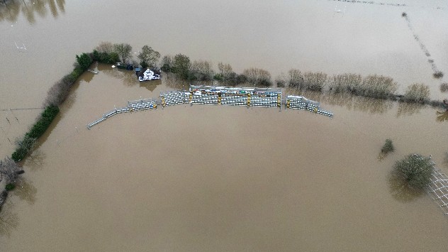
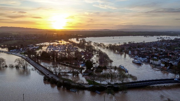
Flooding in Worcestershire and record January heat, two highlights from early 2024. - © L - picture alliance

A fresh year of weather ahead, but we're looking back at everything 2024 threw at us!

January to March

1/10
Peak wind gusts from Storm Henk on January 2nd.

The year started as a prelude of what was to follow... storms. Four named storms in total for the first three months of 2024, and impacts from Storm Nelson which was named by AEMET, Spain's national meteorology service.

Unseasonable warmth saw Kinlochewe, Scotland soar to 19.6°C on January 29th, the warmest day ever recorded in the UK for the month. Though this lasted just a day before being broken again in Achfary with a recording of 29.9°C.

April to June

Things did calm down after the turbulent start, though thunderstorms spread as temperatures naturally rose.

We also saw the first of many displays from the Northern Lights in this period, a sight becoming more common as the Sun reaches the peak of the solar cycle.

On June 24th, a recording of 26.6°C in Phoenix Park, Dublin marked the hottest day of the year in Ireland.

Looking for more from the last year? Check out the July to December round-up now!

Weather & Radar editorial team
More on the topic
Vibrant skies for the last week of July. Your weather - Your shots. . . Sunday, 2 August 2026
Split image showing a golden-orange countryside sunset with silhouetted trees and birds on the left, and glowing blue-white noctilucent clouds rippling across the twilight sky above trees and a lake on the right.
Sunday, 2 August 2026

Your weather - Your shots

Vibrant skies for the last week of July
Your moment, your location, your weather. Capture the scene with us. . . Saturday, 1 August 2026
Promotional graphic for the Weather & Radar app showing a smartphone recording a live weather video in Coventry, England, with a temperature of 27°C, zoom controls, a weather map overlay, and the headline “Weather live – capture your moment.”
Saturday, 1 August 2026

Capture the scene with us

Your moment, your location, your weather
Half of England now in drought. Joining North Wales. . . Wednesday, 29 July 2026
Dry section of the River Thames beneath a small stone bridge, with the riverbed exposed and cracked after prolonged, dry weather, while a person walks along the roadside above.
Wednesday, 29 July 2026

Joining North Wales

Half of England now in drought
All weather news
This might also interest you
Super Typhoon Bavi threatens Taiwan. Up to 1,000 mm of rain. . . Wednesday, 8 July 2026
The image shows an intense tropical cyclone over the western Pacific, east of Taiwan and the Philippines. The centre of the system is depicted as a light purple and white vortex with a clearly visible eye, surrounded by a ring of red and orange areas indicating the strongest wind speeds. A white arrow marks the typhoon’s predicted track towards the north-west, in the direction of Taiwan. To the west of the storm lie the Philippines, with the cities of Manila and Cebu; to the north of these lies Taiwan, with Taipei. Further west, the Chinese coast, including Hong Kong, and parts of Vietnam can be seen. The coloured wind map shows predominantly green areas outside the storm’s core, indicating significantly weaker winds. White streamlines illustrate the typhoon’s anti-clockwise circulation in the Northern Hemisphere. The highest wind speeds are concentrated around the eye of the cyclone.
Wednesday, 8 July 2026

Up to 1,000 mm of rain

Super Typhoon Bavi threatens Taiwan
Historic Storm Éowyn arrives. On this day.... . . Saturday, 24 January 2026
Split image showing a person in a yellow jacket struggling against strong winds and heavy rain on a street at night on the left, and an Irish wind forecast map on the right with red and purple shading, gusts up to 75 mph, and a wind warning icon, divided by a curved white line.
Saturday, 24 January 2026

On this day...

Historic Storm Éowyn arrives
Turbulent weather in the Canary Islands. Storm and rain. . . Friday, 12 December 2025
Weather graphic showing rain and wind fields over the Canary Islands and a central warning symbol.
Friday, 12 December 2025

Storm and rain

Turbulent weather in the Canary Islands
All articles
Weather & Radar

Weather & Radar is also available on

Google Play StoreApp Store

Company

Contact us Privacy Policy Legal info Accessibility statement

Services

Uploader

Socials

facebooktwittertikToklinkList