Home
Weather London
WeatherRadar
RainfallRadar
TemperatureRadar
WindRadar
LightningRadar
Weather News
Editor's Pick
Discover the app
Weather widget
Contact us
Apps
Career
    Home / Editor's Pick /

    Homemade meteorology: Create your own barometer!

06:00
7 December 2022

Homemade meteorology
Create your own barometer!

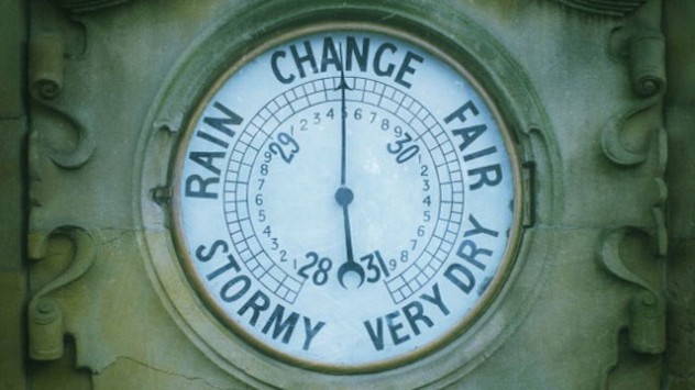
Barometer
A barometer is used to gauge air pressure.

It can be hard to truly understand air pressure without being able to physically see its impact in front of your eyes, so why not make your own barometer at home?

To get started you will need:

A glass such as a jam jar, a straw, a balloon, a rubber band, toothpicks (or cocktail sticks), tape, scissors, pen, ruler, paper, and glue.

Let's get started...

To get the most accurate pointer, stick a toothpick to the straw with tape.

Now cut off the mouthpiece of the balloon, stretch it over the glass and fix a rubber band to secure it in place.

Next, snap a toothpick and glue it to the edge of the glass, follow this by gluing the straw in place in the centre of the balloon and resting on the pick.

That’s your instrument complete! Now for the scale.

Grab a cardboard box and stick paper on it and mark a scale with a ruler. You can draw a sun on top and a cloud on the bottom (more about that later).

It is important that the cardboard stands stable and that the distance between the cardboard and the barometer remains the same from now on.

We’re done, place your creation away from sunlight so that the pressure is not impacted by heat. Be patient, when air pressure rises the pointer will move up towards the sun, a sign of good weather. When it falls the balloon will bulge and the pointer will drop indicating bad weather is on the way.

The UK and Ireland have seen plenty of high pressure recently despite the grey and cloudy conditions overhead.

No matter how accurate your homemade meteorology kit, keep informed of the latest conditions with the WeatherRadar at any time.

Ryan Hathaway
More on the topic
Catastrophic forest fires in Europe. Thousands evacuated. . . Monday, 27 July 2026
A composite image showing a temperature map of south-western Europe and a drone shot of a forest fire near Cap Ferret. A warning symbol featuring a flame indicates the increased risk of forest fires.
Monday, 27 July 2026

Thousands evacuated

Catastrophic forest fires in Europe
Floods and landslides in parts of Asia. An unusual monsoon. . . Wednesday, 29 July 2026
Split image: On the left, flooded villages and fields can be seen in a vast landscape. On the right, a weather map of India shows heavy rainfall, along with a warning sign featuring a car in floodwater.
Wednesday, 29 July 2026

An unusual monsoon

Floods and landslides in parts of Asia
Heavier rainfall over the week for some. Ireland & Scotland. . . Tuesday, 28 July 2026
Split image showing a Europe rainfall accumulation forecast map on the left with the highest totals across the UK, Ireland, and Scandinavia, and a satellite weather map on the right with a broad band of rain stretching across Ireland, Scotland, and northern Britain, highlighted by a rain cloud icon.
Tuesday, 28 July 2026

Ireland & Scotland

Heavier rainfall over the week for some
All weather news
This might also interest you
Seasonal warmth between spring thunder. Your weather - Your shots. . . Sunday, 19 April 2026
Split image showing coastal sunset with layered lenticular clouds over rooftops and palm trees on the left, and a green valley with river and hills under soft daylight on the right.
Sunday, 19 April 2026

Your weather - Your shots

Seasonal warmth between spring thunder
Super Typhoon Bavi threatens Taiwan. Up to 1,000 mm of rain. . . Wednesday, 8 July 2026
The image shows an intense tropical cyclone over the western Pacific, east of Taiwan and the Philippines. The centre of the system is depicted as a light purple and white vortex with a clearly visible eye, surrounded by a ring of red and orange areas indicating the strongest wind speeds. A white arrow marks the typhoon’s predicted track towards the north-west, in the direction of Taiwan. To the west of the storm lie the Philippines, with the cities of Manila and Cebu; to the north of these lies Taiwan, with Taipei. Further west, the Chinese coast, including Hong Kong, and parts of Vietnam can be seen. The coloured wind map shows predominantly green areas outside the storm’s core, indicating significantly weaker winds. White streamlines illustrate the typhoon’s anti-clockwise circulation in the Northern Hemisphere. The highest wind speeds are concentrated around the eye of the cyclone.
Wednesday, 8 July 2026

Up to 1,000 mm of rain

Super Typhoon Bavi threatens Taiwan
Long-term trends need a pinch of salt. 40 °C in July?. . . Tuesday, 30 June 2026
Temperature radar of 2022 heatwave where the all-time temperature record in the UK was set. Warning symbol overlain.
Tuesday, 30 June 2026

40 °C in July?

Long-term trends need a pinch of salt
All articles
Weather & Radar

Weather & Radar is also available on

Google Play StoreApp Store

Company

Contact us Privacy Policy Legal info Accessibility statement

Services

Uploader

Socials

facebooktwittertikToklinkList