Home / Weather News /

Follow our live blog: Storm Mathis impacts UK and Ireland

10:00
31 March 2023

Follow our live blog
Storm Mathis impacts UK and Ireland

Storm Mathis warnings

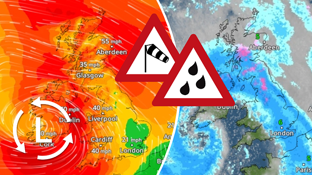
Storm Mathis is impacting the UK and Ireland through Friday, packing gale force winds and heavy rain, stay informed on latest developments with our live blog.

Afternoon update

Strong winds are continuing to batter southern portions with the latest wind gusts reported below since Thursday evening:

LocationWind gust (mph)
Needles, Isle of Wight79
St Mary's, Isle of Scilly66
Berry Head, Devon62
Isle of Portland, Dorset61
Jersey Airport60
Plymouth, Devon59

It is not just here in the UK and Ireland feeling the impact. France is feeling the full force of Mathis with the system also delivering severe weather to western Germany, northern Spain, and Belgium.

Thunderstorms are currently rumbling in the skies above continental Europe as seen on the LightningRadar.

Morning update

Mathis, named by Meteo France, is a cyclonic low-pressure system and is buffeting southern areas on Friday morning.

At least 700 properties are without power in the southwest of England according to the National Grid where multiple trees have also been felled amid the winds.

Severe weather warnings are in place for much of the southern coast in England due to the severe winds with lesser warnings reaching London, Cardiff, and the far south of Ireland.

Watch the progress of Mathis for yourself on the WeatherRadar.

Settings for external content

Privacy Policy
Weather & Radar editorial team
More on the topic
Split image showing a towering storm cloud with rain shafts over the sea on the left and a vivid red aurora illuminating the night sky above residential rooftops on the right, divided by a curved white line.
Tuesday, 9 December 2025

Your weather - Your shots

Autumn captured by you
Map comparison showing 44 degrees in Indulkana and minus 51 degrees in Olenyok. Coloured temperature ranges show stark global contrasts.
Tuesday, 9 December 2025

Global extremes

Almost 100 degrees difference in temperature
Weather radar showing clouds and showers over Algeria and Morocco. Next to it, a warning map with the rain area in Algeria marked. Surrounding regions mostly sunny and dry.
Thursday, 18 December 2025

Algeria affected

Rain in the desert
All weather news
This might also interest you
Split weather map showing the UK and Ireland. The left side illustrates strong winds circulating around a low-pressure system, with gusts of 20–30 mph highlighted in orange and yellow. The right side shows radar imagery with widespread blue rain bands and patches of thunderstorms, especially over northern England and Scotland.
Thursday, 28 August 2025

Breakfast brief

Remaining widely unsettled
Split weather map showing UK wind speeds in orange-red shades up to 40 mph on the left and warning levels in green-yellow on the right, with a central wind warning sign.
Wednesday, 22 October 2025

Warnings active

Storm Benjamin impacts the UK
Weather graphic showing rain and wind fields over the Canary Islands and a central warning symbol.
Friday, 12 December 2025

Storm and rain

Turbulent weather in the Canary Islands
All articles
Weather & Radar

Weather & Radar is also available on

Google Play StoreApp Store

Company

Contact us Privacy Policy Legal info Accessibility statement

Services

Uploader

Socials

facebooktwittertikToklinkList