Home
Weather London
WeatherRadar
RainfallRadar
TemperatureRadar
WindRadar
LightningRadar
Weather News
Editor's Pick
Discover the app
Weather widget
Contact us
Apps
Career
    Home / Editor's Pick /

    El Niño to return? Auckland floods linked to La Niña

06:00
1 February 2023

El Niño to return?
Auckland floods linked to La Niña

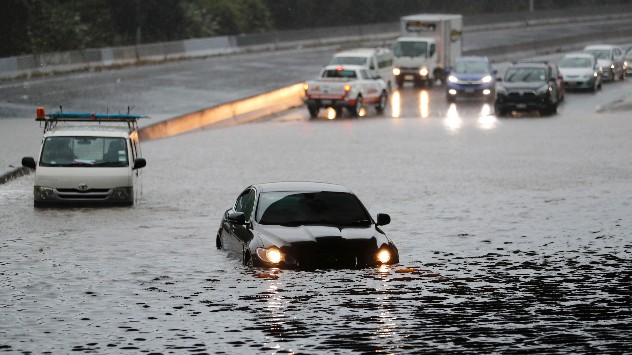
auckland floods
© picture alliance

After three years of experiencing the La Niña weather phenomenon, El Niño is expected to return in 2023, but not without bringing new dangers.

The recent, severe floods in Auckland, New Zealand were said to be exacerbated by La Niña, which causes the North Island to receive more rainfall than normal, due to the directional shift of prevalent winds. Different impacts are expected in different areas.

Both La Niña and El Niño are two sides of the El Niño Southern Oscillation (ENSO) which impacts water temperatures in the equatorial Pacific Ocean. La Niña brings cooler waters while El Niño brings warmer waters.

El Niño is known to intensify severe weather events across much of the planet and causes large swings year-to-year in weather differences.

In addition to influencing weather, both sides of the ENSO coin impact the global climate. La Niña helps cool temperatures. Despite this, 2022 still became one of the hottest years on record.

The potential arrival of El Niño means more heat records are likely to be breached in 2023, and since it intensifies later into the year, 2024 too.

Its impact varies in different regions. In western Pacific areas such as Australia conditions become drier, and hotter. A stark change after years of severe flooding due to intense rainfall.

In Europe the impact of El Niño arriving is not as severe although Spain and Portugal can often see wetter, and warmer winters. Particularly strong events also impact the UK and Ireland similarly.

There is currently a 66% of El Niño forming by August according to the US National Oceanic and Atmospheric Administration.

Not all El Niño events are the same in scale, it is still to early to predict how severe any potential event this year would be.

Ryan Hathaway
More on the topic
Split image showing a European weather map with low-pressyre system, temperature bands, and thunderstorm icon on the left, and a bright rainbow over green countryside and mountains on the right.
Wednesday, 27 May 2026

Early summer ends

A change in the weather is on the way
Weather warning map of Wales and western Britain showing a yellow thunderstorm alert with lightning symbols, alongside a large warning triangle for lightning.
Wednesday, 27 May 2026

Wales & western England

Thunderstorm watch continues
Split image showing a bright rainbow above a residential street on the left and a dramatic ocean sunrise with glowing clouds and reflections on the sea on the right.
Sunday, 24 May 2026

Your weather - Your shots

From unsettled to warm and toasty
All weather news
This might also interest you
Split image showing aerial flooding in a town with muddy water covering roads on the left, and a rural road on the right blocked by heavy snowfall with vans stopped and a person walking in snow.
Tuesday, 27 January 2026

Storm Chandra

Flooding, gales, and heavy snow
Outline of Santa Claus with a yellow and white hat, "Ho-Ho-Ho" next to the outline above a Christmas tree.
Thursday, 25 December 2025

Merry Christmas!

Wishes from Weather & Radar
Weather graphic showing rain and wind fields over the Canary Islands and a central warning symbol.
Friday, 12 December 2025

Storm and rain

Turbulent weather in the Canary Islands
All articles
Weather & Radar

Weather & Radar is also available on

Google Play StoreApp Store

Company

Contact us Privacy Policy Legal info Accessibility statement

Services

Uploader

Socials

facebooktwittertikToklinkList