Home
Weather London
WeatherRadar
RainfallRadar
TemperatureRadar
WindRadar
LightningRadar
Weather News
Editor's Pick
Discover the app
Weather widget
Contact us
Apps
Career
    Home / Editor's Pick /

    Cold Moon rises tonight: Third and final supermoon of the year

09:00
4 December 2025

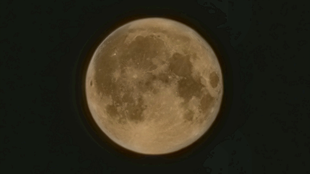
Cold Moon rises tonight
Third and final supermoon of the year

August supermoon, pictured over County Durham.
A supermoon pictured over County Durham, looming larger in the night sky. - © Rachel Easterbrook

The final supermoon of 2025 rises tonight, and it's the third consecutive supermoon since October!

December's Cold Moon is not only the third supermoon in a row, but precedes yet another in January to start 2026.

Conditions for seeing the event are mixed for the UK and Ireland, with the best visibility to be found in Wales, southern England, and parts of Ireland.

Like all full moons, Native Americans provided a name for the December moon, the Cold Moon. Reflecting the time of year when the air cools and winter truly takes hold.

A supermoon occurs when the full moon coincides with the perigee, this is the closest point to Earth in the Moon’s orbit.

Compared to a full moon at its apogee, its furthest point away, a supermoon is typically 30% brighter and 13% larger.

How is visibility near you?WeatherRadar
Ryan Hathaway

More on the topic

Storm Austen approaches. What to expect tonight. . . Thursday, 22 October 2026
Split image showing a wind map with 65 mph near Brest and a swirling storm south of England, beside a man wearing glasses and holding a microphone.
Thursday, 22 October 2026

What to expect tonight

Storm Austen approaches
Severe flooding in the south of France. Roads become rivers. . . Wednesday, 21 October 2026
Weather radar shows heavy rainfall over southern France, northern Italy, Corsica and Sardinia. A warning symbol indicates a risk of flooding.
Wednesday, 21 October 2026

Roads become rivers

Severe flooding in the south of France
Preparing for the storms. What to do now. . . Thursday, 22 October 2026
Split image showing Storm Austen winds up to 65 mph near Brest and 55 mph near Plymouth, alongside fallen tree branches on a cordoned-off park path.
Thursday, 22 October 2026

What to do now

Preparing for the storms
All weather news

This might also interest you

New records for England and Wales. Broken again tomorrow?. . . Thursday, 25 June 2026
Temperature map of southwest Britain on 25.06 showing extreme heat across southern Wales and southwest England, with Bute Park in Cardiff highlighted at 34.2°C and Yeovilton at 36.4°C amid widespread deep red heat zones.
Thursday, 25 June 2026

Broken again tomorrow?

New records for England and Wales
A frozen start to the weekend. Icy conditions. . . Friday, 13 February 2026
UK temperature map dated 14.02 showing widespread subzero values in blue shading, with readings such as −4 in Glasgow, −3 in Dublin, and −2 in London, alongside a blue thermometer icon.
Friday, 13 February 2026

Icy conditions

A frozen start to the weekend
Flooding, gales, and heavy snow. Storm Chandra. . . Tuesday, 27 January 2026
Split image showing aerial flooding in a town with muddy water covering roads on the left, and a rural road on the right blocked by heavy snowfall with vans stopped and a person walking in snow.
Tuesday, 27 January 2026

Storm Chandra

Flooding, gales, and heavy snow
All articles
Weather & Radar

Weather & Radar is also available on

Google Play StoreApp Store

Company

Contact us Privacy Policy Legal info Accessibility statement

Services

Uploader

Socials

facebooktwittertikToklinkList