Home
Weather London
WeatherRadar
RainfallRadar
TemperatureRadar
WindRadar
LightningRadar
Weather News
Editor's Pick
Discover the app
Weather widget
Contact us
Apps
Career
    Home / Editor's Pick /

    A unique phenomenon: Monochrome rainbows

11:00
16 April 2023

A unique phenomenon
Monochrome rainbows

Monochrome rainbow photographed by Hailey Jameson

While rainbows are typically multicoloured, a monochrome rainbow is a rare phenomenon. The above image shows a large monochrome rainbow above Washington, USA.

Not all rainbows are as colourful as their name suggests. Whenever conditions are just right, spectacular monochrome rainbows may be seen.

Rainbows form when sunlight enters water droplets in the air, causing the light to slow down and change direction or bend due to the change in density between air and water.

The light is then refracted and reflected inside the droplet, causing the different colours of light to spread out and become visible as an arc of colours.

A typical rainbow is made up of red, orange, yellow, green, blue, indigo, and violet, with red on the outer edge and violet on the inner edge.

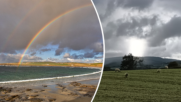
Your weather - Your shots: Rainbowsread more

How are monochrome rainbows formed?

The formation process of a monochrome rainbow is similar to that of a normal rainbow, with light being reflected or refracted in water droplets. The main difference is that a monochrome rainbow occurs when the sun is close to the horizon during sunrise or sunset.

Since the sun is at a lower angle during sunrise and sunset, its light has to travel a longer distance through the atmosphere.

Consequently, the shorter wavelengths of light, such as blue, green, and yellow, get scattered, leaving primarily red light. The monochrome rainbow is most often formed in a low-light environment, which creates a highly dramatic effect.

Weather & Radar editorial team
More on the topic
Hottest summer on record for Ireland. Beating 2025's record. . . Thursday, 3 September 2026
Temperature map of Ireland showing 29°C in Dublin, 26°C in Cork, 24°C in Belfast, and 23°C in Galway, with a red thermometer icon.
Thursday, 3 September 2026

Beating 2025's record

Hottest summer on record for Ireland
Severe weather in southern Europe. Thunderstorms & heavy rain. . . Wednesday, 9 September 2026
On the left, dark storm clouds over a coastline. On the right, a weather map shows thunderstorms over the western Mediterranean, with warning symbols for tornadoes, storms and hail.
Wednesday, 9 September 2026

Thunderstorms & heavy rain

Severe weather in southern Europe
More rain needed to ease drought. Reservoirs still falling. . . Tuesday, 8 September 2026
Aerial view of a depleted reservoir with exposed banks and a narrow winding stream through the dry basin, surrounded by green hills and roads.
Tuesday, 8 September 2026

Reservoirs still falling

More rain needed to ease drought
All weather news
This might also interest you
New records for England and Wales. Broken again tomorrow?. . . Thursday, 25 June 2026
Temperature map of southwest Britain on 25.06 showing extreme heat across southern Wales and southwest England, with Bute Park in Cardiff highlighted at 34.2°C and Yeovilton at 36.4°C amid widespread deep red heat zones.
Thursday, 25 June 2026

Broken again tomorrow?

New records for England and Wales
Super Typhoon Bavi threatens Taiwan. Up to 1,000 mm of rain. . . Wednesday, 8 July 2026
The image shows an intense tropical cyclone over the western Pacific, east of Taiwan and the Philippines. The centre of the system is depicted as a light purple and white vortex with a clearly visible eye, surrounded by a ring of red and orange areas indicating the strongest wind speeds. A white arrow marks the typhoon’s predicted track towards the north-west, in the direction of Taiwan. To the west of the storm lie the Philippines, with the cities of Manila and Cebu; to the north of these lies Taiwan, with Taipei. Further west, the Chinese coast, including Hong Kong, and parts of Vietnam can be seen. The coloured wind map shows predominantly green areas outside the storm’s core, indicating significantly weaker winds. White streamlines illustrate the typhoon’s anti-clockwise circulation in the Northern Hemisphere. The highest wind speeds are concentrated around the eye of the cyclone.
Wednesday, 8 July 2026

Up to 1,000 mm of rain

Super Typhoon Bavi threatens Taiwan
Historic Storm Éowyn arrives. On this day.... . . Saturday, 24 January 2026
Split image showing a person in a yellow jacket struggling against strong winds and heavy rain on a street at night on the left, and an Irish wind forecast map on the right with red and purple shading, gusts up to 75 mph, and a wind warning icon, divided by a curved white line.
Saturday, 24 January 2026

On this day...

Historic Storm Éowyn arrives
All articles
Weather & Radar

Weather & Radar is also available on

Google Play StoreApp Store

Company

Contact us Privacy Policy Legal info Accessibility statement

Services

Uploader

Socials

facebooktwittertikToklinkList