Home
Weather London
WeatherRadar
RainfallRadar
TemperatureRadar
WindRadar
LightningRadar
Weather News
Editor's Pick
Discover the app
Weather widget
Contact us
Apps
Career
    Home / Weather News /

    A stormy week in the skies above

09:00
30 August 2026

Your weather - Your shots
A stormy week in the skies above

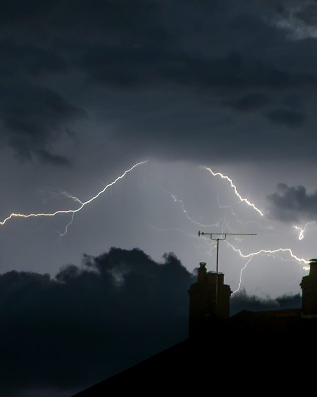
Multiple lightning bolts illuminate dark storm clouds above silhouetted rooftops, chimneys and a television aerial.
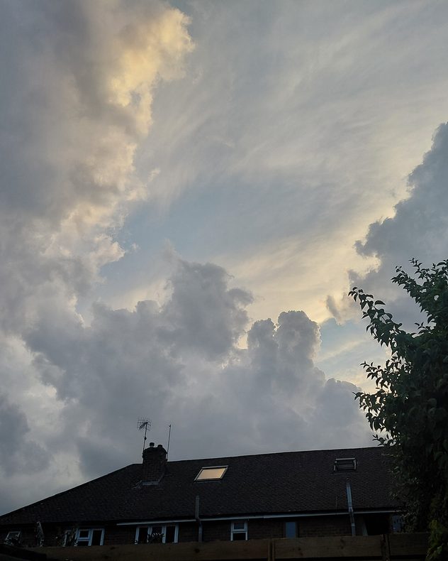
Towering gray cumulus clouds build above rooftops and trees, with pale sunlight illuminating cloud edges and wispy layers higher in the sky.
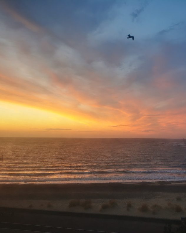
Orange and pink sunset over a calm sea and sandy beach, with gentle waves beneath layered clouds and a bird flying across the blue evening sky.
Dark layered storm clouds over a calm sea at sunset, with vivid orange-pink light breaking through gaps near the horizon and silhouetted seafront structures below.
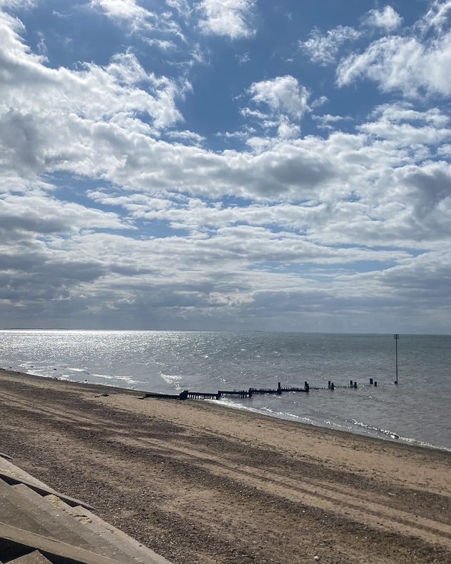
Quiet sandy beach beside a calm sea under broken cumulus clouds, with sunlight shimmering on the water and wooden groynes extending from the shore.
1/5
Fork lightning illuminated the skies over Caister-on-Sea, Norfolk. - © Richard Lay

Another thundery week comes to an end, and the lightning mixed with some more calm conditions to offer many seasonal shots.

The stormy scenes were perfectly captured with the app's video feature too! Alongside some more pleasant summer views.

Want to appear here next week? Use the uploaders for the UK or Ireland to send in your pictures, or record and submit video moments via the app!

Weather & Radar editorial team

More on the topic

South-east saw a record-breaking drought. Rain coming but not enough. . . Thursday, 15 October 2026
Split graphic showing yellow rainfall deficit areas across the UK and Ireland beside a dry, parched landscape with two people walking.
Thursday, 15 October 2026

Rain coming but not enough

South-east saw a record-breaking drought
Where do our storm names come from?. Austen possible this week. . . Monday, 19 October 2026
Lightning strikes beneath dark storm clouds over fields, with warning signs for thunderstorms and strong winds shown in foreground.
Monday, 19 October 2026

Austen possible this week

Where do our storm names come from?
Autumn colours and aurora displays. Your weather - Your shots. . . Sunday, 18 October 2026
Split image showing an orange coastal sunset over a winding tidal stream and jagged rocks beside purple northern lights above houses at night.
Sunday, 18 October 2026

Your weather - Your shots

Autumn colours and aurora displays
All weather news

This might also interest you

Seasonal warmth between spring thunder. Your weather - Your shots. . . Sunday, 19 April 2026
Split image showing coastal sunset with layered lenticular clouds over rooftops and palm trees on the left, and a green valley with river and hills under soft daylight on the right.
Sunday, 19 April 2026

Your weather - Your shots

Seasonal warmth between spring thunder
Historic Storm Éowyn arrives. On this day.... . . Saturday, 24 January 2026
Split image showing a person in a yellow jacket struggling against strong winds and heavy rain on a street at night on the left, and an Irish wind forecast map on the right with red and purple shading, gusts up to 75 mph, and a wind warning icon, divided by a curved white line.
Saturday, 24 January 2026

On this day...

Historic Storm Éowyn arrives
Super Typhoon Bavi threatens Taiwan. Up to 1,000 mm of rain. . . Wednesday, 8 July 2026
The image shows an intense tropical cyclone over the western Pacific, east of Taiwan and the Philippines. The centre of the system is depicted as a light purple and white vortex with a clearly visible eye, surrounded by a ring of red and orange areas indicating the strongest wind speeds. A white arrow marks the typhoon’s predicted track towards the north-west, in the direction of Taiwan. To the west of the storm lie the Philippines, with the cities of Manila and Cebu; to the north of these lies Taiwan, with Taipei. Further west, the Chinese coast, including Hong Kong, and parts of Vietnam can be seen. The coloured wind map shows predominantly green areas outside the storm’s core, indicating significantly weaker winds. White streamlines illustrate the typhoon’s anti-clockwise circulation in the Northern Hemisphere. The highest wind speeds are concentrated around the eye of the cyclone.
Wednesday, 8 July 2026

Up to 1,000 mm of rain

Super Typhoon Bavi threatens Taiwan
All articles
Weather & Radar

Weather & Radar is also available on

Google Play StoreApp Store

Company

Contact us Privacy Policy Legal info Accessibility statement

Services

Uploader

Socials

facebooktwittertikToklinkList