Home
Weather London
WeatherRadar
RainfallRadar
TemperatureRadar
WindRadar
LightningRadar
Weather News
Editor's Pick
Discover the app
Weather widget
Contact us
Apps
Career
    Home / Editor's Pick /

    A rare perspective: Glowing noctilucent clouds from space

11:00
19 April 2023

A rare perspective
Glowing noctilucent clouds from space

Privacy Policy

A unique perspective of rare clouds as the sun shines through a layer of luminous noctilucent clouds captured from the International Space Station (ISS).

Astronaut Alexander Gerst took a picture in a class of its own during his stay on the ISS. It shows an orbital sunrise, through a layer of luminous noctilucent clouds, highlighting how high these stunning clouds actually are.

These are at the upper edge of the blue area. It is impossible not to notice how high the luminous noctilucent clouds actually are compared to “normal clouds”. At an altitude of 80 to 85 kilometres, they only form when temperatures are particularly low due to strong turbulence in this altitudinal layer of the atmosphere.

Noctilucent clouds
It is all about timing with noctilucent clouds.

From Earth, the silky threads of the glowing noctilucent clouds can only be observed during the solar zenith, i.e. from mid-May to the end of July.

The sun must be below the horizon during this time. This is because the clouds are so thin that the sun far outshines their magical light during the day.

Noctilucent clouds over the UKread more

If you manage to spot their rare appearance, be sure to capture the moment, we would love to see what you spot! Send in pictures by tapping the image icon in the corner of the app or using our uploader.

Weather & Radar editorial team
More on the topic
Cheshire Gap produces shower funnel. Local phenomenon. . . Wednesday, 9 September 2026
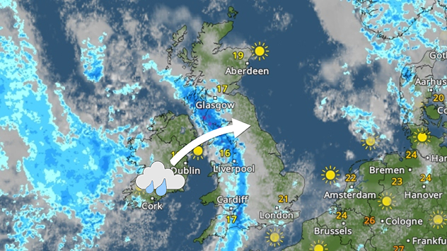
Weather map showing showers moving southeast from Liverpool toward Birmingham, driven by Cheshire Gap convergence across central England.
Wednesday, 9 September 2026

Local phenomenon

Cheshire Gap produces shower funnel
Hottest summer on record for Ireland. Beating 2025's record. . . Thursday, 3 September 2026
Temperature map of Ireland showing 29°C in Dublin, 26°C in Cork, 24°C in Belfast, and 23°C in Galway, with a red thermometer icon.
Thursday, 3 September 2026

Beating 2025's record

Hottest summer on record for Ireland
Record ocean heat halting hurricanes. Strong El Niño influence. . . Friday, 11 September 2026
A weather map shows a calm Atlantic Ocean with no hurricanes, alongside a picture of the sea.
Friday, 11 September 2026

Strong El Niño influence

Record ocean heat halting hurricanes
All weather news
This might also interest you
Historic Storm Éowyn arrives. On this day.... . . Saturday, 24 January 2026
Split image showing a person in a yellow jacket struggling against strong winds and heavy rain on a street at night on the left, and an Irish wind forecast map on the right with red and purple shading, gusts up to 75 mph, and a wind warning icon, divided by a curved white line.
Saturday, 24 January 2026

On this day...

Historic Storm Éowyn arrives
New records for England and Wales. Broken again tomorrow?. . . Thursday, 25 June 2026
Temperature map of southwest Britain on 25.06 showing extreme heat across southern Wales and southwest England, with Bute Park in Cardiff highlighted at 34.2°C and Yeovilton at 36.4°C amid widespread deep red heat zones.
Thursday, 25 June 2026

Broken again tomorrow?

New records for England and Wales
Long-term trends need a pinch of salt. 40 °C in July?. . . Tuesday, 30 June 2026
Temperature radar of 2022 heatwave where the all-time temperature record in the UK was set. Warning symbol overlain.
Tuesday, 30 June 2026

40 °C in July?

Long-term trends need a pinch of salt
All articles
Weather & Radar

Weather & Radar is also available on

Google Play StoreApp Store

Company

Contact us Privacy Policy Legal info Accessibility statement

Services

Uploader

Socials

facebooktwittertikToklinkList