Home
Weather London
WeatherRadar
RainfallRadar
TemperatureRadar
WindRadar
LightningRadar
Weather News
Editor's Pick
Discover the app
Weather widget
Contact us
Apps
Career
    Home / Weather News /

    40 °C in July? Long-term trends need a pinch of salt

13:37
30 June 2026

40 °C in July?
Long-term trends need a pinch of salt

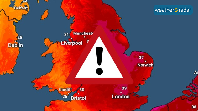
Temperature map of England showing widespread extreme heat, with temperatures reaching 39°C near London, 37°C near Norwich, and over 30°C across much of the country, alongside a large warning symbol indicating dangerous conditions.
Another heatwave is possible, bringing more warnings. Hitting 40 degrees?

There's a lot of talk of temperatures hitting 40 °C in July, with specific graphs being shared online purporting to show the forecast, but is it true?

The short answer is no. Beyond three to five days it gets incredibly difficult to pinpoint specific weather conditions. So, posts suggesting highs of 40 or 41 °C around July 10th should be taken with a pinch of salt.

What is actually happening? These posts are using one extreme output of one weather model. Beyond the five day mark a forecast is no longer possible, only a trend of where conditions are roughly expected to reach.

London

We
9
11
Th
9
15
Fr
12
13
Sa
7
15
Su
11
14
Mo
8
17
Tu
13
15
We
11
17
Th
11
15
Fr
11
15
Sa
11
15
Su
9
14
Mo
11
15
Tu
10
14
Max (°C)
Min (°C)
moreless

Manchester

We
8
11
Th
5
12
Fr
9
12
Sa
6
13
Su
9
11
Mo
7
15
Tu
10
12
We
9
14
Th
9
14
Fr
10
13
Sa
8
13
Su
8
13
Mo
10
13
Tu
8
12
Max (°C)
Min (°C)
moreless

Dublin

We
7
10
Th
6
13
Fr
5
10
Sa
6
16
Su
8
12
Mo
8
16
Tu
8
12
We
10
12
Th
8
14
Fr
9
14
Sa
8
13
Su
8
14
Mo
8
11
Tu
6
11
Max (°C)
Min (°C)
moreless

Edinburgh

We
9
13
Th
4
12
Fr
4
10
Sa
4
11
Su
8
10
Mo
7
14
Tu
9
12
We
9
12
Th
9
13
Fr
11
14
Sa
7
11
Su
7
13
Mo
8
12
Tu
6
11
Max (°C)
Min (°C)
moreless

Cardiff

We
7
11
Th
7
15
Fr
11
11
Sa
6
16
Su
11
13
Mo
8
16
Tu
12
14
We
12
16
Th
12
15
Fr
11
15
Sa
11
14
Su
10
14
Mo
12
14
Tu
9
13
Max (°C)
Min (°C)
moreless

The particular 40 °C claim on July 10th is an extreme scenario which is unlikely. If several model runs point in this direction, it becomes more reliable. This is not the case - the average trend currently shows temperature peaks around 10 degrees below this extreme outlook.

Therefore, at this point we know that we are likely to see another hot spell, likely becoming the third heatwave of the season, but we do not yet know how hot it will be.

Forecast vs trend

Forecasts focus on specific conditions in the short-term, usually accurate up to five days. Trends use data and probabilities to determine a more general outlook for a longer timeframe without details.

Trends are updated regularly with new data, and can change many times before we get to the dates mentioned.

Rather than stressing about the impact of a new record temperature, remember that the details will only become clear as we get closer to the date. Keep an eye on the 14 day weather card and the TemperatureRadar.

Ryan Hathaway

More on the topic

Severe weather hits Turkey and Greece. Torrential rain and storms. . . Thursday, 15 October 2026
On the left, a yellow bus is submerged in deep floodwater. On the right, the weather radar shows numerous thunderstorms over Greece and Turkey. Warning symbols indicate flooding and thunderstorms.
Thursday, 15 October 2026

Torrential rain and storms

Severe weather hits Turkey and Greece
Where do our storm names come from?. Austen possible this week. . . Monday, 19 October 2026
Lightning strikes beneath dark storm clouds over fields, with warning signs for thunderstorms and strong winds shown in foreground.
Monday, 19 October 2026

Austen possible this week

Where do our storm names come from?
South-east saw a record-breaking drought. Rain coming but not enough. . . Thursday, 15 October 2026
Split graphic showing yellow rainfall deficit areas across the UK and Ireland beside a dry, parched landscape with two people walking.
Thursday, 15 October 2026

Rain coming but not enough

South-east saw a record-breaking drought
All weather news

This might also interest you

Turbulent weather in the Canary Islands. Storm and rain. . . Friday, 12 December 2025
Weather graphic showing rain and wind fields over the Canary Islands and a central warning symbol.
Friday, 12 December 2025

Storm and rain

Turbulent weather in the Canary Islands
Flooding, gales, and heavy snow. Storm Chandra. . . Tuesday, 27 January 2026
Split image showing aerial flooding in a town with muddy water covering roads on the left, and a rural road on the right blocked by heavy snowfall with vans stopped and a person walking in snow.
Tuesday, 27 January 2026

Storm Chandra

Flooding, gales, and heavy snow
A frozen start to the weekend. Icy conditions. . . Friday, 13 February 2026
UK temperature map dated 14.02 showing widespread subzero values in blue shading, with readings such as −4 in Glasgow, −3 in Dublin, and −2 in London, alongside a blue thermometer icon.
Friday, 13 February 2026

Icy conditions

A frozen start to the weekend
All articles
Weather & Radar

Weather & Radar is also available on

Google Play StoreApp Store

Company

Contact us Privacy Policy Legal info Accessibility statement

Services

Uploader

Socials

facebooktwittertikToklinkList