Home
Weather London
WeatherRadar
RainfallRadar
TemperatureRadar
WindRadar
LightningRadar
Weather News
Editor's Pick
Discover the app
Weather widget
Contact us
Apps
Career
    Home / Editor's Pick /

    Tricky visibility: Supermoon set to rise tonight

15:00
1 August 2023

Tricky visibility
Supermoon set to rise tonight

Tonight sees the rise of a supermoon, reaching its full peak in the early evening... although visibility of the lunar event will be poor.

The second of four supermoons in 2023 will peak around 07:31 pm this evening, following the first supermoon which rose in July. Typically, the first full moon of August is known as the Full Sturgeon Moon.

This time, its arrival coincides with the moon's perigee. This refers to the point in the moon's orbit where it is at its closest to Earth.

Supermoon
July's supermoon captured by a Weather & Radar user in Lowestoft, Suffolk. - © Elaine High

At a time of a supermoon, our lunar companion will appear around 7% larger and 16% brighter overhead than a usual full moon.

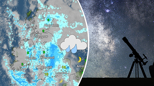
Unfortunately, tonight we also see the arrival of a low-pressure system bringing heavy rain to the southwest of England from 07:00 pm. Lighter, though still heavy, rain is also expected in parts of Wales and southern Ireland.

In addition to the rainfall, it will be an overcast night with few breaks in cloud cover to truly spot the supermoon.

The cloud cover does begin to break up for parts of northern England and northern Scotland from around 10:00 pm.

If you are unable to see tonight's moon, don't worry… there's another coming very soon! We will see another supermoon at the end of August, which, as the second full moon in a month, is also a blue moon.

Check conditions where you are on the WeatherRadar, and check back later this month for more information on the next supermoon.

August astronomy outlookread more
Ryan Hathaway
More on the topic
Hurricane Lowell threatens Hawaii. Gales and flash floods. . . Tuesday, 8 September 2026
WindRadar showing Hurricane Lowell north-west of Hawaii and its well-defined storm centre.
Tuesday, 8 September 2026

Gales and flash floods

Hurricane Lowell threatens Hawaii
Severe weather hits Mallorca and Italy. Severe thunderstorms. . . Thursday, 10 September 2026
Numerous thunderstorms are sweeping across La Palma. The many lightning symbols on the radar and lightning map show that there is heavy lightning activity across large parts of the island. The thunderstorms are striking particularly in the island’s interior and in the south. On the right, you can see the aftermath: a large fallen tree has buried a car beneath it. Emergency services are clearing up the damage. So, along with the thunderstorms, not only heavy rain but also gusts of wind can become a problem.
Thursday, 10 September 2026

Severe thunderstorms

Severe weather hits Mallorca and Italy
Autumn arrives with vivid colour. Your weather - Your shots. . . Sunday, 6 September 2026
Split image showing peach-lit textured clouds above silhouetted trees and golden cumulus clouds reflected in a calm canal lined with boats.
Sunday, 6 September 2026

Your weather - Your shots

Autumn arrives with vivid colour
All weather news
This might also interest you
Super Typhoon Bavi threatens Taiwan. Up to 1,000 mm of rain. . . Wednesday, 8 July 2026
The image shows an intense tropical cyclone over the western Pacific, east of Taiwan and the Philippines. The centre of the system is depicted as a light purple and white vortex with a clearly visible eye, surrounded by a ring of red and orange areas indicating the strongest wind speeds. A white arrow marks the typhoon’s predicted track towards the north-west, in the direction of Taiwan. To the west of the storm lie the Philippines, with the cities of Manila and Cebu; to the north of these lies Taiwan, with Taipei. Further west, the Chinese coast, including Hong Kong, and parts of Vietnam can be seen. The coloured wind map shows predominantly green areas outside the storm’s core, indicating significantly weaker winds. White streamlines illustrate the typhoon’s anti-clockwise circulation in the Northern Hemisphere. The highest wind speeds are concentrated around the eye of the cyclone.
Wednesday, 8 July 2026

Up to 1,000 mm of rain

Super Typhoon Bavi threatens Taiwan
Flooding, gales, and heavy snow. Storm Chandra. . . Tuesday, 27 January 2026
Split image showing aerial flooding in a town with muddy water covering roads on the left, and a rural road on the right blocked by heavy snowfall with vans stopped and a person walking in snow.
Tuesday, 27 January 2026

Storm Chandra

Flooding, gales, and heavy snow
A frozen start to the weekend. Icy conditions. . . Friday, 13 February 2026
UK temperature map dated 14.02 showing widespread subzero values in blue shading, with readings such as −4 in Glasgow, −3 in Dublin, and −2 in London, alongside a blue thermometer icon.
Friday, 13 February 2026

Icy conditions

A frozen start to the weekend
All articles
Weather & Radar

Weather & Radar is also available on

Google Play StoreApp Store

Company

Contact us Privacy Policy Legal info Accessibility statement

Services

Uploader

Socials

facebooktwittertikToklinkList